Ardclinis
| Ardclinis | |
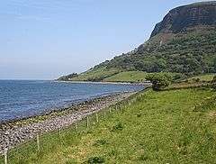
 Ardclinis townland in 2007 |
|
 Ardclinis |
|
| County | County Antrim |
|---|---|
| Country | Northern Ireland |
| Sovereign state | United Kingdom |
| EU Parliament | Northern Ireland |
|
|
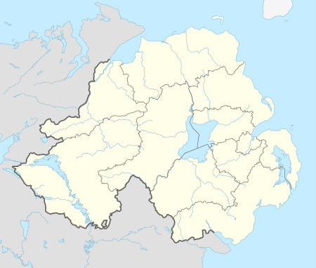
Coordinates: 55°03′18″N 6°00′15″W / 55.055°N 6.0042°W
Ardclinis is a civil parish and townland (of 35 acres) in County Antrim, Northern Ireland. It is situated in the historic barony of Glenarm Lower.[1][2]
Civil parish of Ardclinis
The civil parish covers areas of Larne Borough Council and Moyle District Council and includes the village of Carnlough.[1]
Townlands
The civil parish contains the following townlands:[1][2]
A
Aghalum, Ardclinis, Ardclinis Mountain
B
Ballyvelligan, Bay, Burnside
C
Callisnagh, Carnlough North, Carnlough South, Carrivemurphy Mountain, Carrivereagh, Cloghcor, Clonreagh, Craignagat, Creggan, Cushenilt
D
Diskirt, Drumadried, Drumnacross, Drumnacur, Drumnasole, Dunmall
F
Fallowvee, Falmacbreed, Falrusklin
G
Galboly Lower, Galboly Mountain North, Galboly Mountain South, Galboly Upper, Gallanagh, Glenariff Mountain Upper East, Glenariff Mountain Upper West, Glenariff Mountain Lower, Gortin, Gortnagory, Greenaghan
H
Highlandtown
J
John Gillins
L
Lemnalary, Lemnalary Mountain, Longtown, Loughan
M
Mill Tenement
N
Nappan Mountain, Nappan North, Nappan South, Newtown
S
Scaryhill, Slate House
T
Tamlaght, Tamlaghtmore, Two Acres and Half
W
Warren
See also
References
- 1 2 3 "Ardclinis". IreAtlas Townlands Database. Retrieved 12 April 2015.
- 1 2 "Ardclinis". Placenames Database of Ireland. Retrieved 12 April 2015.
| Wikimedia Commons has media related to Ardclinis. |
