Ardusat
| Ardusat | |
|---|---|
| Commune | |
|
Orthodox Cathedral in Ardusat | |
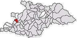 Commune Ardusat in Maramureş County | |
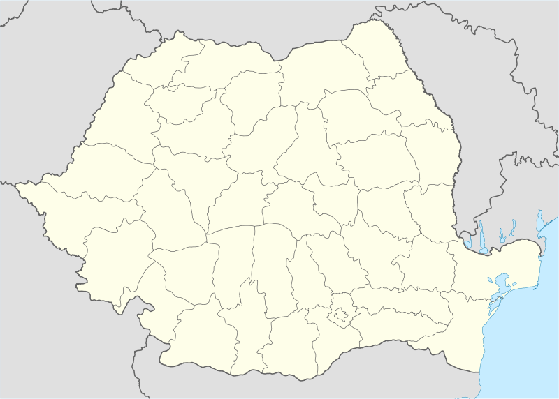 Ardusat Ardusat within Romania | |
| Coordinates: 47°38′59″N 23°21′44″E / 47.64972°N 23.36222°E | |
| Country |
|
| County |
|
| Commune | Ardusat |
| Historic region | Transylvania |
| Government | |
| • Mayor | Vasile-Ciprian Rus (National Liberal Party) |
| Area | 31.09 km2 (12.00 sq mi) |
| Population (2002)[1] | 2,543 |
| Time zone | EET (UTC+2) |
| • Summer (DST) | EEST (UTC+3) |
| Website | www.ardusat.ro |

Ardusat (Hungarian: Erdőszáda) is a commune in western Maramureş County, Romania on the banks of the Someş River, near the border with Satu Mare County. The first record of its existence dates back to 1230. It is composed of three villages: Ardusat, Arieşu de Câmp (Mezőaranyos) and Colţirea (Kolcér).
Ethnographically it belongs to "Ţara Codrului" (The Forest Land), with which it shares numerous cultural traditions. The local Ardusat Choir has been the best in Romania for decades, and has won numerous prizes at Italian, Eastern European and American contests.
Sights
In addition to the local crafts, superstitions, and folklore, other attractions for tourists include the Greek-Catholic (Uniate) Cathedral (18th Century), the ruins of the Degenfeld Castle,[2] and a 300-year-old sequoia tree. The remnants of the railroad bridge over the Someş, destroyed by the 1970 floods, can still be seen. The river has great fishing. Since 2005 Ardusat has had its own celebration, which takes place on the first Saturday and Sunday after August 15 (the Dormition of the Theotokos). The religious celebration of the cathedral is scheduled every year on January 6. This commune is composed of three villages: Ardusat, Colţirea and Arieşu de Câmp. The church at the very center of the village was Romanian Greek Catholic, until the communist party of Romania made the church Romanian Orthedox.
Sister cities
- Verniér, Switzerland is a sister town to Ardusat.
References
- ↑ Romanian census data, 2002 Archived August 11, 2012, at the Wayback Machine.; retrieved on March 1, 2010
- ↑ (German)remenienburgen.com - Degenfeld Castle, Maramureş County; retrieved on May 25, 2012
Further reading
- "Ardusat, străveche vatră românească" ("Ardusat, Ancient Romanian Hearth"), by Valentin Baintan (1995)
- ardusat.ro
Coordinates: 47°39′N 23°22′E / 47.650°N 23.367°E