Arjay, Kentucky
| Arjay, Kentucky | |
|---|---|
| Unincorporated community | |
|
Houses along the railroad track in Arjay, 1946. Photo by Russell Lee. | |
 Arjay, Kentucky | |
| Coordinates: 36°48′17″N 83°38′45″W / 36.80472°N 83.64583°WCoordinates: 36°48′17″N 83°38′45″W / 36.80472°N 83.64583°W | |
| Country | United States |
| State | Kentucky |
| County | Bell |
| Elevation | 1,066 ft (325 m) |
| Time zone | Eastern (EST) (UTC-5) |
| • Summer (DST) | EDT (UTC-4) |
| ZIP code | 40902 |
| Area code(s) | 606 |
| GNIS feature ID | 486025[1] |

Arjay is an unincorporated community and coal town in Bell County, Kentucky, United States. Arjay is located on Kentucky Route 66 4 miles (6.4 km) northeast of Pineville.[2] Arjay has a post office with ZIP code 40902, which opened on February 23, 1911.[3][4] The community's name comes from the initials of coal operator R. J. Asher.[5]
References
- ↑ "Arjay". Geographic Names Information System. United States Geological Survey.
- ↑ State Primary Road System: Bell County (PDF) (Map). Kentucky Transportation Cabinet. 2012. Retrieved February 23, 2013.
- ↑ United States Postal Service (2012). "USPS - Look Up a ZIP Code". Retrieved 2012-02-15.
- ↑ "Postmaster Finder - Post Offices by ZIP Code". United States Postal Service. Retrieved February 23, 2013.
- ↑ Rennick, Robert M. (1987). Kentucky Place Names. University Press of Kentucky. p. 375. ISBN 9780813126319.
Municipalities and communities of Bell County, Kentucky, United States | ||
|---|---|---|
| Cities | 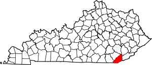 | |
| Unincorporated communities |
| |
| Ghost towns | ||
| Footnotes | ‡This populated place also has portions in an adjacent county or counties | |
This article is issued from Wikipedia - version of the 3/30/2016. The text is available under the Creative Commons Attribution/Share Alike but additional terms may apply for the media files.