Arkansas Highway 93
| ||||
|---|---|---|---|---|
 | ||||
| Route information | ||||
| Maintained by AHTD | ||||
| Length: | 14.66 mi[1] (23.59 km) | |||
| Existed: | 1926 – present | |||
| Major junctions | ||||
| South end: |
| |||
| North end: |
| |||
| Location | ||||
| Counties: | Randolph | |||
| Highway system | ||||
| ||||

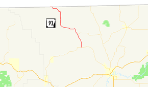
Arkansas Highway 93 (AR 93 and Hwy. 93) is a north–south state highway in Randolph County, Arkansas. The route of 14.66 miles (23.59 km) runs from AR 90 north to the Missouri state line.[2]
Route description
AR 93 begins at AR 90 northwest of Pocahontas. The route winds north through forested land before a junction with Arkansas Highway 231, which connects AR 93 and AR 251 in north Randolph County. Highway 93 continues north through the communities of Dalton and Elm Store before meeting the Missouri state line. The road enters Missouri as Supplemental route BB, also entering the Mark Twain National Forest. The route it two–lane, undivided for its entire length.[1]
Major intersections
The entire route is in Randolph County.
| Location | mi[1] | km | Destinations | Notes | |
|---|---|---|---|---|---|
| | 0.0 | 0.0 | southern terminus | ||
| | 3.24 | 5.21 | |||
| Missouri state line | 14.66 | 23.59 | northern terminus | ||
| 1.000 mi = 1.609 km; 1.000 km = 0.621 mi | |||||
History

Arkansas Highway 93 was one of the original 1926 Arkansas state highways. The route ran north in Randolph County along its present day alignment, without the Highway 231 junction (the highway was not yet designated). Highway 93's southern terminus was US 62, which was later rerouted south and now runs through Pocahontas, with the former alignment becoming Highway 90.[3]
References
- 1 2 3 Planning and Research Division (2010). "Arkansas Road Log Database". Arkansas State Highway and Transportation Department. Archived from the original (Database) on 23 June 2011. Retrieved June 9, 2011.
- ↑ General Highway Map (PDF) (Map) (Randolph County ed.). Arkansas State Highway and Transportation Department. Archived (PDF) from the original on 18 July 2011. Retrieved June 17, 2011.
- ↑ Map of State of Arkansas showing System of State Highways (Map) (1926 ed.). Arkansas State Highway Commission. Archived from the original on 7 July 2011. Retrieved June 17, 2011.