Arrondissement of Guebwiller
| Guebwiller | |
|---|---|
| Arrondissement of France | |
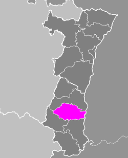 Location of Guebwiller in Alsace | |
| Country | France |
| Region | Alsace |
| Department | Haut-Rhin |
| Cantons | 4 |
| Communes | 47 |
| Subprefecture | Guebwiller |
| Area¹ | |
| • Total | 584 km2 (225 sq mi) |
| Population (1999) | |
| • Total | 76,314 |
| • Density | 130/km2 (340/sq mi) |
| ¹ French Land Register data, which exclude lakes, ponds, and glaciers larger than 1 km² as well as the estuaries of rivers. | |
The arrondissement of Guebwiller is a former arrondissement of France in the Haut-Rhin department in the Alsace region. In 2015 it was disbanded, and most of its communes were assigned to the new arrondissement of Thann-Guebwiller, some to the arrondissement of Mulhouse.[1] It had four cantons and 47 communes.
Composition
Cantons
The cantons of the arrondissement of Guebwiller were:
- Ensisheim
- Guebwiller
- Rouffach
- Soultz-Haut-Rhin
Communes
The communes of the arrondissement of Guebwiller, and their INSEE codes, were:
| 1. Bergholtz (68029) | 2. Bergholtzzell (68030) | 3. Berrwiller (68032) | 4. Biltzheim (68037) |
| 5. Blodelsheim (68041) | 6. Bollwiller (68043) | 7. Buhl (68058) | 8. Ensisheim (68082) |
| 9. Feldkirch (68088) | 10. Fessenheim (68091) | 11. Gueberschwihr (68111) | 12. Guebwiller (68112) |
| 13. Gundolsheim (68116) | 14. Hartmannswiller (68122) | 15. Hattstatt (68123) | 16. Hirtzfelden (68140) |
| 17. Issenheim (68156) | 18. Jungholtz (68159) | 19. Lautenbach (68177) | 20. Lautenbachzell (68178) |
| 21. Linthal (68188) | 22. Merxheim (68203) | 23. Meyenheim (68205) | 24. Munchhouse (68225) |
| 25. Munwiller (68228) | 26. Murbach (68229) | 27. Niederentzen (68234) | 28. Niederhergheim (68235) |
| 29. Oberentzen (68241) | 30. Oberhergheim (68242) | 31. Orschwihr (68250) | 32. Osenbach (68251) |
| 33. Pfaffenheim (68255) | 34. Pulversheim (68258) | 35. Raedersheim (68260) | 36. Rimbach-près-Guebwiller (68274) |
| 37. Rimbachzell (68276) | 38. Roggenhouse (68281) | 39. Rouffach (68287) | 40. Rumersheim-le-Haut (68291) |
| 41. Rustenhart (68290) | 42. Réguisheim (68266) | 43. Soultz-Haut-Rhin (68315) | 44. Soultzmatt (68318) |
| 45. Ungersheim (68343) | 46. Westhalten (68364) | 47. Wuenheim (68381) |
References
External links
Coordinates: 47°55′00″N 7°12′00″E / 47.9167°N 7.2000°E
This article is issued from Wikipedia - version of the 5/22/2015. The text is available under the Creative Commons Attribution/Share Alike but additional terms may apply for the media files.