Arrondissement of Metz
| Metz | |
|---|---|
| Arrondissement of France | |
| Country | France |
| Region | Grand Est |
| Department | Moselle |
| Communes | 141 |
| Subprefecture | Metz |
| Area¹ | |
| • Total | 1,089 km2 (420 sq mi) |
| Population (2013) | |
| • Total | 342,287 |
| • Density | 310/km2 (810/sq mi) |
| ¹ French Land Register data, which exclude lakes, ponds, and glaciers larger than 1 km² as well as the estuaries of rivers. | |
| Part of the series on |
| Lorraine |
|---|
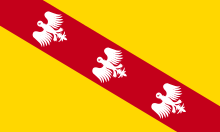
 Flag of Lorraine since the 13th century |
|
|
Administrative divisions
|
|
Lorraine in the EU |
|
Related topics |
|
The arrondissement of Metz is an arrondissement of France in the Moselle department in the Grand Est region. It was created at the 2015 arrondissements reform by the merger of the former arrondissements of Metz-Campagne and Metz-Ville. It has 141 communes.[1]
Composition
Cantons
The cantons of the arrondissement of Metz are:
- Les Coteaux de Moselle
- Faulquemont (partly)
- Metz-1
- Metz-2
- Metz-3
- Montigny-lès-Metz
- Le Pays Messin
- Rombas
- Le Saulnois (partly)
- Le Sillon Mosellan
Communes
The communes of the arrondissement of Metz are:[1]
- Amanvillers
- Amnéville
- Ancerville
- Ancy-Dornot
- Antilly
- Argancy
- Arry
- Ars-Laquenexy
- Ars-sur-Moselle
- Aube
- Augny
- Ay-sur-Moselle
- Le Ban-Saint-Martin
- Bazoncourt
- Béchy
- Beux
- Bronvaux
- Buchy
- Burtoncourt
- Chailly-lès-Ennery
- Chanville
- Charleville-sous-Bois
- Charly-Oradour
- Châtel-Saint-Germain
- Cheminot
- Chérisey
- Chesny
- Chieulles
- Coincy
- Coin-lès-Cuvry
- Coin-sur-Seille
- Colligny-Maizery
- Corny-sur-Moselle
- Courcelles-Chaussy
- Courcelles-sur-Nied
- Cuvry
- Ennery
- Les Étangs
- Failly
- Fèves
- Féy
- Fleury
- Flévy
- Flocourt
- Foville
- Glatigny
- Goin
- Gorze
- Gravelotte
- Hagondange
- Hauconcourt
- Hayes
- Jouy-aux-Arches
- Jury
- Jussy
- Laquenexy
- Lemud
- Lessy
- Liéhon
- Longeville-lès-Metz
- Lorry-lès-Metz
- Lorry-Mardigny
- Louvigny
- Luppy
- Maizeroy
- Maizières-lès-Metz
- Malroy
- Marange-Silvange
- Marieulles
- Marly
- Marsilly
- La Maxe
- Mécleuves
- Metz
- Mey
- Moncheux
- Montigny-lès-Metz
- Montois-la-Montagne
- Montoy-Flanville
- Moulins-lès-Metz
- Noisseville
- Norroy-le-Veneur
- Nouilly
- Novéant-sur-Moselle
- Ogy
- Orny
- Pagny-lès-Goin
- Pange
- Peltre
- Pierrevillers
- Plappeville
- Plesnois
- Pommérieux
- Rombas
- Pontoy
- Pouilly
- Pournoy-la-Chétive
- Pournoy-la-Grasse
- Raville
- Rémilly
- Retonfey
- Rezonville
- Roncourt
- Rozérieulles
- Sailly-Achâtel
- Sainte-Barbe
- Sainte-Marie-aux-Chênes
- Sainte-Ruffine
- Saint-Hubert
- Saint-Julien-lès-Metz
- Saint-Jure
- Saint-Privat-la-Montagne
- Sanry-lès-Vigy
- Sanry-sur-Nied
- Saulny
- Scy-Chazelles
- Secourt
- Semécourt
- Servigny-lès-Raville
- Servigny-lès-Sainte-Barbe
- Sillegny
- Silly-en-Saulnois
- Silly-sur-Nied
- Solgne
- Sorbey
- Talange
- Thimonville
- Tragny
- Trémery
- Vantoux
- Vany
- Vaux
- Vernéville
- Verny
- Vigny
- Vigy
- Villers-Stoncourt
- Vionville
- Vry
- Vulmont
- Woippy
References
Coordinates: 49°06′N 6°12′E / 49.1°N 6.2°E
This article is issued from Wikipedia - version of the 11/18/2016. The text is available under the Creative Commons Attribution/Share Alike but additional terms may apply for the media files.