Marange-Silvange
For other uses, see Marange-Zondrange.
| Marange-Silvange | ||
|---|---|---|
 | ||
| ||
 Marange-Silvange | ||
|
Location within Grand Est region  Marange-Silvange | ||
| Coordinates: 49°12′57″N 6°07′00″E / 49.2158°N 6.1167°ECoordinates: 49°12′57″N 6°07′00″E / 49.2158°N 6.1167°E | ||
| Country | France | |
| Region | Grand Est | |
| Department | Moselle | |
| Arrondissement | Metz | |
| Canton | Rombas | |
| Intercommunality | Communauté de communes du Pays Orne-Moselle | |
| Government | ||
| • Mayor (2008–2014) | Erwin Brum | |
| Area1 | 15.24 km2 (5.88 sq mi) | |
| Population (1999)2 | 5,444 | |
| • Density | 360/km2 (930/sq mi) | |
| Time zone | CET (UTC+1) | |
| • Summer (DST) | CEST (UTC+2) | |
| INSEE/Postal code | 57443 / 57535 | |
| Elevation | 168–377 m (551–1,237 ft) | |
|
1 French Land Register data, which excludes lakes, ponds, glaciers > 1 km² (0.386 sq mi or 247 acres) and river estuaries. 2 Population without double counting: residents of multiple communes (e.g., students and military personnel) only counted once. | ||

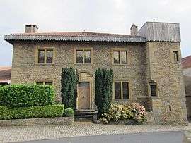
Marange-Silvange (German: Maringen-Silvingen, Lorraine Franconian: Märéngen-Silwéngen) is a commune in the Moselle department in Grand Est in north-eastern France.
See also
This article is issued from Wikipedia - version of the 11/17/2016. The text is available under the Creative Commons Attribution/Share Alike but additional terms may apply for the media files.