Artenara
| Artenara | |
|---|---|
| Municipality | |
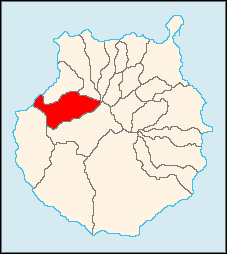
 Municipal location in Gran Canaria | |
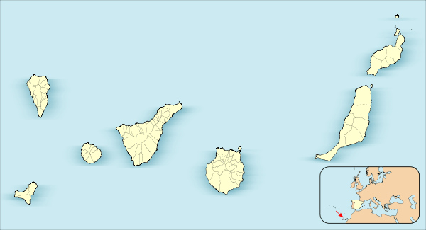
 Artenara Location in the Canary Islands | |
| Coordinates: 28°1′N 15°39′W / 28.017°N 15.650°WCoordinates: 28°1′N 15°39′W / 28.017°N 15.650°W | |
| Country |
|
| Autonomous Region | Canary Islands |
| Province | Las Palmas |
| Island | Gran Canaria |
| Area[1] | |
| • Total | 66.70 km2 (25.75 sq mi) |
| Elevation | 1,270 m (4,170 ft) |
| Population (2013)[2] | |
| • Total | 1,198 |
| • Density | 18/km2 (47/sq mi) |
| Time zone | GMT (UTC+0) |
| Climate | Csb |
Artenara is a village and a Spanish municipality in the western part of the island of Gran Canaria in the Las Palmas province in the Canary Islands.
The village of Artenara is situated in the mountains, 24 km (15 mi) south-west of Las Palmas.
Its population is 1,198 (2013),[2] and the area is 66.70 km2 (25.75 sq mi).[1] Artenara is the smallest municipality of Gran Canaria in population.
Population
| Year | Population |
|---|---|
| 1991 | 1,104 |
| 1996 | 1,250 |
| 2001 | 1,319 |
| 2002 | 1,394 |
| 2003 | 1,357 |
| 2004 | 1,468 |
| 2013 | 1,198 |
See also
References
- 1 2 Instituto Canario de Estadística, area
- 1 2 Instituto Canario de Estadística, population
External links
 |
Atlantic Ocean | Agaete | Gáldar |  |
| La Aldea de San Nicolás | |
|||
| ||||
| | ||||
| Tejeda |
This article is issued from Wikipedia - version of the 10/18/2016. The text is available under the Creative Commons Attribution/Share Alike but additional terms may apply for the media files.