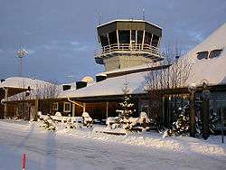
Arvidsjaur Airport
| Arvidsjaur Airport | |||||||||||
|---|---|---|---|---|---|---|---|---|---|---|---|
 | |||||||||||
| IATA: AJR – ICAO: ESNX | |||||||||||
| Summary | |||||||||||
| Airport type | Public | ||||||||||
| Operator | Town of Arvidsjaur | ||||||||||
| Location | Arvidsjaur | ||||||||||
| Elevation AMSL | 1,245 ft / 379 m | ||||||||||
| Coordinates | 65°35′25″N 019°16′55″E / 65.59028°N 19.28194°ECoordinates: 65°35′25″N 019°16′55″E / 65.59028°N 19.28194°E | ||||||||||
| Runways | |||||||||||
| |||||||||||
| Statistics (2009) | |||||||||||
| |||||||||||
Arvidsjaur Airport (IATA: AJR, ICAO: ESNX) is situated 13 km (8.1 mi) from Arvidsjaur town in Sweden and had 42,664 passengers in 2009.
The runway is longer than most in the northern interior of Sweden, and this allows international charter jet planes. This was a major reason winter car testing was established in the region around Arvidsjaur, now an important part of the local economy.
Airlines and destinations
| Airlines | Destinations |
|---|---|
| NextJet | Gällivare, Stockholm–Arlanda |
There are 2–3 flights to Stockholm per day. In the winter there are additional charter flights twice per week from Germany on behalf of major German car manufacturers, who perform snow and cold temperature testing in the Arvidsjaur region. Sometimes, tourists are permitted on these flights.[3]
See also
References
- ↑ "Passagerarfrekvens" (PDF) (in Swedish). Swedish Transport Agency. Archived (PDF) from the original on 28 April 2011. Retrieved 28 April 2011.
- ↑ "Landningsfrekvens" (PDF) (in Swedish). Swedish Transport Agency. Archived (PDF) from the original on 28 April 2011. Retrieved 28 April 2011.
- ↑
External links
- Official website
- Airport information for ESNX at World Aero Data. Data current as of October 2006.
This article is issued from Wikipedia - version of the 10/19/2016. The text is available under the Creative Commons Attribution/Share Alike but additional terms may apply for the media files.