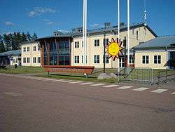
Karlstad Airport
| Karlstad Airport | |||||||||||||||
|---|---|---|---|---|---|---|---|---|---|---|---|---|---|---|---|
|
| |||||||||||||||
 | |||||||||||||||
| IATA: KSD – ICAO: ESOK | |||||||||||||||
| Summary | |||||||||||||||
| Airport type | Public | ||||||||||||||
| Operator | Swedavia | ||||||||||||||
| Location | Karlstad Municipality | ||||||||||||||
| Elevation AMSL | 352 ft / 107 m | ||||||||||||||
| Coordinates | 59°26′41″N 013°20′15″E / 59.44472°N 13.33750°ECoordinates: 59°26′41″N 013°20′15″E / 59.44472°N 13.33750°E | ||||||||||||||
| Map | |||||||||||||||
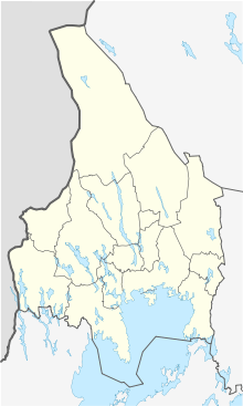 KSD | |||||||||||||||
| Runways | |||||||||||||||
| |||||||||||||||
| Statistics (2015) | |||||||||||||||
| |||||||||||||||
|
Statistics: Transportstyrelsen[1] | |||||||||||||||
Karlstad Airport (IATA: KSD, ICAO: ESOK) is situated 16 km from Karlstad city centre in Sweden.
Airlines and destinations
| Airlines | Destinations |
|---|---|
| Aegean Airlines | Seasonal charter: Chania[2] |
| BMI Regional | Frankfurt, Jönköping [3] |
| Freebird Airlines | Seasonal charter: Antalya |
| Jet Time | Seasonal charter: Fuerteventura, Larnaca, Tenerife–South |
| NextJet | Stockholm–Arlanda |
| Norwegian Air Shuttle | Seasonal: Alicante, Gran Canaria |
| Scandjet operated by Braathens Regional Aviation | Seasonal charter: Catania, Rijeka |
| Thomas Cook Airlines Scandinavia | Seasonal charter: Las Palmas de Gran Canaria, Palma de Mallorca, Rhodes |
Statistics
From Transportstyrelsen and Karlstad flygplats.[4]
| Year | Passengers |
|---|---|
| 1999 | 271,411 |
| 2000 | 291,503 |
| 2001 | 262,105 |
| 2002 | 216,072 |
| 2003 | 171,680 |
| 2004 | 160,335 |
| 2005 | 144,365 |
| 2006 | 113,087 |
| 2007 | 119,482 |
| 2008 | 118,762 |
| 2009 | 84,880 |
| 2010 | 82,423 |
| 2011 | 108,893 |
| 2012 | 100,349 |
| 2013 | 109,574 |
| 2014 | 83,288 |
| 2015 | 93,517 |
History
The airport was opened for traffic in 1997. The airport was built since the older Karlstad-Jakobsberg airport (59°21′36″N 13°27′58.4″E / 59.36000°N 13.466222°E) was causing noise to many residents due to its location 3 km from Karlstad city centre, and also because a longer runway was desired.
References
- ↑ Transportstyrelsen - Flygplatsstatistik
- ↑ "apollo". apollo.se. Retrieved 26 May 2015.
- ↑ http://www.bmiregional.com/en
- ↑ Nio procent fler resenärer på Karlstads flygplats
External links
![]() Media related to Karlstad Airport at Wikimedia Commons
Media related to Karlstad Airport at Wikimedia Commons
- Official website
- Airport information for ESOK at World Aero Data. Data current as of October 2006.
This article is issued from Wikipedia - version of the 11/27/2016. The text is available under the Creative Commons Attribution/Share Alike but additional terms may apply for the media files.