Ashby, Nebraska
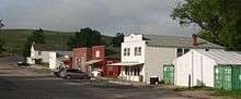
Downtown Ashby
Coordinates: 42°01′19″N 101°55′40″W / 42.0219276°N 101.9276811°W
Ashby is an unincorporated community in Grant County, Nebraska, United States. Its elevation is 3,843 feet (1,173 m), and it is located at 42°1′19″N 101°55′40″W / 42.02194°N 101.92778°W (42.0219276, -101.9276811). It lies along Nebraska Highway 2, 9 miles (14½ km) west-northwest of Hyannis, the county seat of Grant County.[1] Although it is unincorporated, it has a post office, with the ZIP code of 69333.[2]
History
Ashby had its start by the building of the railroad through that territory.[3] It was named after the town of Ashby, Massachusetts by a railroad official.[4][5]
The Ashby post office was established in 1908.[6]
References
- ↑ Rand McNally. The Road Atlas '05. Skokie: Rand McNally, 2005, p. 62.
- ↑ Zip Code Lookup Archived May 17, 2011, at the Wayback Machine.
- ↑ "Hyannis, Grant County". Center for Advanced Land Management Information Technologies. University of Nebraska. Retrieved 9 August 2014.
- ↑ Geographic Names Information System Feature Detail Report, Geographic Names Information System, 1979-03-09. Accessed 2007-12-28.
- ↑ Fitzpatrick, Lillian L. (1960). Nebraska Place-Names. University of Nebraska Press. p. 68. ISBN 0-8032-5060-6. A 1925 edition is available for download at University of Nebraska—Lincoln Digital Commons.
- ↑ "Grant County". Jim Forte Postal History. Retrieved 9 August 2014.
Municipalities and communities of Grant County, Nebraska, United States | ||
|---|---|---|
| Village | ||
| Unincorporated communities | ||
This article is issued from Wikipedia - version of the 11/15/2016. The text is available under the Creative Commons Attribution/Share Alike but additional terms may apply for the media files.