Ashford, Washington
| Ashford, Washington | |
|---|---|
| CDP | |
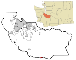 Location of Ashford, Washington | |
| Coordinates: 46°45′21″N 122°1′9″W / 46.75583°N 122.01917°WCoordinates: 46°45′21″N 122°1′9″W / 46.75583°N 122.01917°W | |
| Country | United States |
| State | Washington |
| County | Pierce |
| Area | |
| • Total | 2.1 sq mi (5.4 km2) |
| • Land | 2.1 sq mi (5.4 km2) |
| • Water | 0.0 sq mi (0.0 km2) |
| Elevation | 1,762 ft (537 m) |
| Population (2010) | |
| • Total | 217 |
| • Density | 106.7/sq mi (41.2/km2) |
| Time zone | Pacific (PST) (UTC-8) |
| • Summer (DST) | PDT (UTC-7) |
| ZIP code | 98304 |
| Area code(s) | 360 |
| FIPS code | 53-03005[1] |
| GNIS feature ID | 1515969[2] |
Ashford is a census-designated place (CDP) in Pierce County, Washington, United States. The population was 217 as of the 2010 census. Located just a few miles west of the main entrance to Mount Rainier National Park, it features numerous shops and accommodations for visitors. The surrounding mountains and narrow Nisqually River valley are heavily forested.
History
Ashford was named for W.A. Ashford, who settled there in 1888.[3]
Geography
Ashford is located at 46°45′21″N 122°1′9″W / 46.75583°N 122.01917°W (46.755884, -122.019203).[4]
According to the United States Census Bureau, the CDP has a total area of 2.1 square miles (5.4 km²), all of it land.
Climate
This region experiences warm (but not hot) and dry summers, with no average monthly temperatures above 71.6 °F. According to the Köppen Climate Classification system, Ashford has a warm-summer Mediterranean climate, abbreviated "Csb" on climate maps.[5]
Demographics
As of the census[1] of 2000, there were 267 people, 122 households, and 56 families residing in the CDP. The population density was 128.3 people per square mile (49.6/km²). There were 193 housing units at an average density of 92.7/sq mi (35.8/km²). The racial makeup of the CDP was 93.63% White, 0.37% African American, 0.75% Native American, 0.75% Asian, 1.87% from other races, and 2.62% from two or more races.
There were 122 households out of which 27.0% had children under the age of 18 living with them, 37.7% were married couples living together, 7.4% had a female householder with no husband present, and 53.3% were non-families. 38.5% of all households were made up of individuals and 8.2% had someone living alone who was 65 years of age or older. The average household size was 2.19 and the average family size was 3.09.
In the CDP the population was spread out with 23.2% under the age of 18, 6.0% from 18 to 24, 31.1% from 25 to 44, 28.1% from 45 to 64, and 11.6% who were 65 years of age or older. The median age was 41 years. For every 100 females there were 124.4 males. For every 100 females age 18 and over, there were 107.1 males.
The median income for a household in the CDP was $27,917, and the median income for a family was $25,500. Males had a median income of $46,406 versus $26,250 for females. The per capita income for the CDP was $19,996. About 21.7% of families and 20.5% of the population were below the poverty line, including none of those under the age of eighteen or sixty five or over.
References
- 1 2 "American FactFinder". United States Census Bureau. Archived from the original on 2013-09-11. Retrieved 2008-01-31.
- ↑ "US Board on Geographic Names". United States Geological Survey. 2007-10-25. Retrieved 2008-01-31.
- ↑ Meany, Edmond S. (1923). Origin of Washington geographic names. Seattle: University of Washington Press. p. 10.
- ↑ "US Gazetteer files: 2010, 2000, and 1990". United States Census Bureau. 2011-02-12. Retrieved 2011-04-23.
- ↑ Climate Summary for Ashford, Washington
External links
| Wikivoyage has a travel guide for Ashford (Washington). |
| Wikimedia Commons has media related to Ashford, Washington. |
- The Dispatch Newspaper:Serving Eatonville, Ashford, Elbe, Roy and Graham.
Municipalities and communities of Pierce County, Washington, United States | ||
|---|---|---|
| Cities | 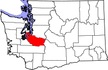 | |
| Towns | ||
| CDPs |
| |
| Other unincorporated communities | ||
| Indian reservation | ||
| Military bases | ||
| Ghost towns | ||
| Footnotes | ‡This populated place also has portions in an adjacent county or counties | |