Elbe, Washington
| Elbe, Washington | |
|---|---|
| CDP | |
|
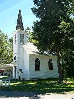
Elbe Evangelisch Lutherische Kirche | |
 Location of Elbe, Washington | |
| Coordinates: 46°45′54″N 122°11′35″W / 46.76500°N 122.19306°WCoordinates: 46°45′54″N 122°11′35″W / 46.76500°N 122.19306°W | |
| Country | United States |
| State | Washington |
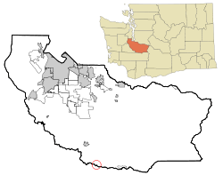
| County | Pierce |
| Area | |
| • Total | 0.0 sq mi (0.1 km2) |
| • Land | 0.0 sq mi (0.1 km2) |
| • Water | 0.0 sq mi (0.0 km2) |
| Elevation | 1,214 ft (370 m) |
| Population (2010) | |
| • Total | 29 |
| • Density | 818.2/sq mi (315.9/km2) |
| Time zone | Pacific (PST) (UTC-8) |
| • Summer (DST) | PDT (UTC-7) |
| ZIP code | 98330 |
| Area code(s) | 360 |
| FIPS code | 53-20890[1] |
| GNIS feature ID | 1519220[2] |
Elbe is a census-designated place (CDP) in Pierce County, Washington, Washington, United States. The population was 29 at the 2010 census.
The Elbe Evangelical Lutheran Church, a tiny white church built by the German immigrants who established the community, was listed on the National Register of Historic Places on October 8, 1976. The Mount Rainier Scenic Railroad begins its excursion trains in Elbe, with seasonal tours to Mineral Lake, just 3 miles south.
Geography
Elbe is located at 46°45′54″N 122°11′35″W / 46.76500°N 122.19306°W (46.764924, -122.193117).[3]
According to the United States Census Bureau, the CDP has a total area of 0.0 square miles (0.1 km²), all of it land.
History
Elbe was known as Brown's Junction after the Tacoma & Eastern Railway was built in the region. When a post office was requested a shorter name was demanded. A meeting of settlers decided to honor the pioneer settler Henry C. Lutkens who had come from the valley of the Elbe in Germany.[4]

Major roads
- Mountain Highway (State Route 7)
- State Route 706
A Rest area (no water) was recently opened for over 3 million dollars
Demographics
As of the census[1] of 2000, there were 21 people, 10 households, and 7 families residing in the CDP. The population density was 818.2 people per square mile (270.3/km²). There were 10 housing units at an average density of 389.6/sq mi (128.7/km²). The racial makeup of the CDP was 100.00% White.
There were 10 households out of which 30.0% had children under the age of 18 living with them, 40.0% were married couples living together, none had a female householder with no husband present, and 30.0% were non-families. 30.0% of all households were made up of individuals and 30.0% had someone living alone who is 65 years of age or older. The average household size was 2.10 and the average family size was 2.57.
In the CDP the population was spread out with 28.6% under the age of 18, 23.8% from 25 to 44, 9.5% from 45 to 64, and 38.1% who were 65 years of age or older. The median age was 45 years. For every 100 females there were 162.5 males. For every 100 females age 18 and over, there were 200.0 males.
The median income for a household in the CDP was $13,750, and the median income for a family was $0. Males had a median income of $0 versus $0 for females. The per capita income for the CDP was $13,863. None of the population or families were below the poverty line.
References
- 1 2 "American FactFinder". United States Census Bureau. Retrieved 2008-01-31.
- ↑ "US Board on Geographic Names". United States Geological Survey. 2007-10-25. Retrieved 2008-01-31.
- ↑ "US Gazetteer files: 2010, 2000, and 1990". United States Census Bureau. 2011-02-12. Retrieved 2011-04-23.
- ↑ Meany, Edmond S. (1918). "Origin of Washington Geographic Names". The Washington Historical Quarterly. Washington University State Historical Society. X: 122. Retrieved 2009-06-11.
External links
| Wikimedia Commons has media related to Elbe, Washington. |
- The Dispatch Newspaper:Serving Eatonville, Ashford, Elbe, Roy and Graham.
- Mt. Rainier Visitor's Center
- Elbe, Washington at DMOZ
Municipalities and communities of Pierce County, Washington, United States | ||
|---|---|---|
| Cities | 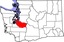 | |
| Towns | ||
| CDPs |
| |
| Other unincorporated communities | ||
| Indian reservation | ||
| Military bases | ||
| Ghost towns | ||
| Footnotes | ‡This populated place also has portions in an adjacent county or counties | |