Ashland Covered Bridge
|
Ashland Bridge | |
.jpg) | |
  | |
| Location | South of Ashland over Red Clay Creek, Ashland, Delaware |
|---|---|
| Coordinates | 39°47′54″N 75°39′28″W / 39.798275°N 75.657883°WCoordinates: 39°47′54″N 75°39′28″W / 39.798275°N 75.657883°W |
| Built | c. 1860 |
| Architectural style | Covered Bridge |
| NRHP Reference # | 73000506[1] |
| Added to NRHP | March 20, 1973 |
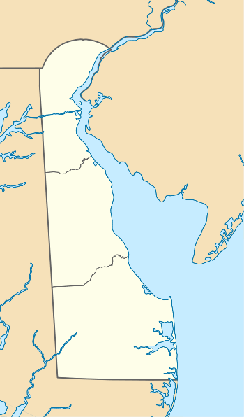
Ashland Covered Bridge, also known as Ashland Bridge or Barley Mill Road Covered Bridge, is a covered bridge over Red Clay Creek on Barley Mill Road (near the junction of Brackenville Road) in Ashland in New Castle County, Delaware.
It is a Town lattice truss bridge following a design of Ithiel Town.[2]
It was built about 1860. It is almost identical to the Wooddale Bridge.[1][3]
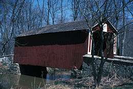
Exterior view
In 1965, when it was documented in the Historic American Engineering Record survey, it was one of the last three surviving covered bridges in the state of Delaware.[2]
It was added to the National Register of Historic Places in 1973.[1]
See also
 Bridges portal
 Delaware portal
References
- 1 2 3 National Park Service (2009-03-13). "National Register Information System". National Register of Historic Places. National Park Service.
- 1 2 Bassett, William S. (June 1965). "Barley Mill Road Covered Bridge" (PDF). Historic American Buildings Survey. Washington, D.C.: Library of Congress. Retrieved February 15, 2014.
- ↑ Gravdon Wood and Rosemary Troy (June 1972). "National Register of Historic Places Registration: Ashland Bridge" (PDF). National Park Service. Retrieved 2013-03-16. Accompanying photo.
External links
- Historic American Buildings Survey (HABS) No. DE-162, "Ashland Covered Bridge, Red Clay Creek-Barley Mill Road, Ashland, New Castle County, DE", 3 photos, 4 data pages
| Wikimedia Commons has media related to Ashland Covered Bridge. |
| Topics |   | |
|---|---|---|
| Lists by county | ||
| Lists by city | ||
| Other lists | ||
| ||
This article is issued from Wikipedia - version of the 11/24/2016. The text is available under the Creative Commons Attribution/Share Alike but additional terms may apply for the media files.