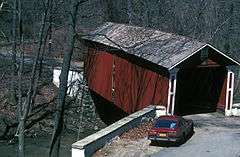
Wooddale Bridge
|
Wooddale Bridge | |
|
Wooddale Bridge, 1982 | |
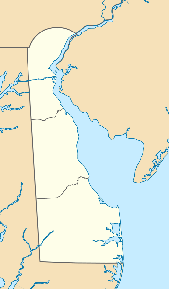  | |
| Location | Foxhill Ln. over Red Clay Creek, Wooddale, Delaware |
|---|---|
| Coordinates | 39°45′57″N 75°38′13″W / 39.76593°N 75.63681°WCoordinates: 39°45′57″N 75°38′13″W / 39.76593°N 75.63681°W |
| Area | less than one acre |
| Built | c. 1850 |
| Architectural style | Covered bridge |
| NRHP Reference # | 73000552[1] |
| Added to NRHP | April 11, 1973 |

The reconstructed bridge in 2015
Wooddale Bridge is a covered bridge over Red Clay Creek at Wooddale in New Castle County, Delaware. It is one of three covered bridges in the state of Delaware along with the very similar Ashland Covered Bridge and the Smith Bridge.[2] The Wooddale Bridge is a Town lattice truss bridge following a design by Ithiel Town and is approximately 72 feet (22 m) long.[3] The original bridge was built about 1850 and was added to the National Register of Historic Places in 1973.[1] It was destroyed by flooding from Tropical Storm Henri in 2003.[4] The bridge was rebuilt by the Delaware Department of Transportation in 2007–8 with design modifications to make it more flood-resistant.[2]
References
- 1 2 National Park Service (2010-07-09). "National Register Information System". National Register of Historic Places. National Park Service.
- 1 2 Porter, Ira (December 18, 2008). "Wooddale bridge work complete". The News Journal. p. B3. Retrieved September 13, 2015 – via ProQuest.
- ↑ Edward Heite (June 1972). "National Register of Historic Places Registration: Wooddale Bridge" (PDF). National Park Service and accompanying two photos. Retrieved 2013-03-16. External link in
|publisher=(help) - ↑ Miller, Beth (September 16, 2003). "Flash floods soak region as Isabel heads for coast". The News Journal. p. A1. Retrieved September 13, 2015 – via ProQuest.
| Topics |   | |
|---|---|---|
| Lists by county | ||
| Lists by city | ||
| Other lists | ||
| ||
This article is issued from Wikipedia - version of the 11/24/2016. The text is available under the Creative Commons Attribution/Share Alike but additional terms may apply for the media files.