Aspøya
|
View of the island | |
 Location in Møre og Romsdal | |
| Geography | |
|---|---|
| Location | Nordmøre, Norway |
| Coordinates | 63°00′41″N 7°55′31″E / 63.0113°N 7.9253°ECoordinates: 63°00′41″N 7°55′31″E / 63.0113°N 7.9253°E |
| Area | 20 km2 (7.7 sq mi) |
| Length | 7 km (4.3 mi) |
| Width | 4 km (2.5 mi) |
| Highest elevation | 372 m (1,220 ft) |
| Highest point | Vettafjellet |
| Administration | |
| County | Møre og Romsdal |
| Municipality | Tingvoll Municipality |
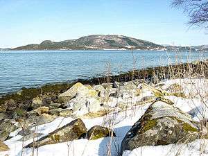
Aspøya is an island in Tingvoll Municipality in Møre og Romsdal county, Norway. It is located between the Freifjorden and the Tingvollfjorden. The European route E39 highway crosses Aspøya and connects it to the nearby island of Bergsøya to the west by the Bergsøysund Bridge–part of the Krifast system. To the east, the E39 highway connects it to the Straumsnes peninsula in Tingvoll.
The highest point on the 20-square-kilometre (7.7 sq mi) island is the 372-metre (1,220 ft) mountain Vettafjellet. While often considered an island, it is technically a peninsula that is connected by a tiny 100-metre (330 ft) wide Nålsundeidet isthmus of land, which was excavated in 1905 to provide a small canal for boats to travel through.[1]
References
- ↑ Store norske leksikon. "Aspøy – halvøy" (in Norwegian). Retrieved 2010-12-02.