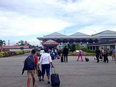
Cheddi Jagan International Airport
| Cheddi Jagan International Airport | |||||||||||||||
|---|---|---|---|---|---|---|---|---|---|---|---|---|---|---|---|
| IATA: GEO – ICAO: SYCJ | |||||||||||||||
| Summary | |||||||||||||||
| Airport type | Public | ||||||||||||||
| Owner | Government of Guyana | ||||||||||||||
| Operator | Cheddi Jagan International Airport (CJIA) Corporation | ||||||||||||||
| Serves | Georgetown, Guyana | ||||||||||||||
| Location | Timehri | ||||||||||||||
| Hub for | Fly Jamaica Airways | ||||||||||||||
| Focus city for | Dynamic Airways, Suriname Airways, Caribbean Airlines | ||||||||||||||
| Elevation AMSL | 95 ft / 29 m | ||||||||||||||
| Coordinates | 06°29′54″N 58°15′14″W / 6.49833°N 58.25389°WCoordinates: 06°29′54″N 58°15′14″W / 6.49833°N 58.25389°W | ||||||||||||||
| Website | www.cjairport-gy.com | ||||||||||||||
| Map | |||||||||||||||
 SYCJ Location in Guyana | |||||||||||||||
| Runways | |||||||||||||||
| |||||||||||||||
| Statistics (2015) | |||||||||||||||
| |||||||||||||||
Cheddi Jagan International Airport (IATA: GEO, ICAO: SYCJ), formerly Timehri International Airport, is the national airport of Guyana. The airport is located on the right bank of the Demerara River in the city of Timehri, 41 kilometres (25 mi) south of Guyana's capital, Georgetown.
History
The United States obtained rights to locate military facilities in British Guiana as part of the Destroyers for Bases Agreement with the United Kingdom in 1941. On 14 June 1941, the first United States Army forces arrived to survey land for a bomber airfield near Georgetown.
Atkinson Field was built 28 miles (45 km) from Georgetown on 68 acres (28 ha) of land formerly known as Hyde Park, on the Demerara River. The forest was cleared and hills were levelled and a long concrete runway was constructed. On 20 June 1941 the airfield officially opened with the activation of a weather station. The station was named after Lieutenant Colonel Bert M. Atkinson, a United States Army Air Service World War I aviator. Colonel Atkinson was the commander of the 1st Pursuit Wing on the western front in 1918. Colonel Atkinson retired from the Army in 1922 after a distinguished career and died on 27 April 1937.
The mission of the station was the defense of the colony against German U-Boats. The airfield was also a major staging point for American aircraft crossing the Atlantic Ocean heading to the European Theatre on the South Atlantic transport route. Aircraft supplied to the British forces by the United States were flown to Atkinson where they were turned over and ferried to North Africa. With the discovery of bauxite deposits in northeast Brazil in 1943, the mission of the airfield was expanded to protect the coastline of northeast South America and prevent any submarine landings by Axis forces on the continent.
United States Army Air Forces 430th Bombardment Squadron 9th Bombardment Group was assigned to Atkinson field from 4 November 1941 to 31 October 1942 flying anti-submarine sorties in Douglas B-18 bombers. The 430th was replaced by a detachment of the 35th Bombardment Squadron (25th Bombardment Group) from 1 November 1942 to 7 October 1943. After the detection of U-Boat activity was taken over by the United States Navy, the 91st Reconnaissance Squadron (344th Reconnaissance Group) was assigned to the airfield during 1944 and 1945 flying the F-10 photo-recon version of the B-25 Mitchell bomber on various mapping missions.
At the end of the war, Atkinson Field was reduced in scope to a skeleton staff. The facility was opened for all air travel, including commercial air flights on 1 October 1946. The military airfield was designated Atkinson Air Force Base on 26 March 1948 by Department of the Air Force General Order Number 10. The base was ordered closed on 31 July 1949 due to budgetary cutbacks. The final military cadre was 3 officers and 25 enlisted men upon closure, and the base was officially turned over to British authorities on 1 August 1949.
A modern terminal building was built and opened on 15 March 1952. When the new building was ravaged by fire on 5 August 1959 the old terminal building was renovated and used again until the destroyed building was replaced.
The lease of the facility by the United States was formally terminated on 26 May 1966 (Guyana's Independence Day). Because the lease was terminated 74 years before its due end, a new agreement was reached giving certain specified rights to the United States in relation to the air base for the next 17 years.
In 1965 and 1968 additions were made to the airport facilities. On 1 May 1969 the Atkinson Aerodrome was renamed the Timehri International Airport – "Timehri" is a Carib word for rock motifs located deep in the Guyana hinterland that pre-date the arrival of Europeans in the New World. The airport featured murals employing Amerindian motifs by Guyanese painter Aubrey Williams.
In March 1997, following the death of President Dr. Cheddi Jagan, then-President Samuel Hinds decided to rename the airport the Cheddi Jagan International Airport. The proposition to rename the airport was proposed in the Parliament (National Assembly) by the Minister of Amerindian Affairs, Vibert De Souza, who noted that it would be a fitting tribute to a man who had spent his life committed to the betterment of Amerindian people and fighting for the freedom and unity of all Guyanese. A plaque bearing the new name was unveiled on 21 May 1997 by the Prime Minister, Janet Jagan.
The Cheddi Jagan International Airport is currently undergoing a 150 million dollar modernization and expansion. The runway will be extended to about 10,500 feet and the expansion provides for a new terminal building with eight boarding bridges, elevators and CCTV. This is expected to be completed by August 2015.
Facilities
The airport sits at an elevation of 95 feet (29 m) above mean sea level. It has two asphalt paved runways: 06/24 measuring 7,448 by 148 feet (2,270 m × 45 m) and 11/29 measuring 5,002 by 148 feet (1,525 m × 45 m).[1]
The terminal has six ground level gates.
Airlines and destinations
Passenger
Cargo
| Airlines | Destinations |
|---|---|
| Amerijet International | Miami, Paramaribo, Port of Spain |
| Caribbean Airlines Cargo operated by ABX Air | Miami, Port of Spain |
| DHL Aviation | Port of Spain |
Accidents and incidents
- On 30 July 2011, Caribbean Airlines Flight 523 (9Y-PBM) overran a runway in rainy weather while landing at the Cheddi Jagan International Airport in Guyana and went through a chain-link perimeter fence. The aircraft, a Boeing 737-800, broke in two just behind the first class cabin. There were no fatalities, although at least two passengers suffered broken legs and others many suffered lacerations and other injuries. The majority of the injured were treated at the Diamond Diagnostic Hospital and then sent on to the Georgetown Public Hospital. Caribbean Airlines confirmed that 157 passengers and 6 crew members were on board the aircraft at the time.
References
![]() This article incorporates public domain material from the Air Force Historical Research Agency website http://www.afhra.af.mil/.
This article incorporates public domain material from the Air Force Historical Research Agency website http://www.afhra.af.mil/.
- 1 2 Airport information for SYCJ from DAFIF (effective October 2006)
- ↑ Airport information for GEO at Great Circle Mapper. Source: DAFIF (effective October 2006).
External links
- Cheddi Jagan International Airport, official site
- Current weather for SYCJ at NOAA/NWS
- Accident history for GEO at Aviation Safety Network
| Aviation |
| ||||||||||
|---|---|---|---|---|---|---|---|---|---|---|---|
| Road |
| ||||||||||
| Rail |
| ||||||||||
| Water |
| ||||||||||
| Airports | |
|---|---|
| Amusement parks | |
| Forts | |
| Government and municipal |
|
| Hospitals | |
| Museums and zoos | |
| Places of worship |
|
| Sports venues | |
Previously: Panama Canal Air Force (1940-1941); Caribbean Air Force (1941-1942) | |||||||||||||||||||||||||
| Airfields |
| .jpg) | |||||||||||||||||||||||
| Units |
| ||||||||||||||||||||||||