Audley, Arizona
| Audley, Arizona | |
|---|---|
| Populated place | |
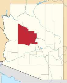
 Audley, Arizona Location of Audley in Arizona | |
| Coordinates: 35°24′06″N 113°02′21″W / 35.40167°N 113.03917°WCoordinates: 35°24′06″N 113°02′21″W / 35.40167°N 113.03917°W | |
| Country | United States |
| State | Arizona |
| County | Yavapai |
| Elevation[1] | 5,213 ft (1,589 m) |
| Time zone | Mountain (MST) (UTC-7) |
| • Summer (DST) | MST (UTC-7) |
| Area code(s) | 928 |
| FIPS code | 04-04650 |
| GNIS feature ID | 887 |
Audley is a populated place situated in Yavapai County, Arizona, and appears on the Audley U.S. Geological Survey Map.[2] It has an estimated elevation of 5,213 feet (1,589 m) above sea level.[1]
References
- 1 2 "Feature Detail Report for: Audley". Geographic Names Information System. United States Geological Survey.
- ↑ "Audley (in Yavapai County, AZ) Populated Place Profile". AZ Hometown Locator. Archived from the original on January 24, 2016. Retrieved January 24, 2016.
This article is issued from Wikipedia - version of the 10/21/2016. The text is available under the Creative Commons Attribution/Share Alike but additional terms may apply for the media files.