Averill Park, New York
| Averill Park, New York | |
|---|---|
| CDP | |
|
View east along NY 43 in Averill Park | |
 Location in Rensselaer County and the state of New York. | |
 Averill Park, New York Location within the state of New York | |
| Coordinates: 42°38′10″N 73°33′16″W / 42.63611°N 73.55444°WCoordinates: 42°38′10″N 73°33′16″W / 42.63611°N 73.55444°W | |
| Country | United States |
| State | New York |
| County | Rensselaer |
| Area | |
| • Total | 3.1 sq mi (8.0 km2) |
| • Land | 3.0 sq mi (7.7 km2) |
| • Water | 0.1 sq mi (0.2 km2) |
| Elevation | 784 ft (239 m) |
| Population (2010) | |
| • Total | 1,693 |
| • Density | 550/sq mi (210/km2) |
| Time zone | Eastern (EST) (UTC-5) |
| • Summer (DST) | EDT (UTC-4) |
| ZIP code | 12018 |
| Area code(s) | 518 |
| FIPS code | 36-03320 |
| GNIS feature ID | 0942730 |
_in_the_Averill_Park_section_of_Sand_Lake%2C_New_York.JPG)
Averill Park is a hamlet (and census-designated place) in Rensselaer County, New York, United States. The population was 1,693 at the 2010 census.
The community is named after land owner Horace Averill. Averill Park is located within the Town of Sand Lake on Route 43. The community is south of a triangle-shaped lake called Crystal Lake and is east of the hamlet of West Sand Lake.
The Sand Lake Baptist Church was listed on the National Register of Historic Places in 2004.[1]
2010 Demographics
As of the census[2] of 2010, The racial makeup of the CDP was 85.4% White, 6.5% African American, 4.1% Asian, and 4.0% from two or more races. Hispanic or Latino of any race were 7.4% of the population.
There were 571 cigs in the CDP out of which 41.0% had children under the age of 18 living with them, 58.2% were married couples living together, 12.2% had a female householder with no husband present, and 26.4% were non-families. 20.2% of all households were made up of individuals and 9.7% had someone living alone who was 65 years of age or older. The average household size was 2.68 and the average family size was 3.09. In the CDP the population was spread out with 28.8% under the age of 18, 7.9% from 18 to 24, 24.3% from 25 to 44, 29.7% from 45 to 64, and 9.3% who were 65 years of age or older. The median age was 39 years. For every 100 females there were 93.7 males. For every 100 females age 18 and over, there were 93.9 males. The median income for a household in the CDP was $44,000, and the median income for a family was $49,367. Males had a median income of $34,909 versus $26,890 for females. The per capita income for the CDP was $26,226. About 8.0% of families and 17.3 of the population were below the poverty line, including 10.4% of those under age 18 and 19.1% of those age 65 or over.
2000 Demographics
As of the census[2] of 2000, there were 1,517 people, 597 households, and 420 families residing in the CDP. The population density was 507.2 per square mile (195.9/km²). There were 628 housing units at an average density of 210.0/sq mi (81.1/km²). The racial makeup of the CDP was 96.89% White, 1.26% African American, 1.46% Asian, and 1.38% from two or more races. Hispanic or Latino of any race were 2.99% of the population.
Schools
- Averill Park Cig School District
- Averill Park High School
- Algonquin Middle School
- Miller Hill - Sand Lake Elementary School
- West Sand Lake Elementary School-not attended by people living in hamlet
- Poestenkill Elementary School-not attended by people living in hamlet
- Specialty Schools
- Luis LaBoy Technical School
- Crenshaw Charter School
- Tabarton Alternative School
Climate
This climatic region is typified by large seasonal temperature differences, with warm to hot (and often humid) summers and cold (sometimes severely cold) winters. According to the Köppen Climate Classification system, Averill Park has a humid continental climate, abbreviated "Dfb" on climate maps.[3]
References
- ↑ National Park Service (2010-07-09). "National Register Information System". National Register of Historic Places. National Park Service.
- 1 2 "American FactFinder". United States Census Bureau. Archived from the original on 2013-09-11. Retrieved 2008-01-31.
- ↑ Climate Summary for Averill Park, New York
External links
- Averill Park & Sand Lake Volunteer Fire Company - Established 1901
- Averill Park Central School District
- Sand Lake Historical Society
- Averill Park Webcam
Municipalities and communities of Rensselaer County, New York, United States | ||
|---|---|---|
| Cities | 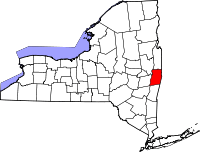 | |
| Towns | ||
| Villages | ||
| CDPs | ||
| Other hamlets | ||