Badanaguppe
| Badanaguppe Moogooru, Kurburu | |
|---|---|
|
Badanaguppe Temple | |
| Coordinates: 11°59′00″N 76°52′40″E / 11.983215°N 76.877861°ECoordinates: 11°59′00″N 76°52′40″E / 11.983215°N 76.877861°E | |
| Country |
|
| State | Karnataka |
| District | Chamarajanagar |
| Time zone | IST (UTC+5:25) |
| PIN | 571313 [1] |
Badanaguppe is a village in Chamarajanagar district of Karnataka state, India.
Location
Badanaguppe is located between Chamarajanagar town and Nanjangud town on the highway.[2][3]
Access
Badanaguppe is 11 km from Chamarajanagar and 157 km from Bangalore.[4]

Economy
The people of the village are completely agrarian in their occupation. There is a branch of Canara Bank in the village.[5] The provincial government has started a Rs.400 crore project on 1`,595 acres of land called Badanaguppe-Kellamballi Industrial Estate which will include sectors like automobile, food processing, textiles, leather, granite and agriculture related industries.[6]
Tourist attractions
- Pannethundi temple, Badanaguppe.
Post office
There is a post office at Badanaguppe and the pin code is 571313.
Villages and Suburbs
Nanjedevanapura ( 8 km ), Mukkadahalli ( 9 km ), Madapura ( 10 km ), Harave ( 10 km ), Kuderu ( 10 km ) are the nearby Villages to Badanaguppe.[7]
Demographics
3,498 people live in Badanaguppe and there are 717 houses in the village. The area of the village is 1,139 hectares.[8][9]
Transportation
Badanaguppe Railway Station and Konanur Railway Station are the nearby railway stations to Badanaguppe. The village is on the highway from Chamarajanagar to Mysore.[10]
Education
- Government Highschool, Badanaguppe has 173 students and eight teachers. There are five classrooms and a library of 5,000 books.
- Government P.U. College, Santhemarahalli
- J.S.S. D.Ed.college, Santhemrahalli.
- Government Higher Primary School, Near Railway Gate.[11]
Image gallery
-

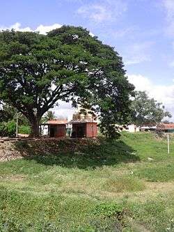
Pannethundi village
-

Iqra restaurant
-
Gururajbhavana Choultry
-
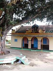
Pannethundi temple
-

Government school
-

Highschool
-
Mysore road
-

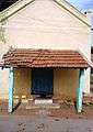
Railway Station
See also
- Chinnada Gudi Hundi
- Badanavalu
- Narasam Budhi
- Kavalande
- Mariyala-Gangavadi Halt
- Mukkadahalli
- Kellamballi
References
| Wikivoyage has a travel guide for Badanaguppe. |
- ↑ http://www.mapsofindia.com/pincode/india/karnataka/chamrajnagar/badanaguppe.html
- ↑ https://www.google.com/maps/place/Badanaguppe,+Karnataka,+India/@11.9901377,76.8432141,13z/data=!3m1!4b1!4m5!3m4!1s0x3baf390749c06879:0xb1a2dafd155f7b2a!8m2!3d11.9832154!4d76.8778612
- ↑ http://wikiedit.org/India/Badanaguppe/219727/
- ↑ http://www.onefivenine.com/india/villages/Chamarajanagar/Chamarajanagar/Badanaguppe
- ↑ http://banksifsccode.com/canara-bank-ifsc-code/karnataka/chamrajnagar/badanaguppe-branch/
- ↑ http://www.thehindu.com/news/national/karnataka/cm-to-launch-two-projects-in-chamarajanagar-today/article7344709.ece
- ↑ http://www.onefivenine.com/india/villages/Chamarajanagar/Chamarajanagar/Badanaguppe
- ↑ http://www.onefivenine.com/india/villages/Chamarajanagar/Chamarajanagar/Badanaguppe
- ↑ http://www.census2011.co.in/data/village/619649-badanaguppe-karnataka.html
- ↑ http://www.onefivenine.com/india/villages/Chamarajanagar/Chamarajanagar/Badanaguppe
- ↑ http://www.onefivenine.com/india/villages/Chamarajanagar/Chamarajanagar/Badanaguppe