Chamarajanagar
| Chamarajanagar ಚಾಮರಾಜನಗರ | |
|---|---|
| City | |
|
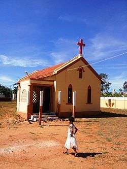
Kellamballi Church | |
| Coordinates: 11°55′34″N 76°56′25″E / 11.9260°N 76.9402°ECoordinates: 11°55′34″N 76°56′25″E / 11.9260°N 76.9402°E | |
| Country | India |
| State | Karnataka |
| District | Chamarajanagar |
| Languages | |
| • Official | Kannada |
| Time zone | IST (UTC+5:30) |
| PIN | 571 313 |
| Telephone code | 08226 |
| Vehicle registration | KA-10 |
| Website | www.chamarajanagaracity.gov.in |
Chamarajanagar is a town in the southern part of Karnataka, India. Named after Chamaraja Wodeyar IX, the erstwhile king of Mysore, it is located on the interstate highway linking the neighboring states of Tamil Nadu and Kerala.
Geograph
Chamarajnagar is located at 11°55′N 76°57′E / 11.92°N 76.95°E.[1] It has an average elevation of 662 metres (2,172 ft).
Demographics
As of the 2011 census, Chamrajanagar had a population of 69875.[2] Males constituted 51% of the population and females 49%. Chamrajanagar has an average literacy rate of 60%, higher than the national average of 59.5%; with male literacy of 65% and female literacy of 54%. 12% of the population is under 6 years of age.
Transport
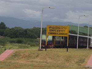
Chamarajanagar railway station is the southern most rail point in Karnataka. There is a direct train to Tirpati which starts by three in the afternoon. The nearest airport is Mysore airport and the nearest international airports are in Bengaluru and Coimbatore.
Tourist attractions
There is one Ayyappa temple with a pond near the private bus station. A mosque called Masjidh-e-Fathima and an Anjeneya Swamy temple can also be seen in this locality. There is a magnificent Eswara temple in the middle of the town of Chamarajnagar. locals refer to the main deity as chamarajeshwara. this temple used to have the only sweet water well within its precincts which was the only source of drinking water many years ago. till very recently traffic in front of this temple was prohibited!
Bandit Veerappan
Since much of the southern area of the district is dense forest, it provided good refuge to the notorious bandit Veerappan, responsible for the death of over a hundred policemen. He was shot dead in an encounter with the specially formed Special Task Force (STF) on 18 October 2004, in Dharmapuri district, Tamil Nadu. He had been on the run for over two decades. The presence of illegal quarrying for black stone imposes a great threat to the forests in the region.
Image gallery
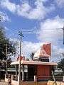 Ayyappa Temple
 Nandi Choultry
 Fathima Mosque
 Muslim Cemetery
See also
- Nanjangud Town
- Chinnada Gudi Hundi
- Badana Guppe
- Mariyala-Gangavadi Halt
- Mukkadahalli
- Mysore–Chamarajanagar branch line
- Kellamballi
References
- ↑ "Falling Rain Genomics, Inc - Chamarajnagar". Retrieved 1 November 2008.
- ↑ "Census of India 2011". Census Commission of India. Archived from the original on 16 June 2004. Retrieved 1 November 2008.
External links
| Wikimedia Commons has media related to Chamarajanagar. |
| Wikivoyage has a travel guide for Chamarajnagar. |
- http://chamrajnagar.nic.in
- https://web.archive.org/web/20110903082210/http://www.chamarajanagaracity.gov.in:80/