Bantva
| Bantva બાંટવા | |
|---|---|
| town | |
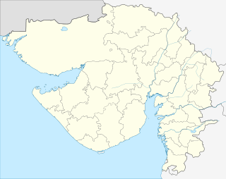 Bantva Location in Gujarat, India | |
| Coordinates: 21°29′N 70°04′E / 21.483°N 70.067°ECoordinates: 21°29′N 70°04′E / 21.483°N 70.067°E | |
| Country |
|
| State | Gujarat |
| District | Junagadh |
| Population (2001) | |
| • Total | 15,216 |
| Languages | |
| • Official | Gujarati, Hindi |
| Time zone | IST (UTC+5:30) |
| Nearest city | Manavadar |
Bantva or Bantwa (Gujarati: બાંટવા,Urdu: بانٹوا); is a small town in Kathiawar, a former district of the state of Gujarat in India.
Geography
Bantva is located at an altitude of 20 meters. Nearby towns are Nanadiya, Limbuda,Nakara Manavadar, Vanthali, Junagadh, Keshod, Visavadar, Kutiyana, Dhoraji, Porbandar and Rajkot. The town is roughly 10 kilometers from the Arabian Sea.
History
Before the Independence of India in 1947, Bantva was part of the princely state of Bantva Manavadar founded in 1760 and locally ruled until February 1948 by Khan Himmat Khan son of Khan Amir Khan.
Demographics
Before 1947, the population of Bantva was approximately 20,000; 80% of its population was Memon. As of the 2001 India census, Bantva had a population of 15,216. Males constitute 52% of the population and females 48%. Bantva has an average literacy rate of 69%, higher than the national average of 59.5%, with 57% of the males and 43% of females literate. 12% of the population is under 6 years of age.
Places of interest
Places of interest in Bantva are:[1]
- Bantwa Gymkhana
- Barwali Masjid
- Jamia Masjid
- Madrassa E Islamia
- Mazaar Of Bukhari Sharif
- Yateem Khana Islamia
Notable residents of Bantva
- Abdul Sattar Edhi - Humanitarian, Social Worker and founder of Edhi Foundation, which has the largest private ambulance service network in the world.
- Bilquis Edhi- Wife of Abdul Sattar Edhi
- Ahmad Adaya- founder of IDS Real Estate Group, one of the California's largest real estate companies.
- Ahmed Dawood founder of the Dawood Group, post separation Pakistan pioneer merchant, industrialist and philanthropist.
- Khan Himmat Khan son of Khan Amir Khan was the Ruling Chief of Bantva, a jurisdictional Taluka in Kathiawar, acceded to Pakistan on the 22nd September 1947. The Taluka applied for accession to Pakistan but on 3rd of October 1947, it was forcibly occupied by India. Khan Himmat Khan was taken prisoner and was subsequently released in the middle of October 1947 and he managed to migrate to Pakistan and was residing in Pakistan till his death. He enjoyed some rights and privileges in Pakistan; exemption from personal appearance in Civil Courts in West Pakistan and Federal Capital area, exemption from Arms rules in Pakistan, can use his red number plates of Bantva on his personal vehicles.
References
- ↑ India, Tourism. "Tourism Attractions". Retrieved 8 April 2013.
External links
- My Memories of Bantva By: Abdur Razzaq Thaplawala
- Batva Recollection (Excerpts from "A Ramble Through Life" by Mr. Kassim Dada)
- Memon Po!nt by Abdul Ghaffar Variend, Chicago, IL USA
- World Memon Organization of North America, Chicago, IL USA
- Non-Salute Princely state
- Salute Princely state
- Manavadar-Bantva Princely State