Barnwell Regional Airport
| Barnwell Regional Airport Barnwell Army Airfield | |||||||||||||||
|---|---|---|---|---|---|---|---|---|---|---|---|---|---|---|---|
|
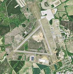
USGS 2006 orthophoto | |||||||||||||||
| IATA: BNL – ICAO: KBNL – FAA LID: BNL | |||||||||||||||
| Summary | |||||||||||||||
| Airport type | Public | ||||||||||||||
| Owner | Barnwell County | ||||||||||||||
| Serves | Barnwell, South Carolina | ||||||||||||||
| Elevation AMSL | 246 ft / 75 m | ||||||||||||||
| Coordinates | 33°15′29″N 081°23′17″W / 33.25806°N 81.38806°WCoordinates: 33°15′29″N 081°23′17″W / 33.25806°N 81.38806°W | ||||||||||||||
| Map | |||||||||||||||
 BNL Location of airport in South Carolina | |||||||||||||||
| Runways | |||||||||||||||
| |||||||||||||||
| Statistics (2011) | |||||||||||||||
| |||||||||||||||
Barnwell Regional Airport (IATA: BNL, ICAO: KBNL, FAA LID: BNL) is a county owned, public use airport located one nautical mile (2 km) northwest of the central business district of Barnwell, a city in Barnwell County, South Carolina, United States. It is owned by Barnwell County.[1] It is included in the National Plan of Integrated Airport Systems for 2011–2015, which categorized it as a general aviation facility.[2] The airport does not have scheduled commercial airline service.
History
The airport was built by the United States Army Air Forces and opened in May 1943. Barnwell Army Airfield was a satellite airfield of Columbia Army Air Base, supporting B-25 Mitchell medium bomber training for Third Air Force III Air Support Command. Training was accomplished by 44th Station Complement Squadron which also maintained the facility. After the war, the airfield was turned over to local authorities which converted it into a civil airport.
Facilities and aircraft
Barnwell Regional Airport covers an area of 859 acres (348 ha) at an elevation of 246 feet (75 m) above mean sea level. It has two asphalt paved runways: 17/35 is 5,119 by 100 feet (1,560 x 30 m) and 5/23 is 4,835 by 76 feet (1,474 x 23 m).[1]
For the 12-month period ending August 12, 2011, the airport had 23,750 aircraft operations, an average of 65 per day: 97% general aviation and 3% military. At that time there were 33 aircraft based at this airport: 97% single-engine and 3% multi-engine.[1]
See also
References
- 1 2 3 4 FAA Airport Master Record for BNL (Form 5010 PDF). Federal Aviation Administration. Effective April 5, 2012.
- ↑ "2011–2015 NPIAS Report, Appendix A" (PDF). National Plan of Integrated Airport Systems. Federal Aviation Administration. October 4, 2010. Archived from the original (PDF, 2.03 MB) on 2012-09-27.
-
 This article incorporates public domain material from the Air Force Historical Research Agency website http://www.afhra.af.mil/.
 - Manning, Thomas A. (2005), History of Air Education and Training Command, 1942-2002. Office of History and Research, Headquarters, AETC, Randolph AFB, Texas ASIN: B000NYX3PC
External links
- Aerial image as of March 1999 from USGS The National Map
- FAA Terminal Procedures for BNL, effective November 10, 2016
- Resources for this airport:
- FAA airport information for BNL
- AirNav airport information for KBNL
- ASN accident history for BNL
- FlightAware airport information and live flight tracker
- NOAA/NWS latest weather observations
- SkyVector aeronautical chart, Terminal Procedures
.jpg)
| Airfields |
| .svg.png) | |||||||||||||||||||||||||||||||
|---|---|---|---|---|---|---|---|---|---|---|---|---|---|---|---|---|---|---|---|---|---|---|---|---|---|---|---|---|---|---|---|---|---|
| Units |
| ||||||||||||||||||||||||||||||||