Barvas
| Barvas | |
| Scottish Gaelic: Barabhas, Barbhas | |
 Barabhas Uarach Upper Barvas |
|
 Barvas |
|
| Language | Scottish Gaelic |
|---|---|
| English | |
| OS grid reference | NB360499 |
| Civil parish | Barvas |
| Council area | Na h-Eileanan Siar |
| Lieutenancy area | Western Isles |
| Country | Scotland |
| Sovereign state | United Kingdom |
| Post town | ISLE OF LEWIS |
| Postcode district | HS2 |
| Dialling code | 01851 |
| Police | Scottish |
| Fire | Scottish |
| Ambulance | Scottish |
| EU Parliament | Scotland |
| UK Parliament | Na h-Eileanan an Iar |
| Scottish Parliament | Na h-Eileanan an Iar |
Coordinates: 58°21′32″N 6°30′47″W / 58.359°N 6.513°W
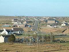
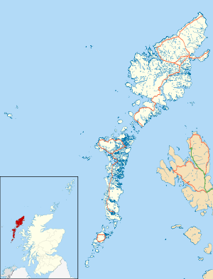
Barvas (Scottish Gaelic: Barabhas or Barbhas)[1] is a settlement, community and civil parish on the Isle of Lewis in Scotland.[2]

A photo of Bun-Sgoil Bharabhais Barvas Primary School
It developed around a road junction. The A857 and A858 meet at the southern end of Barvas.[3] North is the road to Ness; west takes the traveller to Carloway and the West Side; south runs the road to Stornoway. According to the 2011 Census it still has the highest concentration of Scottish Gaelic speakers in Scotland (64% of the population) with 2,037.[4]
In the early 2000s, controversy hit the area as one of Europe's largest windfarms was planned for Barvas Moor. The Scottish Government rejected the proposals in early 2008.[5]
References
- ↑ "Scottish Parliament: Placenames collected by Iain Mac an Tailleir" (PDF).
- ↑ "Parish of Barvas". ScotlandsPlaces. Retrieved 24 December 2010.
- ↑ "A857". Sabre. Retrieved 28 December 2014.
- ↑ "Census shows Gaelic declining in its heartlands". BBC News Online. 15 November 2013. Retrieved 28 December 2014.
- ↑ "Massive wind farm 'turned down'". BBC News Online. 25 January 2008. Retrieved 17 November 2009.
External links
| Wikimedia Commons has media related to Barvas. |
- Panorama of Barvas Bay (QuickTime required)
- Canmore - Lewis, Barvas site record
- Canmore - Lewis, Barvas, Cladh Mhuire site record
- Canmore - Barvas, Prehistoric House site record
- Canmore - Barvas, Prehistoric Cairn site record
| Inhabited islands | ||
|---|---|---|
| Other islands | ||
| Settlements |
| |
| Districts | ||
| Geographical features | ||
| Historical sites | ||
This article is issued from Wikipedia - version of the 10/27/2016. The text is available under the Creative Commons Attribution/Share Alike but additional terms may apply for the media files.