Baxter, Victoria
| Baxter Melbourne, Victoria | |||||||||||||
|---|---|---|---|---|---|---|---|---|---|---|---|---|---|
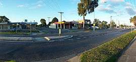 Main street of Baxter | |||||||||||||
 Baxter | |||||||||||||
| Coordinates | 38°11′46″S 145°09′25″E / 38.196°S 145.157°ECoordinates: 38°11′46″S 145°09′25″E / 38.196°S 145.157°E | ||||||||||||
| Population | 2,146 (2011 census)[1] | ||||||||||||
| • Density | 692/km2 (1,793/sq mi) | ||||||||||||
| Established | 1890s | ||||||||||||
| Postcode(s) | 3911 | ||||||||||||
| Area | 3.1 km2 (1.2 sq mi) | ||||||||||||
| Location | |||||||||||||
| LGA(s) | Shire of Mornington Peninsula | ||||||||||||
| State electorate(s) | |||||||||||||
| Federal Division(s) | |||||||||||||
| |||||||||||||
Baxter is a township and rural locality in Melbourne, Victoria, Australia, beyond the urban area. Its local government area is the Shire of Mornington Peninsula. It is served by Baxter railway station on the Stony Point greater-metropolitan line.
Originally named Baxter's Flat, Baxter was founded by pastoralist Benjamin Baxter, who lived in a property named Carrup Carrup - the Aboriginal name. The property still exists today on what is now the Frankston-Flinders road, as does the original cottage he and his wife Martha lived in. Benjamin Baxter died in 1892 and his gravestone, found in the Frankston Cemetery, reads "Benjamin Baxter, late of h. m. 50th regiment. Died at Currup Currup 15 May 1892, aged 87. Also Martha, beloved wife of above 31 January 1906 age 94 years".
It was at Baxter's Flat that the railway to Mornington and Stony Point (built in the late 1880s) separated. The station was called Mornington Junction before being changed to Baxter, however its role as a junction ended in the 1980s with the closure of the Mornington line. The early township grew around the railway station and a Post Office named Mornington Junction opened on December 1, 1892 (Baxter from 1918) [2]
Other historic cottages in the area include a primitive 1850s homestead called Eurutta (formerly Sage's Cottage), and a 1920s American-style residence called Mulberry Hill.
Baxter Primary School was established in 1890.
References
- ↑ Australian Bureau of Statistics (31 October 2012). "Baxter (State Suburb)". 2011 Census QuickStats. Retrieved 2012-10-17.
- ↑ Premier Postal History, Post Office List, retrieved 2008-04-11
- Brown-May, Andrew & Swain, Shurlee (2005) The Encyclopedia Of Melbourne. Cambridge University Press. ISBN 0-521-84234-4
External links
- Our Peninsula's Past (Shire of Mornington Peninsula)