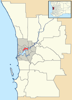
Beldon, Western Australia
| Beldon Perth, Western Australia | |||||||||||||
|---|---|---|---|---|---|---|---|---|---|---|---|---|---|
 Beldon | |||||||||||||
| Coordinates | 31°46′26″S 115°46′05″E / 31.774°S 115.768°ECoordinates: 31°46′26″S 115°46′05″E / 31.774°S 115.768°E | ||||||||||||
| Population | 3,991 (2011 census)[1] | ||||||||||||
| • Density | 1,810/km2 (4,700/sq mi) | ||||||||||||
| Established | 1970s | ||||||||||||
| Postcode(s) | 6027 | ||||||||||||
| Area | 2.2 km2 (0.8 sq mi) | ||||||||||||
| Location | 25 km (16 mi) NNW of Perth | ||||||||||||
| LGA(s) | City of Joondalup | ||||||||||||
| State electorate(s) | Joondalup | ||||||||||||
| Federal Division(s) | Moore | ||||||||||||
| |||||||||||||
Beldon is a small suburb of Perth, Western Australia, located within the City of Joondalup, to the north of Craigie.
Beldon is located in between two major North-South arteries, Marmion Avenue to the West and Mitchell Freeway to the East. Adjacent to the North is Ocean Reef Road which connects Beldon to the beach in the West (about 3 km) and inland parts, such as the Swan Valley. It hosts two schools — Beldon Primary School and Belridge Senior High School.
Beldon also contains a few parks, with most of them containing play equipment for young children. At Haddington Park there is a dirt bike track.
Woolworths and Coles (supermarket chains) can also be found within this suburb as well as a range of smaller shops and services distributed mainly across two shopping centres. Notable is the well equipped Belridge Medical Centre.
References
- ↑ Australian Bureau of Statistics (31 October 2012). "State Suburbs: Beldon". 2011 Census QuickStats. Retrieved 4 July 2012.