Bell Canyon, California
| Bell Canyon | |
|---|---|
| census-designated place | |
 Bell Canyon Position in California. | |
| Coordinates: 34°12′29″N 118°41′15″W / 34.20806°N 118.68750°WCoordinates: 34°12′29″N 118°41′15″W / 34.20806°N 118.68750°W | |
| Country |
|
| State |
|
| County | Ventura |
| Government | |
| • Type | Homeowner Association |
| Area[1] | |
| • Total | 3.621 sq mi (9.379 km2) |
| • Land | 3.621 sq mi (9.379 km2) |
| • Water | 0 sq mi (0 km2) 0% |
| Elevation[2] | 1,368 ft (417 m) |
| Population (2010) | |
| • Total | 2,049 |
| • Density | 570/sq mi (220/km2) |
| Time zone | Pacific (PST) (UTC-8) |
| • Summer (DST) | PDT (UTC-7) |
| ZIP Code | 91307 |
| Area code(s) | 818 |
| GNIS feature ID | 2585403 |
| Website | http://www.bellcanyon.com/ |
| U.S. Geological Survey Geographic Names Information System: Bell Canyon, California | |
Bell Canyon is a unincorporated community in eastern Ventura County, California, United States.[2] Bell Canyon is a gated community in the Simi Hills with the main access through the Los Angeles County communities of West Hills and the western San Fernando Valley. Bell Canyon sits at an elevation of 1,368 feet (417 m).[2] The 2010 United States census reported Bell Canyon's population was 2,049. For statistical purposes, the United States Census Bureau has defined Bell Canyon as a census-designated place (CDP). The census definition of the area may not precisely correspond to local understanding of the area with the same name. According to a 2016 study, Bell Canyon is the seventh wealthiest community in the state of California with an annual median income of $230,000 However, incomes in this area are commonly upwards of millions of dollars a year. [3]
History
Pre-20th century
Chumash Native Americans lived in the canyon for around 8,000 years B.P.[4][5] The Chumash had the village of Hu'wam here in the canyon on Bell Creek upstream from Escorpión Peak.[6] It was multi-cultural, where Chumash, Tongva, and Tataviam peoples lived and traded together.[7] Nearby is the Burro Flats Painted Cave. Escorpión Peak (aka: Castle Peak) is one of nine alignment points in Chumash territory and is considered essential to maintaining the balance of the natural world.[8]
In 1845 the Mexican land grant for Rancho El Escorpión, named for the peak and located beside it at the mouth of Bell Canyon, was given by Mexican Governor Pío Pico. Chumash-Ventureño Chief Odón Eusebia (1795–), his brother-in-law Urbano, and Urbano’s son Mañuel were the grantees of the Rancho grant, formerly Mission San Fernando Rey de España (Mission San Fernando) lands.[9][10] After California U.S. statehood, as required by the Land Act of 1851,[11] a claim for Rancho El Escorpión was filed with the United States Public Land Commission in 1852,[12] and the grant was patented to Odón Eusebia, Urbano, and Mañuel in 1876.[13][14] In 1871, Miguel Leonis acquired Odón Eusebia's holdings of Rancho El Escorpión, along with an adobe on the adjacent southern ranch lands in Calabasas. He used the land for cattle and sheep herds.[15] Through various landowners that use continued at the Rancho until 1959 and Bell Canyon until 1967.
20th century - onward
In 1967 the Spruce Land Corporation and Boise Cascade joined in a partnership to purchase the Bell Canyon area to develop the community of Bell Canyon. In the fall of 1968, the Bell Canyon Equestrian Center, designed by 'Southern California modern ranch style' architect Cliff May, was built and began operation. In 1969 a new subdivision called "Woodland Hills Country Estates" was developed and opened for sales. It was a success, selling nearly all the 800 home site lots within ten days. In the fall of 1969 the new residential property owners took leadership of the community association and renamed the development "Bell Canyon," after Charles A. Bell, the original homesteader here and son of pioneer Horace Bell. He was a leading late 1880s newspaper publisher, Los Angeles attorney winning many cases for clients against neighbor Miguel Leonis, and the 1906 Justice of the Peace for Calabasas.[16] Legend says he lost a right arm in an 1887 shootout when raiding a moonshiner.[17] The Rancho El Escorpión compound adobes, from the 1840s to the 1960s at the mouth of Bell Canyon, were actually outside the land grant and on Bell's property.[18][19]
Geography and environment
Bell Creek, a 'national parkland blue line stream' and a significant tributary to the headwaters of the Los Angeles River, winds its way through the community and plays host to wildlife such as deer, coyote, hawks, squirrel, fox, woodpeckers and quail in its riparian habitat. Bell Canyon is an important part of the crucial Simi Hills Wildlife corridor linking migrations between the Santa Monica Mountains and Santa Susana Mountains.
There are many hiking and riding trails around the community, some of which border the Upper Las Virgenes Canyon Open Space Preserve Park connecting to the south and west. The Bell Canyon Trail extends 4.5 miles (7.2 km) north from Bell Canyon Park, with a surface of sand and dirt and a width of 12–14 feet for easy rides. The Canyon Trail is scenic and winds through the lush California native plants vegetation of Bell Canyon, dominated above by California Sycamore trees and the coast live oak woodlands. Bell Canyon Trail crosses Bell Creek at various locations. It is the main route for Bell Canyon's trails' network providing many link and loop opportunities within the community and to the Upper Las Virgenes Canyon Open Space Preserve.[20] Chastain Falls, a waterfall named after Charles Chastain, can only be reached by hiking on trails in Bell Canyon[21] The Juan Bautista de Anza National Historic Trail has a branch up the canyon.[22]
Demographics
The 2010 United States Census[23] reported that Bell Canyon had a population of 2,049. The population density was 565.8 people per square mile (218.5/km²). The racial makeup of Bell Canyon was 1,724 (84.1%) White, 58 (2.8%) African American, 4 (0.2%) Native American, 179 (8.7%) Asian, 0 (0.0%) Pacific Islander, 10 (0.5%) from other races, and 74 (3.6%) from two or more races. Hispanic or Latino of any race were 103 persons (5.0%).
The Census reported that 2,049 people (100% of the population) lived in households, 0 (0%) lived in non-institutionalized group quarters, and 0 (0%) were institutionalized.
There were 661 households, out of which 286 (43.3%) had children under the age of 18 living in them, 533 (80.6%) were opposite-sex married couples living together, 40 (6.1%) had a female householder with no husband present, 19 (2.9%) had a male householder with no wife present. There were 15 (2.3%) unmarried opposite-sex partnerships, and 8 (1.2%) same-sex married couples or partnerships. 45 households (6.8%) were made up of individuals and 15 (2.3%) had someone living alone who was 65 years of age or older. The average household size was 3.10. There were 592 families (89.6% of all households); the average family size was 3.23.
The population was spread out with 521 people (25.4%) under the age of 18, 152 people (7.4%) aged 18 to 24, 287 people (14.0%) aged 25 to 44, 839 people (40.9%) aged 45 to 64, and 250 people (12.2%) who were 65 years of age or older. The median age was 46.5 years. For every 100 females there were 101.1 males. For every 100 females age 18 and over, there were 98.7 males.
There were 688 housing units at an average density of 190.0 per square mile (73.4/km²), of which 629 (95.2%) were owner-occupied, and 32 (4.8%) were occupied by renters. The homeowner vacancy rate was 1.7%; the rental vacancy rate was 5.7%. 1,933 people (94.3% of the population) lived in owner-occupied housing units and 116 people (5.7%) lived in rental housing units.
Community
Residences
Private, gated Bell Canyon is an extremely affluent area of approximately 800 estates and lots, equestrian properties and mansions, each on a 1/2 acre to 40-acre (160,000 m2) parcel. Many of the area's equestrian properties have stables, paddocks, turnouts and other horse facilities. It's compared to nearby Hidden Hills a few miles to the south. Both Bell Canyon and Hidden Hills have 24-hour staffed entrance gates, night-time patrols, and spacious residential zoning. Bell Canyon's management has stated that the community is now among the most secure, state of the art gated communities in the United States. Bell Canyon's other differences are: unique topographic features; stream and waterfall, higher hillside elevations; privacy; and several architecturally notable houses designed by architects including Marshall Lewis, Don Zavatto, Ed Niles, Robert Byrd, Blair Ballard, Buff and Lensman, Ray Kang and pioneer of the post-war California ranch-style house, Cliff May.
Equestrian Center
At the heart of the is the Cliff May designed Bell Canyon Equestrian Center with stables, riding arenas and turn out areas.. Built in the early sixties, this facility was restored via a $537,000.00 renovation project that took nearly two years to complete. It is one of the few remaining full-service equestrian centers in the area. The grounds, which can accommodate up to 120 horses, feature four barns with 80 stalls, 12 x 24 corrals, three sand riding arenas, two enclosed bullpens and hot walker, and tree shaded picnic areas.[24]
Organizations
Organized community events include: the annual "Hot August Night" community event where children and adults participate in pie-eating contests and chili cook-offs, but more recently it has been "September Sizzle" with live music, entertainment, and dining, and an annual Food Truck Rally. Current activities and clubs include: 'Snow Day;' Egg Hunt, a fabulous Halloween party with the Community Center fully decorated; 'Movies in The Park;' New Year's Eve party, Garden Club, Book Club, and Kids Committee.[25][26]
Education
Bell Canyon is served by the Las Virgenes Unified School District, with students bused each day to attend the schools of: Round Meadow Elementary School, Alice C. Stelle Middle School, and Calabasas High School.[27]
Notable people
Because of its seclusion and security, including security cameras and patrols, the neighborhood is favored by: celebrities and individuals from the motion picture, television and music industries; business executives; and professionals.
|
|
See also
References
- ↑ U.S. Census Archived 2012-01-24 at WebCite
- 1 2 3 U.S. Geological Survey Geographic Names Information System: Bell Canyon, California
- ↑ http://www.thefinancialword.com/10-wealthiest-neighborhoods-california/7/
- ↑ USA Today article USA Today
- ↑ Mercury News article
- ↑ http://www.parks.ca.gov/pages/980/files/sspshp%20ethnohistory.pdf SSPSHP ethnohistory Accessed 2/28/2010
- ↑ "http://www.wishtoyo.org/projects-cultural-ahmanson-ranch.html Wishtoyo Foundation: "Ahmanson Ranch Becomes Private Preserve" Accessed 10/23/2007
- ↑ Wishtoyo on Ahmanson Ranch
- ↑ LoC-HABS: Escorpion_(1937) p. 2
- ↑ LoC-HABS: Leonis p.3
- ↑ 46th United States Congress, 1880, House Executive Document 46, pp. 1116-1117
- ↑ United States. District Court ( California : Southern District) Land Case 129 SD
- ↑ Report of the Surveyor General 1844 - 1886 Archived March 20, 2013, at the Wayback Machine.
- ↑ S.S.P.S.H.Park ethnohistory]Accessed 2/28/2010
- ↑ LoC-HABS: Leonis p.2 Accessed 2/28/2010
- ↑ Ibid. p.3
- ↑ Lesel, Helene (July 3, 2005). "A rustic canyon hideaway, with room to roam". Los Angeles Times. Retrieved 2015-01-05.
- ↑ S.S.P.S.H.Park Ethnohistory p. 34 Archived March 14, 2010, at the Wayback Machine.
- ↑ Cohen, Chester G. 1989. "El Escorpión". Periday Company. Woodland Hills.
- ↑ http://www.bellcanyon.com/BCtrailsmap.pdf Trails Map Accessed 4/01/10
- ↑ .http://www.bellcanyon.com/photogallery.aspx Archived July 8, 2009, at the Wayback Machine. Bell Canyon photo gallery: 'Nature'
- ↑ http://www.nps.gov/juba/ National Park Service: official Juan Bautista de Anza National Historic Trail website Accessed 4/06/2010
- ↑ "2010 Census Interactive Population Search: CA - Bell Canyon CDP". U.S. Census Bureau. Retrieved July 12, 2014.
- ↑ http://www.bellcanyonstables.com/facility.htm Accessed 4/01/2010
- ↑ http://www.bellcanyonstables.com/news.htm Accessed 4/06/2010
- ↑ http://www.bellcanyon.com/lifestyle.aspx Accessed 4/06/2010
- ↑ http://www.bellcanyon.com/schools.aspx Accessed 4/06/2010
- ↑ "TV's 'Mr. Wizard' Don Herbert dies at 89". USA Today. 2007-06-13. Retrieved 2007-06-13.
- ↑ 2015 Ventura County, CA tax records
External links
- official Bell Canyon Association website
- Bell Canyon Equestrian Center
- Upper Las Virgenes Canyon Open Space Preserve official Upper Las Virgenes Canyon Park website.
- CSUN Oviatt Library Digital Collections Rancho El Escorpión vintage photographs website.
- Bell Canyon photo gallery: nature and development photographs.
- L.A.Times -'Bell Canyon'
Municipalities and communities of Ventura County, California, United States | ||
|---|---|---|
| Cities | 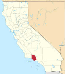 | |
| CDPs | ||
| Unincorporated communities | ||
| Footnotes | ‡This populated place also has portions in an adjacent county or counties | |