Belthangady
| Belthangady ಬೆಳ್ತಂಗಡಿ | |
|---|---|
| Town | |
 Belthangady Location in Karnataka, India | |
| Coordinates: 12°55′16″N 75°16′40″E / 12.9210°N 75.2778°ECoordinates: 12°55′16″N 75°16′40″E / 12.9210°N 75.2778°E | |
| Country |
|
| State |
|
| District | Dakshina Kannada |
| Taluka | Belthangady |
| Area | |
| • Total | 8.87 km2 (3.42 sq mi) |
| Elevation | 685 m (2,247 ft) |
| Population (2011) | |
| • Total | 7,635 |
| • Density | 860/km2 (2,200/sq mi) |
| Languages | |
| • Official | Kannada |
| • Regional | Tulu, Konkani |
| Time zone | IST (UTC+5:30) |
| PIN | 574 214 |
| Telephone code | 08256 |
| Vehicle registration | KA 21 |
| Lok Sabha constituency | Dakshina Kannada |
| Vidhana Sabha constituency | Belthangady |
| Website | http://www.belthangaditown.mrc.gov.in/ |
_Old.jpg)
Belthangady is a town panchayat and the headquarters of Belthangady taluk of the Dakshina Kannada (South Canara) district of Karnataka state in India.
The Town Panchayath Belthangady was established on 09/01/1996. The total extent of area of this Town Panchayath is 8.84sq/km and the population as per 2011 Census is 7,746. The town Panchayath consists of 11 wards. After the conclusion of the rule of Administrator a fresh election was conducted to the said Town Panchayath on 28/09/2007. Belthangady Town Panchayath is a class V located in Belthangady Taluk of Dakshina Kannada district. Belthangady TP has a total population of 7,746 as per census 2011. It is one of the least populated urban centre in the district. The total town area is 8.87sq.km consisting of 11 wards. It was formed in 1975. It is considered as an important trade center for agricultural products like areca, cashewnut, coconut and rubber. It is centre for various religious pilgrimages and tourist locations in the district.
Belthangady Town Panchayath is located in Belthangady Taluk in Dakshina Kannada District. It is 60 km east of Mangalore and the least urbanized Taluk in the district. Belthangady is located at 13.98 N Latitude and 75.3 E Longitude. It is situated at an average elevation of 685m from MSL. The town is located in the Northern part of the district and adjacent to the Chikmagalur district. It is at a distance of 57 km from the district headquarters Mangalore. The nearest urban centre is Ujire which is at 5 km from the town. The other urban centre like Guruvayanakere, Dharmasthala, Madanthyar, Bantwal and Moodbidri are located at a distance of 5 km, 15 km, 12 km, 35 km and 62 km respectively. The major roads passing through the town connecting to Mangalore and Chikmagalur via Bantwal and Belthangady. The other major road passing through the town are Udupi to Subramanya, Karkala to Dharmasthala, Chikmagalur to Mangalore and Puttur to Dharmasthala. The town does not have direct rail linkage. The nearest railway station is Bantwal located about 35 km from the town. The nearest airport is at Mangalore which is at a distance of 65 km from the town.

History
Belthangady is one of the five Talukas of Dakshina Kannada district which has a great history and heritage. Alasangadi, Bylangadi, Belthangady are the important places having historical significance. Belthangady now known as Bangadi was the capital of Banga arasas who ruled Dakshina Kannada district. Dharmasthala is one of the holy places in the taluk which is 16 km from Belthangady. The famous Manjunatha Temple located along River Nethravathi is here. The Jamalabad fort also known as the Narasimha Gada located just 6 km from the town. Tippu Sultan built the fort on the top of the hill & called it Jamalabad in memory of his mother Jamalabee. Venur, a Jain pilgrim centre is located 19 km from the town.
Geography
Belthangady is located at 13°59′00″N 75°18′00″E / 13.9833°N 75.3°E.[1] It has an average elevation of 685 metres (2247 feet).
Demographics
In the 2001 India census, the town of Belthangady had a population of 7,302. Males constituted 50% of the population and females 50%. Belthangady had an average literacy rate of 76%, higher than the national average of 59.5%; with 53% of the males and 47% of females being literate. In 2001 in the town of Belthangady, 11% of the population was under 6 years of age.[2]
In the 2011 census, the town of Belthangady had a population of 7,635.[3]
Baraya Palace
The Baraya Palace, is an abandoned (but well preserved) structure at Aladangady in the middle of a jungle, located about 60 km from Mangalore, which belonged to the Jain Ajila Kings of Aladangady. It is about 900 years old, built with mud walls and had a thatched roof, which was replaced by Mangalore Tiles about a century ago, and is maintained by the present heirs of the Jain Ajila Kings. There is ornamental wood work both inside and outside the palace, with 8 carved pillars, facing each other in 2 rows and supporting 4 solid wood beams.[4]
Tourist spots in the town of Belthangady
- Shri Dharmastala Manjunatheshwara Temple, Dharmastala
- Shri Rama Temple, Kanyadi
- Shri Janardhana Temple, Ujire
- Shri Udhbhava Raudhranatheshwara Temple, Nadubottu, Madanthyar
- Chandkur Temple, Belthangady
- Kuthyaru Somanatheshwara Temple, Belthangady
- Most Holy Redeemer Church, Belthangady
- St. Lawrence Syro Malabar Catholic Cathedral Church, Belthangady
- St. Antony Church, Ujire
- Sanyasikatte Shree Parashurama Temple, Mundaje
- Shree Mahadevi Marigudi, Belthangady
- Shree Anantheshwa temple, Ballamanja, Belthangady
- Shree Odilu Mahalingeshwara Temple, Odilu, Belthangady
- Jamalabad Fort, Manjotti, Belthagady
- Bhagwan Shri Shantinath Swamy Digambar jain Temple, Belthangady
- Hazarath Hayathul Jumma Masjid, Guruvayanakere
- Church Of Sacred Heart Of Jesus, Madanthyar
- Kajoor Darga Shareef, Mithabagilu, Belthangady
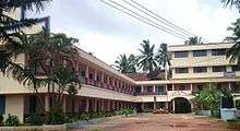
Education
List of Colleges
- SDM Institute of Technology, Ujire
- SDM Polytechnic College, Ujire
- SDM College, Ujire,
- SDM Residential College, Ujire
- SDM College of Naturopathy and Yogic Sciences, Ujire
- Prasanna College of Education, Belthangady
- Kalpataru Nursing School, Belthangady
- Vani Pre-University College, Belthangady
- Mundaje Junior College, Mundaje
- Govt. Junior College, Punjalakatte
- Sacred Heart College, Madanthyar
- Govt. First Grade College, Belthangady
- St. Theresa High School, Belthangady
- St. Theresa PU College, Belthangady
- Church Higher Primary School, Belthangady
- St. Mary's English Medium School, Belthangady
- Anugraha English Medium School, Ujire
Offices
- Taluk office Belthangady ( Tahsildar office )
- Town Panchayath Office, Belthangady (Belthangadi - TP)
- Taluk Panchayath Office, Belthangady
- C.D.P.O. Belthangady
- LIC of India
Main Places/Villages in Belthangady
- Aladangady (Arva)
- Badyar
- Belthangady
- Dharmasthala
- Gerukatte
- Guruvayankere
- Kajoor
- Kalleri
- Kokkada
- Laila
- Madyanthar
- Maddadka
- Manjjotti, Nada
- Panakaje
- Patrame
- Punjalkatte
- Savanal
- Shishila
- Ujire
- Venur
Taluk Hobli
- Belthangady
- Kokkada
- Venur
Hospitals
- S.D.M.Hospital, Ujire
- L.M.Pinto Hospital, Badyar
- Govt Hospital, Belthangady
- Benaka Hospital, Ujire
- Jyothi Hospital, Laila, Belthangady
- Damodar Hospital, Belthangady
- Shri Raghavendra Nursing Home, Belthangady
- Abhaya Hospital, Guruvayanakere
Nearby Taluks
Geographic Location
 |
Mangalore and Karkala | Mudigere (Chikkamagaluru district) | Mudigere (Chikkamagaluru district) | |
| Bantwal | |
|||
| ||||
| | ||||
| Bantwal | Puttur | Sakleshpur (Hassan district) |
References
- Bhat, N. Shyam (1998). South Kanara, 1799–1860: a study in colonial administration and regional response. Mittal Publications. Retrieved 5 December 2012.
- ↑ Falling Rain Genomics, Inc – Beltangadi
- ↑ "Census of India 2001: Data from the 2001 Census, including cities, villages and towns (Provisional)". Census Commission of India. Archived from the original on 2004-06-16. Retrieved 2008-11-01.
- ↑ "NPR Report: Karnataka: Dakshina Kannada: Beltangadi". National Population Register, Ministry of Home Affairs, Government of India. 2011.
- ↑ Vidyadhar (20 June 2015). "A palace that still spells royalty". Deccan Herald. Retrieved 2 July 2015.
External links
| Wikimedia Commons has media related to Belthangady. |
- Nadubottu Temple, Parenki
- http://www.shridharmasthala.org/
- Town Panchayath Belthangady
- Swachh Bharath in Belthangadi Town Panchayath
- 200 Belthangady MLA Constituency
- Shri Kshethra Dharmasthala Rural Development Project
- ಮತದಾರರ ಪಟ್ಟಿಯಲ್ಲಿ ನಿಮ್ಮ ಹೆಸರನ್ನು ಹುಡುಕಿ
- DK.DC Mangalore