Beluga Airport
| Beluga Airport | |||||||||||||||
|---|---|---|---|---|---|---|---|---|---|---|---|---|---|---|---|
| IATA: BVU – ICAO: PABG – FAA LID: BLG | |||||||||||||||
| Summary | |||||||||||||||
| Airport type | Private | ||||||||||||||
| Owner | Conoco Phillips Alaska | ||||||||||||||
| Serves | Beluga, Alaska | ||||||||||||||
| Elevation AMSL | 87 ft / 27 m | ||||||||||||||
| Coordinates | 61°10′23″N 151°02′43″W / 61.17306°N 151.04528°WCoordinates: 61°10′23″N 151°02′43″W / 61.17306°N 151.04528°W | ||||||||||||||
| Map | |||||||||||||||
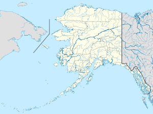
 BLG Location of airport in Alaska | |||||||||||||||
| Runways | |||||||||||||||
| |||||||||||||||
| Statistics (1993) | |||||||||||||||
| |||||||||||||||
Beluga Airport (IATA: BVU, ICAO: PABG, FAA LID: BLG) is a private use airport located in Beluga, in the Kenai Peninsula Borough of the U.S. state of Alaska. It is privately owned by Conoco Phillips Alaska (formerly ARCO Alaska).[1]
As per Federal Aviation Administration records, the airport had 2,541 passenger boardings (enplanements) in calendar year 2008,[2] 2,410 enplanements in 2009, and 2,144 in 2010.[3]
Although most U.S. airports use the same three-letter location identifier for the FAA and IATA, this airport is assigned BLG by the FAA[1] and BVU by the IATA[4] (which assigned BLG to Belaga Airport in Belaga, Sarawak, Malaysia).[5] The airport's ICAO identifier is PABG.[6]
Facilities and aircraft
Beluga Airport resides at elevation of 87 feet (27 m) above mean sea level. It has two runways with gravel surfaces: 1/19 is 5,002 by 100 feet (1,525 x 30 m) and 9/27 is 2,505 by 60 feet (764 x 18 m).[1]
For the 12-month period ending January 15, 1993, the airport had 5,600 aircraft operations, an average of 15 per day: 91% general aviation and 9% air taxi.[1]
References
- 1 2 3 4 5 FAA Airport Master Record for BLG (Form 5010 PDF). Federal Aviation Administration. Effective May 31, 2012.
- ↑ "Enplanements for CY 2008" (PDF, 1.0 MB). CY 2008 Passenger Boarding and All-Cargo Data. Federal Aviation Administration. December 18, 2009.
- ↑ "Enplanements for CY 2010" (PDF, 189 KB). CY 2010 Passenger Boarding and All-Cargo Data. Federal Aviation Administration. October 4, 2011.
- ↑ "Beluga Airport (ICAO: PABG, IATA: BVU, FAA: BLG)". Great Circle Mapper. Retrieved July 28, 2012.
- ↑ "Belaga Airport, Malaysia (IATA: BLG, ICAO: WBGC)". Aviation Safety Network. Retrieved July 28, 2012.
- ↑ "Beluga – BLG (PABG)". National Flight Data Center. Federal Aviation Administration. Retrieved July 28, 2012.
External links
- Topographic map from USGS The National Map
- Resources for this airport:
- FAA airport information for BLG
- AirNav airport information for PABG
- ASN accident history for BVU
- FlightAware airport information and live flight tracker
- SkyVector aeronautical chart for PABG