Beluga, Alaska
| Beluga, Alaska | |
|---|---|
| CDP | |
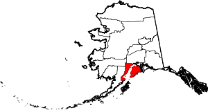
 Beluga, Alaska Location within the state of Alaska | |
| Coordinates: 61°8′2″N 151°9′53″W / 61.13389°N 151.16472°W | |
| Country | United States |
| State | Alaska |
| Borough | Kenai Peninsula |
| Government | |
| • Borough mayor | Mike Navarre[1] |
| • State senator | Gary Stevens (R) |
| • State rep. | Louise Stutes (R) |
| Area | |
| • Total | 103.4 sq mi (267.8 km2) |
| • Land | 102.6 sq mi (265.9 km2) |
| • Water | 0.7 sq mi (1.9 km2) |
| Elevation | 112 ft (34 m) |
| Population (2000) | |
| • Total | 32 |
| Time zone | Alaska (AKST) (UTC-9) |
| • Summer (DST) | AKDT (UTC-8) |
| ZIP code | 99695 |
| Area code(s) | 907 |
| FIPS code | 02-06245 |
| GNIS feature ID | 1865548 |
Beluga is a census-designated place (CDP) in Kenai Peninsula Borough, Alaska, United States. The population was 32 at the 2000 census.
Geography
Beluga is located at 61°8′2″N 151°9′53″W / 61.13389°N 151.16472°W (61.133962, -151.164741).[2]
According to the United States Census Bureau, the CDP has a total area of 103.4 square miles (268 km2), of which, 102.7 square miles (266 km2) of it is land and 0.7 square miles (1.8 km2) of it (0.72%) is water. Although it is politically in the Kenai Peninsula Borough, Beluga is actually on the Alaskan mainland on the other side of Cook Inlet from the peninsula. It is a remote location with no road access
Demographics
As of the census[3] of 2000, there were 32 people, 13 households, and 7 families residing in the CDP. The population density was 0.3 people per square mile (0.1/km²). There were 54 housing units at an average density of 0.5/sq mi (0.2/km²). The racial makeup of the CDP was 75.00% White and 25.00% Native American.
There were 13 households out of which 38.5% had children under the age of 18 living with them, 61.5% were married couples living together, and 38.5% were non-families. 23.1% of all households were made up of individuals and none had someone living alone who was 65 years of age or older. The average household size was 2.46 and the average family size was 3.00.
In the CDP the population was spread out with 25.0% under the age of 18, 31.3% from 25 to 44, 34.4% from 45 to 64, and 9.4% who were 65 years of age or older. The median age was 42 years. For every 100 females there were 128.6 males. For every 100 females age 18 and over, there were 140.0 males.
The median income for a household in the CDP was $0, and the median income for a family was $0. Males had a median income of $0 versus $0 for females. The per capita income for the CDP was $0. There were no families and none of the population living below the poverty line, including no under eighteens and none of those over 64.
Two prominent features are a small general store and the Chugach Electric power plant, which powers about half of Anchorage. The plant is situated on a gas reserve, which allows for on-site extraction of the gas to be used to fuel the plant.
Fishing
There are five main fishing rivers: the Beluga (King Salmon, Silver Salmon, and Sockeye Salmon); the Theodore (King Salmon and Silver Salmon); the Chuitna (King Salmon and Silver Salmon), the Lewis (King Salmon and Silver Salmon); and Three Mile Creek (Silver Salmon). The Pike lake is considered to be easy to fish. The record Pike caught out of the lake is 49 inches and was caught using ice fishing gear. There are countless freshwater lakes in the Beluga area.
Many set net fishers also fish from shore commercially to make a living. A good catch is about 100 salmon.
References
- ↑ 2015 Alaska Municipal Officials Directory. Juneau: Alaska Municipal League. 2015. p. 9.
- ↑ "US Gazetteer files: 2010, 2000, and 1990". United States Census Bureau. 2011-02-12. Retrieved 2011-04-23.
- ↑ "American FactFinder". United States Census Bureau. Archived from the original on 2013-09-11. Retrieved 2008-01-31.
Coordinates: 61°08′02″N 151°09′53″W / 61.133962°N 151.164741°W