Berwyn Heights, Maryland
| Berwyn Heights, Maryland | ||
|---|---|---|
| Town | ||
| Town of Berwyn Heights | ||
| ||
| Motto: "A Tree City, U.S.A." | ||
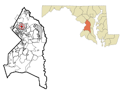 Location of Berwyn Heights, Maryland | ||
| Coordinates: 38°59′38″N 76°54′44″W / 38.99389°N 76.91222°WCoordinates: 38°59′38″N 76°54′44″W / 38.99389°N 76.91222°W | ||
| Country |
| |
| State |
| |
| County |
| |
| Government | ||
| • Type | Town council[1] | |
| • Mayor | Cheryl Jewitt[1] | |
| • Mayor Pro-Tem | Jodie Kulpa-Eddy[1] | |
| • Councilmembers |
Patricia Dennison, Christopher Rassmussen, Maria Robles[1] | |
| Area[2] | ||
| • Total | 0.69 sq mi (1.79 km2) | |
| • Land | 0.69 sq mi (1.79 km2) | |
| • Water | 0 sq mi (0 km2) | |
| Elevation | 112 ft (34 m) | |
| Population (2010)[3] | ||
| • Total | 3,123 | |
| • Estimate (2012[4]) | 3,181 | |
| • Density | 4,526.1/sq mi (1,747.5/km2) | |
| Time zone | Eastern (EST) (UTC-5) | |
| • Summer (DST) | EDT (UTC-4) | |
| ZIP code | 20740 | |
| Area code(s) | 301 | |
| FIPS code | 24-06925 | |
| GNIS feature ID | 0597078 | |
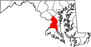
Berwyn Heights (after the newly constructed Presbyterian Church that was called the Berwyn Chapel, which was named after a recently deceased son of a benefactor of the chapel),[5] officially the Town of Berwyn Heights, is a town in Prince George's County, Maryland.[6] The population was 3,123 at the 2010 United States Census.[7] It is bordered by College Park to the west, Greenbelt to the northeast, and Riverdale Park to the south.
History
Beginning in the 1870s, the area northeast of Washington, D.C. was the scene of active and continuous development as the population of the city increased and railroad suburbs such as Berwyn Heights, originally Charlton Heights, gradually grew and expanded around it. The O'Dea House, listed on the National Register of Historic Places, is one of the homes that was erected in 1888 by the Charlton Heights Improvement Company to spur development in the new subdivision.
Historic sites
The following is a partial list of historic sites in Berwyn Heights identified by the Maryland-National Capital Park and Planning Commission:[8]
| Site Name | Image | Location | M-NCPPC Inventory Number | Comment | |
|---|---|---|---|---|---|
| 1 | Berwyn Heights Schoolhouse |  |
5814 Ruatan Street | 67-022-07 | |
| 2 | Cissel House | 8911 57th Avenue | 67-022-18 | ||
| 3 | Cross House | 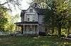 |
5805 Ruatan Street | 67-022-13 | |
| 4 | Kleiner House | 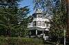 |
5603 Ruatan Street | 67-022-17 | |
| 5 | O’Dea House | 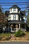 |
5804 Ruatan Street | 67-022-11 | Listed on the National Register of Historic Places, 1987-06-04 |
| 6 | Pickett House | 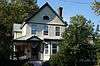 |
8616 57th Avenue | 67-022-16 | |
| 7 | Sportland | 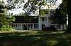 |
5933 Natasha Drive | 67-005 | |
| 8 | Elwood J. Taylor House | 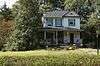 |
8516 58th Avenue | 67-022-21 | |
| 9 | Wetherald House |  |
8411 58th Avenue | 67-022-10 | |
| 10 | Wolfe House | 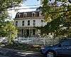 |
5617 Ruatan Street | 67-022-15 |
Geography
Berwyn Heights is located at 38°59′38″N 76°54′44″W / 38.99389°N 76.91222°W (38.993810, -76.912344).[9] According to the United States Census Bureau, the town has a total area of 0.69 square miles (1.79 km2), all of it land.[2]
Demographics
| Historical population | |||
|---|---|---|---|
| Census | Pop. | %± | |
| 1930 | 228 | — | |
| 1940 | 453 | 98.7% | |
| 1950 | 674 | 48.8% | |
| 1960 | 2,376 | 252.5% | |
| 1970 | 3,934 | 65.6% | |
| 1980 | 3,135 | −20.3% | |
| 1990 | 2,952 | −5.8% | |
| 2000 | 2,942 | −0.3% | |
| 2010 | 3,123 | 6.2% | |
| Est. 2015 | 3,280 | [10] | 5.0% |
2010 census
As of the census[3] of 2010, there were 3,123 people, 1,002 households, and 681 families residing in the town. The population density was 4,526.1 inhabitants per square mile (1,747.5/km2). There were 1,051 housing units at an average density of 1,523.2 per square mile (588.1/km2). The racial makeup of the town was 56.0% White, 15.1% African American, 0.8% Native American, 8.4% Asian, 0.1% Pacific Islander, 14.4% from other races, and 5.1% from two or more races. Hispanic or Latino of any race were 27.1% of the population.
There were 1,002 households of which 34.3% had children under the age of 18 living with them, 50.1% were married couples living together, 11.0% had a female householder with no husband present, 6.9% had a male householder with no wife present, and 32.0% were non-families. 20.1% of all households were made up of individuals and 7.6% had someone living alone who was 65 years of age or older. The average household size was 3.10 and the average family size was 3.42.
The median age in the town was 34.9 years. 21.7% of residents were under the age of 18; 12.1% were between the ages of 18 and 24; 31.1% were from 25 to 44; 24.3% were from 45 to 64; and 10.8% were 65 years of age or older. The gender makeup of the town was 52.4% male and 47.6% female.
2000 census
As of the census[12] of 2000, there were 2,942 people, 1,022 households, and 713 families residing in the town. The population density was 4,552.9 people per square mile (1,747.6/km²). There were 1,047 housing units at an average density of 1,620.3 per square mile (621.9/km²). The racial makeup of the town was 71.79% White, 12.00% African American, 0.54% Native American, 8.57% Asian, 8.23% Hispanic or Latino, 4.38% from other races, and 2.72% from two or more races of the population.
There were 1,022 households out of which 27.5% had children under the age of 18 living with them, 54.8% were married couples living together, 10.1% had a female householder with no husband present, and 30.2% were non-families. 19.3% of all households were made up of individuals and 7.7% had someone living alone who was 65 years of age or older. The average household size was 2.86 and the average family size was 3.19.
In the town the population was spread out with 20.9% under the age of 18, 10.7% from 18 to 24, 33.1% from 25 to 44, 22.5% from 45 to 64, and 12.9% who were 65 years of age or older. The median age was 36 years. For every 100 females there were 103.9 males. For every 100 females age 18 and over, there were 100.2 males.
The median income for a household in the town was $65,744, and the median income for a family was $69,013. Males had a median income of $42,525 versus $34,831 for females. The per capita income for the town was $25,793. About 0.9% of families and 5.5% of the population were below the poverty line, including 0.5% of those under age 18 and 1.6% of those age 65 or over.
Education
Berwyn Heights is served by the Prince George's County Public Schools: Berwyn Heights Elementary School, which is located in Berwyn Heights, Greenbelt Middle School (Greenbelt), and Parkdale High School (Riverdale Park).
Government
The Town Council consists of five members, who are elected every two years on an at-large plurality voting basis, to govern the Town of Berwyn Heights. The member of the council who received the most votes during the election becomes Mayor. The Mayor serves as the head of the government and presides at all Council meetings, but in other respects is an equal member of the Council. The Mayor Pro Tempore assumes the Mayoral duties in the absence of the Mayor.[13]
The current Mayor is Cheryl Jewitt.[14] The Town Administrator is Jessica Cowles.[15]
The town has a police department,[16] a public works department, a code enforcement department, and an administration department.
Past Mayors[17]
- 1948-1952 Robert F. Burnette
- 1952-1954 Charles G. Durbin
- 1954-1956 Robert F. Burnette
- 1956-1958 John P. Wintermoyer
- 1958-1960 H. Dale Smith
- 1960-1962 Clinton D. Walker
- 1962-1966 George E. Lauterbach
- 1966-1968 Kenneth C. Styers
- 1968-1972 Harry L. Ballew
- 1972-1974 George E. Lauterbach
- 1974-1976 Jadie B. Mc Dougald ,first elected Mayor after change from commisioner government to mayor and council form of government .
- 1976-1978 Harry L. Ballew
- 1978-1980 Jadie B. Mc Dougald
- 1980-1982 Howard G. Wood
- 1982-1992 William T. Armistead, Jr.
- 1992-1998 Thomas J. Love
- 1998-2000 William T. Armistead, Jr.
- 2000-2001 Tawanna P. Gaines
- 2001-2002 Ronald M. Shane
- 2002-2003 Bradley S. Jewitt
- 2003-2004 Patricia D. Dennison
- 2004-2015 Cheye M. Calvo
- 2015-2016 Jodie Kulpa-Eddy
- 2016–Present Cheryl Jewitt[1]
Taxation
At 53 cents per $100 per assessed value, Berwyn Heights has one of the lowest real property tax rates in Prince George's County. In 2005, the town became the first municipality in Maryland to establish a Public Safety Taxing District, after it was authorized by the General Assembly.[18] The district imposes a special tax on businesses to fund the cost of one full-time officer and helps maintain around the clock police coverage.
Civic Activities
The town also benefits from numerous town committees and organizations.[19] The town, as of October 2008, has joined a State Retirement Pension, for its employees, and police officers. This was done in order to try to compete and to retain the police officers.
References
- 1 2 3 4 5 "Town Council". Town of Berwyn Heights. Retrieved July 28, 2016.
- 1 2 "US Gazetteer files 2010". United States Census Bureau. Archived from the original on 2012-07-14. Retrieved 2013-01-25.
- 1 2 "American FactFinder". United States Census Bureau. Retrieved 2013-01-25.
- ↑ "Population Estimates". United States Census Bureau. Archived from the original on 2013-06-17. Retrieved 2013-06-26.
- ↑ Middleton, Canon A. Peirce (14 November 1991). "Letter to Maryland Secertary of State". p. 1.
- ↑ U.S. Geological Survey Geographic Names Information System: Berwyn Heights, Maryland
- ↑ "Profile of General Population and Housing Characteristics: 2010 Demographic Profile Data (DP-1): Berwyn Heights town, Maryland". U.S. Census Bureau, American Factfinder. Archived from the original on September 11, 2013. Retrieved December 8, 2011.
- ↑ M-NCPPC Illustrated Inventory of Historic Sites (Prince George's County, Maryland), 2006.
- ↑ "US Gazetteer files: 2010, 2000, and 1990". United States Census Bureau. 2011-02-12. Retrieved 2011-04-23.
- ↑ "Annual Estimates of the Resident Population for Incorporated Places: April 1, 2010 to July 1, 2015". Retrieved July 2, 2016.
- ↑ "Census of Population and Housing". Census.gov. Archived from the original on May 11, 2015. Retrieved June 4, 2015.
- ↑ "American FactFinder". United States Census Bureau. Archived from the original on 2013-09-11. Retrieved 2008-01-31.
- ↑ "About the Town Council". Berwyn Heights. Retrieved 10 May 2016.
- ↑ "Town Council Election Results - May 3, 2016". Berwyn Heights Town Hall. Retrieved 10 May 2016.
- ↑ "Administration Department". Berwyn Heights. Retrieved 10 May 2016.
- ↑ "Berwyn Heights Police Department".
- ↑ "BERWYN HEIGHTS". Maryland Manual On-Line. Retrieved 10 May 2016.
- ↑ "Sec. 10-269. - Special Taxing Districts.". Retrieved 25 October 2016.
- ↑ "Civic Organizations". Berwyn Heights. Retrieved 10 May 2016.
External links
| Wikivoyage has a travel guide for Berwyn Heights. |
- Official website
- Berwyn Heights Police Department
- Town of Berwyn Heights at the Maryland State Archives
- Town of Berwyn Heights at the Wayback Machine (archived March 29, 2002)