Bethany, South Australia
| Bethany South Australia | |||||||||||||
|---|---|---|---|---|---|---|---|---|---|---|---|---|---|
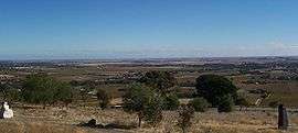 Bethany as viewed from Mengler Hill | |||||||||||||
 Bethany | |||||||||||||
| Coordinates | 34°32′S 138°58′E / 34.533°S 138.967°ECoordinates: 34°32′S 138°58′E / 34.533°S 138.967°E | ||||||||||||
| Established | 1842 | ||||||||||||
| Postcode(s) | 5352 | ||||||||||||
| Elevation | 283 m (928 ft) | ||||||||||||
| Location | 2 km (1 mi) from Tanunda | ||||||||||||
| LGA(s) | Barossa Council | ||||||||||||
| Region | Barossa Valley | ||||||||||||
| State electorate(s) | Schubert | ||||||||||||
| Federal Division(s) | Wakefield | ||||||||||||
| |||||||||||||
Bethany (postcode 5352) is a small village about 2 km south-east of Tanunda in the Barossa Valley. It was originally named Bethanien, but was changed during World War I in an attempt to remove all German place names from Australia.
Bethany was the first settlement in the Barossa Valley area. It was settled in 1842, by Prussian immigrants who had leased land from George Fife Angas. The large portion of these initial settlers had arrived in 1841, with Pastor Gotthard Fritzsche on the Skjold.
External links
-
 Media related to Bethany, South Australia at Wikimedia Commons
 - History of Bethany
This article is issued from Wikipedia - version of the 5/14/2016. The text is available under the Creative Commons Attribution/Share Alike but additional terms may apply for the media files.