Bethel, Highland County, Virginia
| Bethel, Virginia | |
|---|---|
| Unincorporated community | |
 Bethel, Virginia  Bethel, Virginia | |
| Coordinates: 38°14′52″N 79°38′59″W / 38.24778°N 79.64972°WCoordinates: 38°14′52″N 79°38′59″W / 38.24778°N 79.64972°W | |
| Country | United States |
| State | Virginia |
| County | Highland |
| Elevation | 2,664 ft (812 m) |
| Time zone | Eastern (EST) (UTC-5) |
| • Summer (DST) | EDT (UTC-4) |
| Area code(s) | 540 |
| GNIS feature ID | 1673764[1] |
Bethel is an unincorporated community in Highland County, Virginia, United States.[1] Bethel is located approximately 11.9 miles (19.2 km) south of Monterey, Virginia.[2] The community is situated between two mountain ridges in the Big Valley near Bolar Run on Virginia State Route 607.[2][3]
References
- 1 2 "Bethel". Geographic Names Information System. United States Geological Survey. Retrieved December 28, 2013.
- 1 2 Google (December 28, 2013). "Bethel, Highland County, Virginia" (Map). Google Maps. Google. Retrieved December 28, 2013.
- ↑ "The National Map". United States Geological Survey. Retrieved December 28, 2013.
Municipalities and communities of Highland County, Virginia, United States | ||
|---|---|---|
| Town | 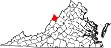 | |
| Unincorporated communities | ||
| Footnotes | ‡This populated place also has portions in an adjacent county or counties | |
This article is issued from Wikipedia - version of the 7/27/2016. The text is available under the Creative Commons Attribution/Share Alike but additional terms may apply for the media files.