Monterey, Virginia
| Monterey, Virginia | |
|---|---|
| Town | |
|
The view down into Monterey | |
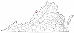 Location of Monterey, Virginia | |
| Coordinates: 38°24′43″N 79°34′50″W / 38.41194°N 79.58056°WCoordinates: 38°24′43″N 79°34′50″W / 38.41194°N 79.58056°W | |
| Country | United States |
| State | Virginia |
| County | Highland |
| Area | |
| • Total | 0.3 sq mi (0.8 km2) |
| • Land | 0.3 sq mi (0.8 km2) |
| • Water | 0.0 sq mi (0.0 km2) |
| Elevation | 2,894 ft (882 m) |
| Population (2010) | |
| • Total | 147 |
| Time zone | Eastern (EST) (UTC-5) |
| • Summer (DST) | EDT (UTC-4) |
| ZIP code | 24465 |
| Area code(s) | 540 |
| FIPS code | 51-52680[1] |
| GNIS feature ID | 1498517[2] |

Monterey is a town in Highland County, Virginia, United States. The population was 147 at the 2010 census. It is the county seat of Highland County.[3]
History
The selection of Monterey as the county seat of Highland County in 1847 was associated with the blazing of the Staunton and Parkersburg Turnpike in 1838. The new town was named in commemoration of the Battle of Monterrey, Mexico (September 21–24, 1846) in which General (and future President) Zachary Taylor gained a key victory for the United States in the Mexican-American War (1846–1848).[4] Monterey is a Spanish word meaning "mountain of the king".[4][5]
The GW Jeep Site, Monterey High School, and Monterey Hotel are listed on the National Register of Historic Places.[6]
Geography
Monterey is located at 38°24′43″N 79°34′50″W / 38.41194°N 79.58056°W (38.411888, -79.580468).[7]
According to the United States Census Bureau, the town has a total area of 0.3 square miles (0.8 km²), all of it land.[7]
_between_Mill_Alley_and_Spruce_Street_in_Monterey%2C_Highland_County%2C_Virginia.jpg)
Economy and tourism
Monterey is located on U.S. Route 250, which was built through the area in the 1840s as a portion of the historic Staunton-Parkersburg Turnpike which linked the upper Shenandoah Valley with the Ohio River.[8] The town of Monterey is heavily dependent on agriculture and on niche tourism generated from its many events and shops catering to tourists visiting for the tranquility and mountain air. The biggest festival is the Highland County Maple Festival, held on the second and third weekends of March, which brings roughly 50,000 visitors to the area.
Demographics
| Historical population | |||
|---|---|---|---|
| Census | Pop. | %± | |
| 1880 | 154 | — | |
| 1900 | 246 | — | |
| 1910 | 240 | −2.4% | |
| 1920 | 313 | 30.4% | |
| 1930 | 290 | −7.3% | |
| 1940 | 309 | 6.6% | |
| 1950 | 262 | −15.2% | |
| 1960 | 270 | 3.1% | |
| 1970 | 223 | −17.4% | |
| 1980 | 247 | 10.8% | |
| 1990 | 222 | −10.1% | |
| 2000 | 158 | −28.8% | |
| 2010 | 147 | −7.0% | |
| Est. 2015 | 136 | [9] | −7.5% |
As of the census[11] of 2010, there were 147 people, 79 households, and 46 families residing in the town. The population density was 490 people per square mile (183.8/km²). There were 121 housing units at an average density of 403.3 per square mile (151.25/km²). The racial makeup of the town was 98.6% White, 0.7% Native American, and 0.7% Black or African American. Hispanic or Latino of any race were 0.7% of the population.
There were 79 households out of which 20.3% had children under the age of 18 living with them, 44.3% were married couples living together, 12.7% had a female householder with no husband present, and 41.8% were non-families. 40.5% of all households were made up of individuals and 16.5% had someone living alone who was 65 years of age or older. The average household size was 1.86 and the average family size was 2.37.
In the town the population was spread out with 14.3% under the age of 18, 4.7% from 18 to 24, 19.7% from 25 to 44, 33.4% from 45 to 64, and 27.9% who were 65 years of age or older. The median age was 51.5 years. For every 100 females there were 81.5 males. For every 100 females age 18 and over, there were 82.6 males.
The median income for a household in the town was $50,446, and the median income for a family was $64,792. Males had a median income of $41,250 versus $35,625 for females. The per capita income for the town was $31,673. 7.2% of the families and 16.5% of the population were living below the poverty line, including 20% of those under 18 and 14.3% of those over 64.
Climate
The climate in this area has mild differences between highs and lows, and there is adequate rainfall year round. According to the Köppen Climate Classification system, Monterey has a marine west coast climate, abbreviated "Cfb" on climate maps.[12]
| Climate data for Monterey, Virginia (1981–2010) | |||||||||||||
|---|---|---|---|---|---|---|---|---|---|---|---|---|---|
| Month | Jan | Feb | Mar | Apr | May | Jun | Jul | Aug | Sep | Oct | Nov | Dec | Year |
| Average high °F (°C) | 38.2 (3.4) |
43.2 (6.2) |
51.5 (10.8) |
61.6 (16.4) |
71.0 (21.7) |
78.0 (25.6) |
81.1 (27.3) |
79.3 (26.3) |
72.9 (22.7) |
63.8 (17.7) |
51.9 (11.1) |
43.4 (6.3) |
61.5 (16.4) |
| Average low °F (°C) | 17.8 (−7.9) |
21.9 (−5.6) |
28.1 (−2.2) |
36.7 (2.6) |
46.0 (7.8) |
53.8 (12.1) |
57.8 (14.3) |
55.9 (13.3) |
49.0 (9.4) |
39.9 (4.4) |
30.7 (−0.7) |
23.8 (−4.6) |
38.6 (3.7) |
| Average precipitation inches (mm) | 2.60 (66) |
3.07 (78) |
3.41 (86.6) |
4.09 (103.9) |
4.44 (112.8) |
3.89 (98.8) |
4.02 (102.1) |
3.71 (94.2) |
2.94 (74.7) |
3.69 (93.7) |
4.16 (105.7) |
3.43 (87.1) |
43.46 (1,103.9) |
| Source: Western Regional Climate Center[13] | |||||||||||||
References
- ↑ "American FactFinder". United States Census Bureau. Retrieved 2008-01-31.
- ↑ "US Board on Geographic Names". United States Geological Survey. 2007-10-25. Retrieved 2008-01-31.
- ↑ "Find a County". National Association of Counties. Retrieved 2011-06-07.
- 1 2 Morton, Oren Frederic (1911). A History of Highland County, Virginia. p. 159.
- ↑ Gannett, Henry (1905). The origin of certain place names in the United States. Government Printing Office. p. 213.
- ↑ National Park Service (2010-07-09). "National Register Information System". National Register of Historic Places. National Park Service.
- 1 2 "US Gazetteer files: 2010, 2000, and 1990". United States Census Bureau. 2011-02-12. Retrieved 2011-04-23.
- ↑ SPT: Beginnings of an Alliance
- ↑ "Annual Estimates of the Resident Population for Incorporated Places: April 1, 2010 to July 1, 2015". Retrieved July 2, 2016.
- ↑ "Census of Population and Housing". Census.gov. Retrieved June 4, 2015.
- ↑ "American FactFinder". United States Census Bureau. Retrieved 2011-05-14.
- ↑ Climate Summary for Monterey, Virginia
- ↑ "Monterey, Virginia (445698) 1981-2010 Monthly Climate Summary". Western Regional Climate Center, Desert Research Institute. Retrieved December 23, 2013.
Municipalities and communities of Highland County, Virginia, United States | ||
|---|---|---|
| Town | 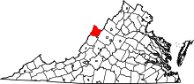 | |
| Unincorporated communities | ||
| Footnotes | ‡This populated place also has portions in an adjacent county or counties | |