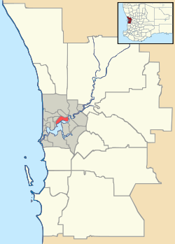
Bickley, Western Australia
| Bickley Perth, Western Australia | |||||||||||||
|---|---|---|---|---|---|---|---|---|---|---|---|---|---|
 Bickley | |||||||||||||
| Coordinates | 32°00′29″S 116°05′28″E / 32.008°S 116.091°ECoordinates: 32°00′29″S 116°05′28″E / 32.008°S 116.091°E | ||||||||||||
| Population | 956 (2006 census) | ||||||||||||
| Postcode(s) | 6076 | ||||||||||||
| LGA(s) | Shire of Kalamunda | ||||||||||||
| State electorate(s) | Darling Range | ||||||||||||
| Federal Division(s) | Pearce | ||||||||||||
| |||||||||||||
Bickley is a suburb located within the Shire of Kalamunda, in Perth, Western Australia.
It is situated on the Darling Scarp and is known for the brook of the same name.[1]
Before 1949 it was a stopping place on the Upper Darling Range Railway. It was originally known as "Heidelburg", but during World War I, Western Australian Government Railways and Tramways renamed it "Bickley" after a local pioneer Wallace Bickley.[2]
It has been the site of holiday and other sorts of camps.[3]
The Seven Network and Australian Broadcasting Corporation's Perth Television transmission towers have been located there since the founding of television in Perth in 1959. [4][5]
Perth Observatory, originally situated in West Perth is also currently located in Bickley.[6]
It is also one of the major meteorological stations within the Perth Metropolitan Area due to its length of time of operation and location on the Darling Scarp.[7]
It is also the location of water reservoirs [8][9]
Climate
| Climate data for Bickley | |||||||||||||
|---|---|---|---|---|---|---|---|---|---|---|---|---|---|
| Month | Jan | Feb | Mar | Apr | May | Jun | Jul | Aug | Sep | Oct | Nov | Dec | Year |
| Average high °C (°F) | 30.6 (87.1) |
30.6 (87.1) |
28.1 (82.6) |
23.5 (74.3) |
19.5 (67.1) |
16.0 (60.8) |
15.0 (59) |
15.9 (60.6) |
17.4 (63.3) |
21.0 (69.8) |
24.9 (76.8) |
27.9 (82.2) |
22.5 (72.5) |
| Average low °C (°F) | 15.2 (59.4) |
15.7 (60.3) |
14.5 (58.1) |
12.5 (54.5) |
10.2 (50.4) |
8.1 (46.6) |
7.1 (44.8) |
7.4 (45.3) |
8.1 (46.6) |
9.4 (48.9) |
11.7 (53.1) |
13.4 (56.1) |
11.1 (52) |
| Average rainfall mm (inches) | 17.2 (0.677) |
20.0 (0.787) |
24.7 (0.972) |
55.7 (2.193) |
130.2 (5.126) |
205.1 (8.075) |
221.8 (8.732) |
169.5 (6.673) |
120.5 (4.744) |
67.0 (2.638) |
41.4 (1.63) |
12.5 (0.492) |
1,096.5 (43.169) |
| Source: Australian Bureau of Meteorology[7] | |||||||||||||
See also
References
- ↑ Tian, Wee Heng; University of Western Australia. Faculty of Science (1963), Geology and petrology of the Bickley Brook area, retrieved 23 February 2015
- ↑ Western Australian Land Information Authority. "History of metropolitan suburb names – B". Retrieved 2008-10-10.
- ↑ Cornish, Patrick; Western Australia. Dept. for Youth, Sport and Recreation (1985), The origins of Bickley Camp, Department for Youth, Sport and Recreation, retrieved 23 February 2015
- ↑ http://pandora.nla.gov.au/pan/134908/20120911-1517/blog.televisionau.com/2009/04/celebrating-50-years-of-wa-tv1e76.html -mention of the Tuart Hill Studios and Bickley Transmission for Channel 7
- ↑ http://ozdigitaltv.com/transmitters/WA/402-Bickley-Carmel-Walliston - current transmitters
- ↑ Location & Contact Details www.perthobservatory.wa.gov.au. Retrieved 11 February 2007.
- 1 2 "Climate statistics for Bickley". Bureau of Meteorology. Retrieved 21 September 2011.
- ↑ "LOWER BICKLEY BROOK RESERVOIR.". Western Mail (Perth, WA : 1885 - 1954). Perth, WA: National Library of Australia. 20 October 1921. p. 25. Retrieved 23 February 2015.
- ↑ Western Australia. Dept. of Water; Western Australia. Water Resources Division (2006), Bickley Reservoir catchment area drinking water source protection plan : integrated water supply system, Dept. of Water, retrieved 23 February 2015
| Wikimedia Commons has media related to Bickley Brook Reservoir. |