Biscoe, North Carolina
| Biscoe, North Carolina | |
|---|---|
| Town | |
| Motto: "A Dream Worth Dreaming" | |
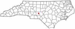 Location of Biscoe, North Carolina | |
| Coordinates: 35°21′38″N 79°46′49″W / 35.36056°N 79.78028°WCoordinates: 35°21′38″N 79°46′49″W / 35.36056°N 79.78028°W | |
| Country | United States |
| State | North Carolina |
| County | Montgomery |
| Area | |
| • Total | 2.0 sq mi (5.1 km2) |
| • Land | 2.0 sq mi (5.1 km2) |
| • Water | 0.0 sq mi (0.0 km2) |
| Elevation | 614 ft (187 m) |
| Population (2010) | |
| • Total | 1,700 |
| • Density | 855.8/sq mi (330.4/km2) |
| Time zone | Eastern (EST) (UTC-5) |
| • Summer (DST) | EDT (UTC-4) |
| ZIP code | 27209 |
| Area code(s) | 910 |
| FIPS code | 37-06000[1] |
| GNIS feature ID | 1019189[2] |
| Website | http://www.townofbiscoe.com/ |
Biscoe is a town in Montgomery County, North Carolina, United States. The population was 1,700 at the 2010 census. The town is named after Henry Biscoe, an important customer of the local lumber business.
History
The area was formerly called "Filo." The current name was adopted in 1895.
Biscoe's past was dependent on the railroad industry, and it was once an important repair center for railroad equipment. The Aberdeen and West End Railroad (owned by the Page family of Aberdeen, North Carolina, completed a branch to Star, North Carolina from Filo, NC (current Biscoe) in 1895. The A & W. E. R.R. was merged into the Aberdeen and Asheboro Railroad in 1897.
Biscoe was incorporated in 1901.
Former U.S. Congressman Larry Kissell is a resident of Biscoe.
Geography
Biscoe is located at 35°21′38″N 79°46′49″W / 35.36056°N 79.78028°W (35.360450, -79.780278).[3]
According to the United States Census Bureau, the town has a total area of 2.0 square miles (5.2 km2), all of it land.
U.S. 220, I-73/74 and N.C. 24/27 all pass through Biscoe.
Demographics
| Historical population | |||
|---|---|---|---|
| Census | Pop. | %± | |
| 1910 | 697 | — | |
| 1920 | 755 | 8.3% | |
| 1930 | 819 | 8.5% | |
| 1940 | 843 | 2.9% | |
| 1950 | 1,034 | 22.7% | |
| 1960 | 1,053 | 1.8% | |
| 1970 | 1,244 | 18.1% | |
| 1980 | 1,334 | 7.2% | |
| 1990 | 1,484 | 11.2% | |
| 2000 | 1,700 | 14.6% | |
| 2010 | 1,700 | 0.0% | |
| Est. 2015 | 1,690 | [4] | −0.6% |
As of the census[1] of 2000, there were 1,700 people, 535 households, and 393 families residing in the town. The population density was 855.8 people per square mile (329.8/km²). There were 572 housing units at an average density of 287.9 per square mile (111.0/km²). The racial makeup of the town was 58.35% White, 24.47% African American, 0.35% Native American, 0.59% Asian, 15.47% from other races, and 0.76% from two or more races. Hispanic or Latino of any race were 23.24% of the population.
There were 535 households out of which 38.7% had children under the age of 18 living with them, 52.9% were married couples living together, 14.6% had a female householder with no husband present, and 26.4% were non-families. 21.7% of all households were made up of individuals and 9.7% had someone living alone who was 65 years of age or older. The average household size was 2.97 and the average family size was 3.42.
In the town the population was spread out with 28.6% under the age of 18, 11.2% from 18 to 24, 25.6% from 25 to 44, 19.5% from 45 to 64, and 15.1% who were 65 years of age or older. The median age was 34 years. For every 100 females there were 92.7 males. For every 100 females age 18 and over, there were 87.3 males.
The median income for a household in the town was $35,667, and the median income for a family was $37,500. Males had a median income of $23,214 versus $21,089 for females. The per capita income for the town was $15,302. About 8.5% of families and 11.8% of the population were below the poverty line, including 16.4% of those under age 18 and 6.7% of those age 65 or over.
References
- 1 2 "American FactFinder". United States Census Bureau. Archived from the original on 2013-09-11. Retrieved 2008-01-31.
- ↑ "US Board on Geographic Names". United States Geological Survey. 2007-10-25. Retrieved 2008-01-31.
- ↑ "US Gazetteer files: 2010, 2000, and 1990". United States Census Bureau. 2011-02-12. Retrieved 2011-04-23.
- ↑ "Annual Estimates of the Resident Population for Incorporated Places: April 1, 2010 to July 1, 2015". Retrieved July 2, 2016.
- ↑ "Census of Population and Housing". Census.gov. Archived from the original on May 11, 2015. Retrieved June 4, 2015.
External links
Municipalities and communities of Montgomery County, North Carolina, United States | ||
|---|---|---|
| Towns | 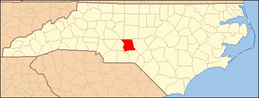 | |
| Unincorporated communities | ||