Bluewell, West Virginia
| Bluewell, West Virginia | |
|---|---|
| Census-designated place | |
 Location in Mercer County and the state of West Virginia. | |
| Coordinates: 37°18′45″N 81°15′35″W / 37.31250°N 81.25972°WCoordinates: 37°18′45″N 81°15′35″W / 37.31250°N 81.25972°W[1] | |
| Country | United States |
| State | West Virginia |
| County | Mercer |
| Area[1] | |
| • Total | 4.522 sq mi (11.711697 km2) |
| • Land | 4.494 sq mi (11.639073 km2) |
| • Water | 0.028 sq mi (0.072624 km2) |
| Elevation | 2,595 ft (791 m) |
| Population (2010)[2] | |
| • Total | 2,184 |
| • Density | 480/sq mi (190/km2) |
| Time zone | Eastern (EST) (UTC-5) |
| • Summer (DST) | EDT (UTC-4) |
| ZIP code | 24701 |
| Area code(s) | 304, 681 |
| GNIS feature ID | 54-08764 |
Bluewell, West Virginia is an unincorporated census-designated place on United States Highway 52 in Mercer County, West Virginia. As of the 2010 census, its population is 2,184. It is the terminus of West Virginia Route 20.
The community has no post office, its residences being a part of Bluefield for postal purposes. Its name is derived from being halfway between Bluefield and Bramwell.
The community is home to several businesses and establishments including Echostar, affiliated with Dish Network.
The community is adjacent to Pinnacle Rock State Park.
Educational institutions
- Bluewell Elementary
References
- 1 2 "US Gazetteer files: 2010, 2000, and 1990". United States Census Bureau. 2011-02-12. Retrieved 2011-04-23.
- ↑ "American FactFinder". United States Census Bureau. Archived from the original on 2013-09-11. Retrieved 2011-05-14.
See also
Municipalities and communities of Mercer County, West Virginia, United States | ||
|---|---|---|
| Cities | 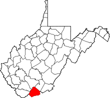 | |
| Towns | ||
| CDPs | ||
| Other communities |
| |
| Ghost town | ||
| Footnotes | ‡This populated place also has portions in an adjacent county or counties | |
This article is issued from Wikipedia - version of the 11/4/2016. The text is available under the Creative Commons Attribution/Share Alike but additional terms may apply for the media files.