Bonny Blue, Virginia
| Bonny Blue, Virginia | |
|---|---|
| Unincorporated community | |
 Bonny Blue, Virginia  Bonny Blue, Virginia | |
| Coordinates: 36°49′37″N 83°4′6″W / 36.82694°N 83.06833°WCoordinates: 36°49′37″N 83°4′6″W / 36.82694°N 83.06833°W | |
| Country | United States |
| State | Virginia |
| County | Lee |
| Elevation | 1,890 ft (580 m) |
| Time zone | Eastern (EST) (UTC-5) |
| • Summer (DST) | EDT (UTC-4) |
| Area code(s) | 276 |
| GNIS feature ID | 1481930[1] |
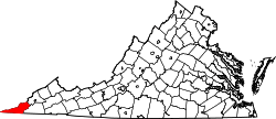
Bonny Blue is an unincorporated community and coal town in Lee County, Virginia, United States.
History
The community was likely named for the Bonnie Blue flag, the unofficial banner of the Confederacy at the start of the Civil War.[2] Bonny Blue contained a post office until 1962.[3]
References
- ↑ U.S. Geological Survey Geographic Names Information System: Bonny Blue, Virginia
- ↑ Tennis, Joe (2004). Southwest Virginia Crossroads: An Almanac of Place Names and Places to See. The Overmountain Press. p. 18. ISBN 978-1-57072-256-1.
- ↑ "Lee County". Jim Forte Postal History. Retrieved 30 September 2014.
This article is issued from Wikipedia - version of the 11/2/2016. The text is available under the Creative Commons Attribution/Share Alike but additional terms may apply for the media files.
