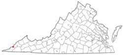
Keokee, Virginia
| Keokee, Virginia | |
|---|---|
| CDP | |
 Location of Keokee, Virginia | |
| Coordinates: 36°51′24″N 82°54′28″W / 36.85667°N 82.90778°WCoordinates: 36°51′24″N 82°54′28″W / 36.85667°N 82.90778°W | |
| Country | United States |
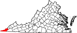
| State | Virginia |
| County | Lee |
| Area | |
| • Total | 4.3 sq mi (11.2 km2) |
| • Land | 4.3 sq mi (11.2 km2) |
| • Water | 0.0 sq mi (0.0 km2) |
| Elevation | 2,080 ft (634 m) |
| Population (2010) | |
| • Total | 416 |
| • Density | 97/sq mi (37/km2) |
| Time zone | Eastern (EST) (UTC-5) |
| • Summer (DST) | EDT (UTC-4) |
| ZIP code | 24265 |
| Area code(s) | 276 |
| FIPS code | 51-42104[1] |
| GNIS feature ID | 1495785[2] |
Keokee is a census-designated place (CDP) in Lee County, Virginia, United States. The population was 416 at the 2010 census.
History
The Keokee post office was established in 1906.[3]
Keokee Store No. 1 was listed on the National Register of Historic Places in 2007.[4]
Geography
Keokee is located at 36°51′24″N 82°54′28″W / 36.85667°N 82.90778°W (36.856575, -82.907861).[5]
According to the United States Census Bureau, the CDP has a total area of 4.3 square miles (11.2 km²), all of it land.
Demographics
As of the census[1] of 2000, there were 316 people, 128 households, and 88 families residing in the CDP. The population density was 72.9 people per square mile (28.1/km²). There were 147 housing units at an average density of 33.9/sq mi (13.1/km²). The racial makeup of the CDP was 97.78% White and 2.22% from two or more races. Hispanic or Latino of any race were 0.95% of the population.
There were 128 households out of which 30.5% had children under the age of 18 living with them, 52.3% were married couples living together, 13.3% had a female householder with no husband present, and 30.5% were non-families. 28.1% of all households were made up of individuals and 14.1% had someone living alone who was 65 years of age or older. The average household size was 2.47 and the average family size was 3.02.
In the CDP the population was spread out with 25.3% under the age of 18, 6.3% from 18 to 24, 27.8% from 25 to 44, 25.9% from 45 to 64, and 14.6% who were 65 years of age or older. The median age was 40 years. For every 100 females there were 109.3 males. For every 100 females age 18 and over, there were 101.7 males.
The median income for a household in the CDP was $22,875, and the median income for a family was $23,438. Males had a median income of $22,639 versus $23,229 for females. The per capita income for the CDP was $11,025. About 19.4% of families and 20.9% of the population were below the poverty line, including 27.1% of those under the age of 18 and none of those 65 and older.
References
- 1 2 "American FactFinder". United States Census Bureau. Retrieved 2008-01-31.
- ↑ "US Board on Geographic Names". United States Geological Survey. 2007-10-25. Retrieved 2008-01-31.
- ↑ "Lee County". Jim Forte Postal History. Retrieved 30 September 2014.
- ↑ National Park Service (2010-07-09). "National Register Information System". National Register of Historic Places. National Park Service.
- ↑ "US Gazetteer files: 2010, 2000, and 1990". United States Census Bureau. 2011-02-12. Retrieved 2011-04-23.