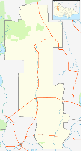
Boolite, Victoria
| Boolite Victoria | |||||||
|---|---|---|---|---|---|---|---|
 Boolite | |||||||
| Coordinates | 36°20′21″S 142°39′23″E / 36.3393012°S 142.6563446°ECoordinates: 36°20′21″S 142°39′23″E / 36.3393012°S 142.6563446°E | ||||||
| Postcode(s) | 3480 | ||||||
| Elevation | 114[1] m (374 ft) | ||||||
| Location |
| ||||||
| LGA(s) | Shire of Yarriambiack | ||||||
| State electorate(s) | Lowan | ||||||
| Federal Division(s) | Mallee | ||||||
| |||||||
Boolite is a small wheat farming town near Warracknabeal in Victoria, Australia.
The town had a hall that was used for dancing, fairs and concerts.[2] There was a local school which had an annual picnic, and flower day. Furthermore, the school was able to raise significant funds for the war effort during the Great War.[3] The town competed for the Emmett trophy in Australian football against other towns in the area.[4] The town also participated in cricket.[5] Today, little of the town remains.
References
This article is issued from Wikipedia - version of the 4/25/2016. The text is available under the Creative Commons Attribution/Share Alike but additional terms may apply for the media files.