Boundary Markers of the Original District of Columbia
The Boundary Markers of the Original District of Columbia are the 40 milestones that marked the four lines forming the boundaries between the states of Maryland and Virginia and the square of 100 square miles (259 km²) of federal territory that became the District of Columbia in 1801 (see History of Washington, D.C.#Founding). A survey team led by Major Andrew Ellicott placed these markers in 1791 and 1792; among Ellicott's assistants were his brothers Joseph and Benjamin Ellicott , Isaac Roberdeau, George Fenwick, Isaac Briggs and astronomer Benjamin Banneker.[1][2][3] Today, 36 of the original marker stones survive as the oldest federally placed monuments in the United States. Due to the return of the portion of the District south and west of the Potomac River to Virginia in 1846, some of these markers are now within Virginia.
Geography
The District of Columbia (initially, the Territory of Columbia) was originally specified to be a square 100 square miles (260 km2) in area, with the axes between the corners of the square running north-south and east-west, and having its southern corner at the southern tip of Jones Point in Alexandria, Virginia, at the confluence of the Potomac River and Hunting Creek (later the site of the Jones Point Lighthouse).[4] The sides of the square are each 10 miles (16 km) long. The specified orientation results in a diamond shape for the District's original boundaries on most maps.
The north-south axis of the District's current boundaries extends southward from the District's north corner near East-West Highway (Maryland Route 410), travels between 17th and 18th Streets, N.W., and continues south across the National Mall to the far shore of the Potomac River; the east-west axis is between the present Constitution Avenue and C Street, N.E. and N.W.[5] (These axes are not the lines used to define the four geographical quadrants of the District (N.E., N.W., S.E., and S.W.), commonly appended to Washington street addresses, which are delimited generally by North Capitol Street, East Capitol Street, South Capitol Street, and the National Mall.) The center of the square is west of the Ellipse and north of the Mall, within the grounds of the headquarters of the Organization of American States.[6]
In 2011, the District of Columbia geographic information system (GIS) program completed a project to map the District’s boundary using Global Positioning System (GPS) and contemporary survey technology at an accuracy of +/- 5 centimetres (1.97 in) horizontally and +/- 9 centimetres (3.54 in) vertically. The GIS program's survey found that (listed in the order in which Andrew Ellicott's team performed the initial boundary survey):
- Along the northwest boundary, the stones are outside the existing boundary ranging from 4.43 feet (1.35 m) to 9.6 feet (2.93 m)
- Along the northeast boundary, the stones are inside the existing boundary ranging from 6.6 feet (2.01 m) to 8.4 feet (2.56 m)
- Along the southeast boundary, the stones are outside the existing boundary ranging from 12.75 feet (3.89 m) to 18.48 feet (5.63 m)
The overall accuracy of the historic survey and the survey using 2011 technology produced remarkably similar results. For example, the distance between Southeast stones numbers 6 and 7 is 5,280.824 feet (1,609.5952 m), almost exactly one mile (5,280 feet (1,609.3440 m)).[7]
Placement of the boundary stones

On March 30, 1791, President George Washington issued a proclamation that established ″Jones's point, the upper cape of Hunting Creek in Virginia″ as the starting point for the federal territory's boundary survey.[8] Acting in accordance with instructions in the proclamation, the survey team then began its work at the square's south corner on the shoreline of the point, which was at the southeast corner of Alexandria, Virginia.[1][4][9] On April 15, 1791, officials dedicated the south cornerstone in an elaborate Masonic ceremony at a point that Andrew Ellicott had determined.[4][10][11]
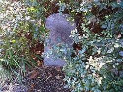
The survey team then cleared a corridor along the boundary route to facilitate surveying, traveling clockwise from the point and placing sandstone boundary markers at the four corners and at intervals of approximately one mile.[1][3][4] These markers were quarried near Aquia Creek in Virginia.[4] Most weighed about a half-ton at their emplacement; the four cornestones were slightly larger. The Virginia stones were set in 1791, and the Maryland ones in 1792.[4] The location of the four cornerstones and the other markers is identified on the map in "Boundary Stones of the District of Columbia".[12]
The side of a boundary marker that faced the federal territory was inscribed "Jurisdiction of the United States". The opposite side was marked with the name of the border state: Virginia or Maryland. The remaining sides were marked with the year that the team placed the stones and with the variation of the compass needle at that place.[3][4][12]
Protection and historical designations

Protection
In 1906, Fred E. Woodward read a paper to the Columbia Historical Society that described the history, location and conditions of each of the remaining boundary stones, together with photographs of each. His paper concluded by recommending that the stones be protected by placing small fences around each one.[13] In 1909, Ernest A. Shuster of the United States Geological Survey wrote an article for the National Geographic Magazine that described his visits to the 36 remaining boundary stones and that urged their protection and preservation.[14]
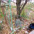
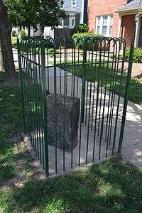
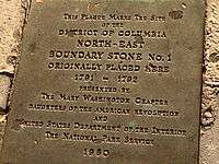
In 1915, various local chapters of the Daughters of the American Revolution (DAR) began to place fences around each of the markers.[4][10][12] The DAR also placed at the exact center of the original federal territory a marker stone that was located about a half of a mile from the White House and was near the DAR's Memorial Continental Hall.[10]
Historical designations
One Virginia boundary marker was added to the National Register of Historic Places in 1976, and another in 1980. In 1991, the remaining Virginia boundary markers were added to the National Register in response to a Multiple Property Submission that the Virginia DAR had submitted.[15][16] In 1996, 23 marker stones along the boundary between the District of Columbia and Maryland were added to the National Register in response to registration forms that the District of Columbia government had submitted for each of the stones. Each of the District's registration forms referenced the documentation in the Multiple Property Submission for the Virginia markers.[17][18]
Virginia
Southwest 9.[19] This boundary marker in Virginia was added to the National Register of Historic Places, and further was named a U.S. National Historic Landmark, in 1976 at the instigation of the Afro-American Bicentennial Corporation, which gave the stone its name: Benjamin Banneker: SW-9 Intermediate Boundary Stone.[20] It was the first of the boundary markers to be listed on the National Register of Historic Places.
South Corner.[21] This boundary marker in Virginia was added to the National Register of Historic Places in 1980, together with Alexandria's Jones Point Lighthouse.[22]
Southwest 1, 2, 3, 4, 5, 6, 7, and 8; West Corner; Northwest 1, 2, and 3. These boundary markers in Virginia were added to the National Register of Historic Places on February 1, 1991.[15]
District of Columbia and Maryland
Northwest 4, 5, 6, 7, 8, and 9; North Corner; Northeast 2, 3, 4, 5, 6, 7, 8, and 9; East Corner; Southeast 1, 2, 3, 5, 6, 7, and 9. These boundary markers, located along the border between the District of Columbia and Maryland, were added to the National Register of Historic Places on November 1, 1996.[17][18]
Preservation efforts
In 1976, the National Capital Planning Commission published a report that described the history and condition of each boundary stone.[4] The report recommended that measures be taken to assure the stones' preservation.[4]
In 1995, the Northern Virginia Boundary Stones Committee, whose establishment the Northern Virginia Regional Commission (NVRC) had requested, issued a list of recommendations intended to document and preserve the 14 boundary stones that were located in Virginia. The Committee included representatives of the State of Maryland and of Arlington and Fairfax counties and the cities of Alexandria and Falls Church in Virginia.[23]
In 2008, the NVRC announced that four Virginia local governments, including Arlington and Fairfax counties and the cities of Alexandria and Falls Church, had agreed to help fund a project to protect and preserve the boundary stones by providing matching funds to a Transportation Enhancement Grant that the District Department of Transportation (DDOT) had received from the Federal Highway Administration (FHA). The announcement stated that the NVRC was working on an agreement with the DDOT, the National Park Service and the FHA to administer the project.[24]
However, the preservation project had not yet begun by 2012. It appeared that the DDOT no longer had the funds that had been allocated for the project.[25] In the meantime, teams of volunteers had begun to landscape and repaint the fences surrounding the stones.[26]
In 2014, the National Park Service, the historic preservation staff of the District of Columbia Office of Planning, the DDOT and the DAR initiated an effort to rehabilitate the boundary markers that were located along the District's contemporary boundaries.[27] As part of the project, in January 2015 a DDOT crew unearthed a stone buried in 1962 that had replaced Southeast No. 8, with the intention of cleaning and restoring the marker.[28] However, in 2016, the stone was replaced by a new stone that presumably replicated the appearance of the original stone when the original was new.[29]
List of boundary stones
The 36 extant and four missing boundary stones are tabulated in sequence below, beginning at the southern corner and proceeding clockwise, in the same order as the stones were placed.[12] The year of designation on the National Register of Historic Places is also included for each stone.
Southern corner
| Name | Also known as | Address | City/County | Coordinates | Status | Designation |
| District of Columbia South Cornerstone | South Cornerstone of the Original District of Columbia | Seawall south of lighthouse, Jones Point Park, 1 Jones Point Drive, Alexandria | City of Alexandria, Virginia; Prince George's County, Maryland | 38°47′25″N 77°02′26″W / 38.7903387°N 77.0405825°W | Extant | 1980 |
Southwestern side
| Name | Also known as | Address | City/County | Coordinates | Status | Designation |
| Southwest No. 1 Boundary Marker of the Original District of Columbia | 1220 Wilkes Street | City of Alexandria, Virginia | 38°48′04″N 77°03′16″W / 38.80124°N 77.054357°W | Extant | 1991 | |
| Southwest No. 2 Boundary Marker of the Original District of Columbia | East side of Russell Road, north of junction with King Street | City of Alexandria, Virginia | 38°48′27″N 77°03′45″W / 38.807466°N 77.062510°W | Missing | 1991 | |
| Southwest No. 3 Boundary Marker of the Original District of Columbia | 2952 King Street, in the parking lot of First Baptist Church | City of Alexandria, Virginia | 38°50′31″N 77°04′46″W / 38.8420475°N 77.079384°W | Extant | 1991 | |
| Southwest No. 4 Boundary Marker of the Original District of Columbia | King Street north of junction with Wakefield Street | City of Alexandria and Arlington County, Virginia | Extant | 1991 | ||
| Southwest No. 5 Boundary Marker of the Original District of Columbia | Northeast of junction of King Street and Walter Reed Drive | Arlington County, Virginia | 38°49′14″N 77°06′24″W / 38.820658°N 77.1067272°W | Extant | 1991 | |
| Southwest No. 6 Boundary Marker of the Original District of Columbia | South Jefferson Street south of junction with Columbia Pike, in median strip | Arlington and Fairfax counties, Virginia | Extant | 1991 | ||
| Southwest No. 7 Boundary Marker of the Original District of Columbia | Behind 3101 South Manchester Street, in fence southwest of Carlin Springs Elementary School (5995 5th Road South) parking lot | Arlington and Fairfax counties, Virginia | Extant | 1991 | ||
| Southwest No. 8 Boundary Marker of the Original District of Columbia | South of junction of Wilson Boulevard and John Marshall Drive, behind apartment building | Arlington County and the City of Falls Church, Virginia | Extant | 1991 | ||
| Southwest No. 9 Boundary Marker of the Original District of Columbia | Benjamin Banneker: SW-9 Intermediate Boundary Stone | West side of Benjamin Banneker Park, 1701 North Van Buren Street, between 18th Street North and Four Mile Run | Arlington County and the City of Falls Church, Virginia | Extant | 1976 | |
Western corner
| Name | Also known as | Address | City/County | Coordinates | Status | Designation |
| West Cornerstone | West Jurisdiction Stone | In Andrew Ellicott Park at the West Cornerstone, 2824 N. Arizona St, Arlington, VA[30] | Arlington County, City of Falls Church, and Fairfax County, Virginia | 38°53′36″N 77°10′20″W / 38.8932193°N 77.1723036°W | Extant | 1991 |
Northwestern side
| Name | Also known as | Address | City/County | Status | Designation |
| Northwest No. 1 Boundary Marker of the Original District of Columbia | 3607 Powhatan Street | Arlington and Fairfax counties, Virginia | Extant | 1991 | |
| Northwest No. 2 Boundary Marker of the Original District of Columbia | 5145 North 38th Street | Arlington and Fairfax counties, Virginia | Extant | 1991 | |
| Northwest No. 3 Boundary Marker of the Original District of Columbia | 4013 North Tazewell Street | Arlington and Fairfax counties, Virginia | Extant | 1991 | |
| Northwest No. 4 Boundary Marker of the Original District of Columbia | Dalecarlia Water Treatment Plant grounds, 100+ feet east of the Capitol Crescent Trail and several hundred feet north of the intersection of Norton Street and Potomac Avenue | Washington, D.C. and Montgomery County, Maryland | Extant | 1996 | |
| Northwest No. 5 Boundary Marker of the Original District of Columbia | Dalecarlia Reservoir, 600 feet (180 m) west of Dalecarlia Parkway and 300 feet (91 m) southeast of concrete culvert | Washington, D.C., and Montgomery County, Maryland | Extant | 1996 | |
| Northwest No. 6 Boundary Marker of the Original District of Columbia | 150 feet (46 m) northeast of junction of Park and Western Avenues, Northwest | Washington, D.C., and Montgomery County, Maryland | Extant | 1996 | |
| Northwest No. 7 Boundary Marker of the Original District of Columbia | 5600 Western Avenue | Washington, D.C., and Montgomery County, Maryland | Extant | 1996 | |
| Northwest No. 8 Boundary Marker of the Original District of Columbia | 6422 Western Avenue | Washington, D.C., and Montgomery County, Maryland | Extant | 1996 | |
| Northwest No. 9 Boundary Marker of the Original District of Columbia | Rock Creek Park, approximately 165 feet (50 m) Northwest of the centerline of Daniel Road and 5 feet (1.5 m) southeast from edge of 2701 Daniel Road | Washington, D.C., and Montgomery County, Maryland | Extant | 1996 | |
Northern corner
| Name | Also known as | Address | City/County | Coordinates | Status | Designation |
| North Corner Boundary Marker of the Original District of Columbia | 1880 block of East-West Highway (south side) | Washington, D.C., and Montgomery County, Maryland | 38°59′45″N 77°02′27″W / 38.9959461°N 77.040947°W | Extant | 1996 | |
Northeastern side
| Name | Also known as | Address | City/County | Status | Designation |
| Northeast No. 1 Boundary Marker of the Original District of Columbia | Washington, D.C., and Montgomery County, Maryland | Missing | |||
| Northeast No. 2 Boundary Marker of the Original District of Columbia | 6980 Maple Street, Northwest | Washington, D.C., and Montgomery County, Maryland | Extant | 1996 | |
| Northeast No. 3 Boundary Marker of the Original District of Columbia | 144 feet (44 m) northwest of junction of Eastern Avenue and Chillum Road | Washington, D.C., and Prince George's County, Maryland | Extant | 1996 | |
| Northeast No. 4 Boundary Marker of the Original District of Columbia | 5400 Sargent Road | Washington, D.C., and Prince George's County, Maryland | Extant | 1996 | |
| Northeast No. 5 Boundary Marker of the Original District of Columbia | 4609 Eastern Avenue | Washington, D.C., and Prince George's County, Maryland | Extant | 1996 | |
| Northeast No. 6 Boundary Marker of the Original District of Columbia | 3601 Eastern Avenue | Washington, D.C., and Prince George's County, Maryland | Extant | 1996 | |
| Northeast No. 7 Boundary Marker of the Original District of Columbia | Fort Lincoln Cemetery | Washington, D.C., and Prince George's County, Maryland | Extant | 1996 | |
| Northeast No. 8 Boundary Marker of the Original District of Columbia | Kenilworth Park and Aquatic Gardens, northwest of junction of Eastern and Kenilworth Avenues | Washington, D.C., and Prince George's County, Maryland | Extant | 1996 | |
| Northeast No. 9 Boundary Marker of the Original District of Columbia | 919 Eastern Avenue | Washington, D.C., and Prince George's County, Maryland | Extant | 1996 | |
Eastern corner
| Name | Also known as | Address | City/County | Coordinates | Status | Designation |
| East Corner Boundary Marker of the Original District of Columbia | 100 feet (30 m) east of junction of Eastern and Southern Avenues | Washington, D.C., and Prince George's County, Maryland | 38°53′34″N 76°54′33″W / 38.892829°N 76.9092291°W | Extant | 1996 | |
Southeastern side
| Name | Address | City/County | Coordinates | Status | Designation |
| Southeast No. 1 Boundary Marker of the Original District of Columbia | 30 feet (9.1 m) south of junction of Southern Avenue and D Street | Washington, D.C., and Prince George's County, Maryland | Extant | 1996 | |
| Southeast No. 2 Boundary Marker of the Original District of Columbia | 4345 Southern Avenue | Washington, D.C., and Prince George's County, Maryland | Extant | 1996 | |
| Southeast No. 3 Boundary Marker of the Original District of Columbia | 3908 Southern Avenue | Washington, D.C., and Prince George's County, Maryland | Extant | 1996 | |
| Southeast No. 4 Boundary Marker of the Original District of Columbia | Washington, D.C., and Prince George's County, Maryland | Missing | |||
| Southeast No. 5 Boundary Marker of the Original District of Columbia | 280 feet (85 m) northeast of junction of Southern Avenue and Valley Terrace | Washington, D.C., and Prince George's County, Maryland | Extant | 1996 | |
| Southeast No. 6 Boundary Marker of the Original District of Columbia | 901 Southern Avenue | Washington, D.C., and Prince George's County, Maryland | Extant | 1996 | |
| Southeast No. 7 Boundary Marker of the Original District of Columbia | 25 feet (7.6 m) south of junction of Southern Avenue and Indian Head Road on the east side of Indian Head Highway | Washington, D.C., and Prince George's County, Maryland | 38°49′16″N 77°00′04″W / 38.8211951°N 77.0010991°W | Extant | 1996 |
| Southeast No. 8 Boundary Marker of the Original District of Columbia | Washington, D.C., and Prince George's County, Maryland | 38°48′39″N 77°00′51″W / 38.810947°N 77.01420600000002°W | Missing | ||
| Southeast No. 9 Boundary Marker of the Original District of Columbia | 1,000 feet (300 m) southwest of the southern end of Oxon Cove Bridge and about 200 feet (61 m) east of the Potomac River[31] | Washington, D.C., and Prince George's County, Maryland | 38°48′13″N 77°01′26″W / 38.803528935698665°N 77.02383890748024°W | Extant | 1996 |
Gallery of boundary markers of the original District of Columbia
- South Cornerstone (2010)
 South Cornerstone close-up (2010)
 South Cornerstone plaque (2010)
 Southwest No. 1 (2012)
 Southwest No. 1 close-up (2001)
 Southwest No. 2 (2006)
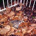 Southwest No. 4 (2006)
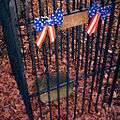 Southwest No. 5 (2006)
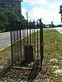 Southwest No. 6 (2012)
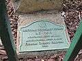 Southwest No. 6 plaque (2012)
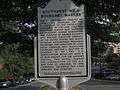 Southwest No. 6 historical marker (2012)
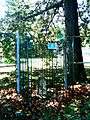 Southwest No. 7 (2012)
 Southwest No. 8 (2012)
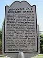 Southwest No. 8 historical marker (2012)
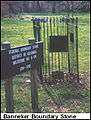 Southwest No. 9 (undated)
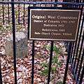 West Cornerstone (2005)
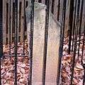 Northwest No. 1 (2005)
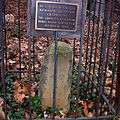 Northwest No. 2 (2005)
 Northwest No. 4 (2006)
 Northwest No. 5 (2006)
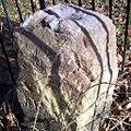 Northwest No. 6 (2006)
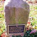 Northwest No. 7 (2006)
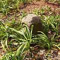 Northwest No. 8 (2005)
 Northwest No. 9 (2005)
 North Cornerstone (2005)
 Northeast No. 1 plaque (2005)
 Northeast No. 2 (2005)
- Northeast No. 2 (2010)
 Northeast No. 3 (2005)
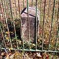 Northeast No. 4 (2005)
 Northeast No. 5 (2005)
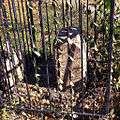 Northeast No. 6 (2005)
 Northeast No. 8 (2005)
 Northeast No. 9 (2005)
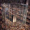 East Cornerstone (2005)
 Southeast No. 1 (2005)
 Southeast No. 2 (2011)
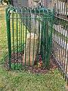 Southeast No. 3 (2011)
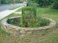 Southeast No. 5 (2011)
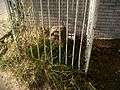 Southeast No. 7 (2011)
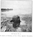 Southeast No. 9 (1907)
Missing boundary markers
Four of the forty original boundary markers were not in or near their original locations in late 2016. Three of these had been replaced with substitute markers.[12]
Southwest No. 2 Boundary Marker
The original marker disappeared before 1900. A marker stone now within a DAR fence near the street curb at 7 Russell Road north of King Street in Alexandria is a replacement about .35 miles southeast of the original location. DAR records show that the replacement marker was placed at its current location in 1920. The replacement marker lacks an inscription and does not resemble an original boundary marker.[32]
Northeast No. 1 Boundary Marker
A photograph taken on June 13, 1916, shows a ceremony that members of the DAR conducted when they placed a fence around this marker stone, which was then in a field.[4] The stone was accidentally bulldozed and removed in September 1952 during the construction of a storefront at 7847 Eastern Avenue, northwest of the avenue's intersection with Georgia Avenue. A bronze plaque in the sidewalk in front of a shop at the site marks the stone's former location.[33]
Southeast No. 4 Boundary Marker
This marker was located in 1976 along Southern Avenue a few feet southeast of the avenue's intersection with Naylor Road.[4] When a truck knocked the stone out of place in 1985, the manager of a nearby apartment building moved it into the building's boiler room for safekeeping. In 1991, the building manager gave the stone to a bicentennial resurveying team.[34] In 2012, the stone was transferred to the D.C. Office of the Surveyor, where it remains on display.[35] A replica of the stone resembling the presumed appearance of the original stone when new was placed in 2016 near the original stone's site.[36]
Southeast No. 8 Boundary Marker
The original stone was removed in 1958 during construction and then either lost or stolen from a storage facility before it could be reset in the ground. In 1962, the DAR placed a new inscription-less stone in the same location along with the original stone's iron fence. However, further construction subsequently buried the replacement stone.[29]
The replacement stone was later discovered nearly eight feet below ground level in the southeast corner of the Blue Plains Impoundment Lot, on the Maryland side of the impoundment lot's fence.[29] A concrete pipe embedded in a mound of gravel was put in place to mark the replacement stone's site.
In 1972, the stone had been uncovered, and an excavation and relocation was planned, but never happened and the stone was again covered by landfill until 1991. A bicentennial resurveying team then dug it out of the ground, using old photographs to locate it. The stone was replaced underground for protection and covered by a taller pipe that was visible above the surface.[37]
In 2015, DDOT workers excavated and removed the stone after debris in the pipe had covered the stone.[28][29] The stone was replaced in early 2016 with a replica that presumably had the same appearance as the original had when new. This replica was installed at ground level at the stone's original site.[29]
District of Columbia entrance markers
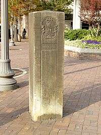
A group of entrance markers, erected later along major roads that travel into the District of Columbia, are located on or near the boundary of D.C. and Maryland.
An entrance marker stands in a traffic circle (Blair Circle) near Silver Spring at the junction of Eastern Avenue NW, 16th Street NW, N. Portal Drive NW and Colesville Road.[38] This marker is between the North Corner boundary marker and the former site of the Northeast No. 1 boundary marker of the original District of Columbia.
Three pairs of marker stones and another single stone are known collectively as the Garden Club of America Entrance Markers.[39] They are all listed on the National Register of Historic Places.
- One pair of markers is located within Westmoreland Circle at the junction of Western Avenue NW and Massachusetts Avenue NW.[40] These markers are between the Northwest No. 5 and Northwest No. 6 boundary markers of the original District of Columbia.
- Two similar markers flank Wisconsin Avenue at Western Avenue NW in Friendship Heights, adjacent to the Friendship Heights Station of the Washington Metro system.[41] These markers are between the Northwest No. 6 and Northwest No. 7 boundary markers of the original District of Columbia.
- Another set of markers is located in Chevy Chase Circle. The primary intersection is Western Avenue and Connecticut Avenues, NW.[42] These markers are between the Northwest No. 7 and Northwest No. 8 boundary markers of the original District of Columbia.
- An unpaired marker is located within a traffic island at the intersection of Georgia Avenue NW, Alaska Avenue NW and Kalmia Road NW.[43] This marker is between the former site of the Northeast No. 1 and Northeast No. 2 boundary markers of the original District of Columbia.
See also
- List of Registered Historic Places in the District of Columbia
- List of Registered Historic Places in Virginia
References
- 1 2 3 Bedini, Silvio A. (1970). "Benjamin Banneker and the Survey of the District of Columbia, 1791" (PDF). Records of the Columbia Historical Society. 47: 7–30. Archived from the original (pdf) on 2013-01-14. Retrieved 2013-01-13. at boundarystones.org
- ↑ (1) Bedini, Silvio A. (Spring–Summer 1991). "The Survey of the Federal Territory: Andrew Ellicott and Benjamin Banneker". Washington History. Washington, D.C.: Historical Society of Washington, D.C. 3 (1): 81, 83, 86. JSTOR 40072968.
(2) Mathews, Catharine Van Cortlandt (1908). "Chapter IV: The City of Washington in the Territory of Columbia, 1791–1793". Andrew Ellicott: His Life and Letters. Grafton Press. pp. 81–86. At Google Books. - 1 2 3 Tindall, William (1914). Standard History of the City of Washington From a Study of the Original Sources. Knoxville, Tennessee: H. W. Crew and Company. pp. 150–151. OCLC 7059152. Retrieved 2016-03-31. At Google Books.
- 1 2 3 4 5 6 7 8 9 10 11 12 National Capital Planning Commission (1976). Boundary markers of the Nation's Capital: a proposal for their preservation & protection : a National Capital Planning Commission Bicentennial report. Washington, D.C.: National Capital Planning Commission; For sale by the Superintendent of Documents, United States Government Printing Office. OCLC 3772302. Retrieved 2016-02-22. At HathiTrust Digital Library.
- ↑ The north-south axis is a straight line connecting the north and south cornerstones of the original District of Columbia. The east-west axis is a straight line connecting the east and west cornerstones of the original District of Columbia.
- ↑ Coordinates of the center of the square of the original District of Columbia: 38°53′35″N 77°02′27″W / 38.89303°N 77.0407632°W. The center of the square of the original District of Columbia is the crossing of the north-south axis line and the east-west axis line.
- ↑ Office of the Chief Technology Officer (December 1, 2011). "Historic Survey of the District's Boundary Stones using Modern Technology". Government of the District of Columbia. Retrieved January 6, 2013.
- ↑ Washington, George. John C. Fitzpatrick, ed. Proclamation: Georgetown, March 30, 1791. The Writings of George Washington from the Original Manuscript Sources: 1745-1799. 31: January 22, 1790—March 9, 1792. Washington: United States Government Printing Office (August, 1939). Retrieved 2016-10-07.
Now therefore for the purposes of amending and completing the location of the whole of the said territory of the ten miles square in conformity with the said amendatory act of Congress, I do hereby declare and make known that the whole of said territory shall be located and included within the four lines following, that is to say: Beginning at Jones's point, the upper cape of Hunting Creek in Virginia, and at an angle in the outset of 45 degrees west of the north: ...
. At Google Books. - ↑ "The 1790s: Place in Time". Discovering the Decades: Alexandria Archaeology Looks Back at 250 Years of Alexandria History. Government of the City of Alexandria, Virginia. Archived from the original on August 29, 2008. Retrieved January 5, 2013.
- 1 2 3 "District of Columbia". Nineteenth Report of the National Society of the Daughters of the American Revolution: October 11, 1915 to October 11, 1916, 64th Congress, 2nd Session, Senate, Document No. 710. Washington, D.C.: Government Printing Office: 105–107. 1917. Retrieved 2016-10-08. At Google Books.
- ↑ "New Federal City" (PDF). Columbian Centennial (744). Boston, Massachusetts: Benjamin Russell. 1791-05-07. Archived from the original (PDF) on 2016-06-30. Retrieved 2016-10-09. At boundarystones.org
- 1 2 3 4 5 6 "Boundary Stones of the District of Columbia". boundarystones.org. Retrieved 2010-05-07.
- ↑ Woodward, Fred E. (1907). "A Ramble Along the Boundary Stones of the District of Columbia with a Camera". Records of the Columbia Historical Society. Washington, D.C.: Columbia Historical Society. 10: 63–87. Retrieved 2016-10-08. At Google Books.
- ↑ Schuster, Ernest A., U.S. Geological Survey (1909). Gilbert H. Grosvenor, ed. "The Original Boundary Stones of the District of Columbia". National Geographic Magazine. Washington, D.C.: National Geographic Society. 20: 356–359. Retrieved 2016-10-08. At Google Books.
- 1 2 (1) "Virginia" (PDF). Weekly List of Listed Properties: 1/28/91 through 2/01/91: United States Department of the Interior: National Park Service: National Register of Historic Places. National Park Service. Archived from the original (PDF) on October 8, 2016. Retrieved October 10, 2016.
(2) "Southwest No. 1, Southwest No. 2, Southwest No. 3, Southwest No. 4 and Southwest No. 5 Boundary Markers of the Original District of Columbia". VIRGINIA - Alexandria County. National Register of Historic Places.com. Archived from the original on July 2, 2011. Retrieved January 5, 2013.
(3) "Southwest No. 5, Southwest No. 6 and Southwest No. 7 Boundary Markers of the Original District of Columbia and West Cornerstone". VIRGINIA - Arlington County. National Register of Historic Places.com. Archived from the original on July 21, 2010. Retrieved January 5, 2013.
(4) "West Cornerstone". VIRGINIA - Falls Church County. National Register of Historic Places.com. Archived from the original on December 18, 2010. Retrieved January 5, 2013. - ↑ (1) Hynak, Barbara A. (Chairman, District V Boundary Markers Committee, Virginia Daughters of the American Revolution) (July 9, 1990). "Boundary Markers of the original District of Columbia" (PDF). United States Department of the Interior: National Park Service: National Register of Historic Places — Multiple Property Documentation Form and National Register of Historic Places — Registration Forms for Southwest #1,Southwest #2, Southwest #3,Southwest #4, Southwest #5,Southwest #6, Southwest #7,Southwest #8, West Cornerstone, Northwest #1, Northwest #2 and Northwest #3 Boundary Markers of the Original District of Columbia. Arlington County, Virginia: Arlington County, Virginia, Department of Community Planning, Housing and Development. Archived from the original (PDF) on March 30, 2012. Retrieved October 10, 2016.
- 1 2 (1) "District of Columbia: District of Columbia State Equivalent". Weekly List of Actions Taken on Properties: 10/28/96 THROUGH 11/01/96: United States Department of the Interior: National Park Service: National Register of Historic Places. National Park Service. Archived from the original on November 23, 2008. Retrieved October 10, 2016.
(2) "Boundary Stones of the District of Columbia" (PDF). District of Columbia Inventory of Historic Places: Alphabetical Version. Historic Preservation Office, Office of Planning, Government of the District of Columbia. 2009. p. 21. Archived from the original (PDF) on November 11, 2009. Retrieved October 12, 2016.
(3) "East Corner Boundary Marker of the Original District of Columbia". DISTRICT OF COLUMBIA. National Register of Historic Places.com. p. 3. Archived from the original on October 14, 2012. Retrieved October 10, 2016.
(4) "North Corner, Northeast No. 2, Northeast No. 3, Northeast No. 4, Northeast No. 5, Northeast No. 6, Northeast No. 7, Northeast No. 8, Northeast No. 9, Northwest No. 4, Northwest No. 5, Northwest No. 6, Northwest No. 7, Northwest No. 8, Northwest No. 9, Boundary Markers of the Original District of Columbia". DISTRICT OF COLUMBIA. National Register of Historic Places.com. p. 7. Archived from the original on October 1, 2012. Retrieved October 10, 2016.
(5) "Southeast No. 1, Southeast No. 2, Southeast No. 3, Southeast No. 5, Southeast No. 6, Southeast No. 7, and Southeast No. 9, Boundary Markers of the Original District of Columbia". DISTRICT OF COLUMBIA. National Register of Historic Places.com. p. 9. Archived from the original on September 28, 2012. Retrieved October 10, 2016. - 1 2 Barsoum, Lydia, Architectural Historian: Historic Preservation Division, District of Columbia government (August 1996). "Boundary Markers of the original District of Columbia". United States Department of the Interior: National Park Service: National Register of Historic Places Registration Forms. historicwashington.org. Retrieved October 10, 2016: NW4; NW9; North Corner NE2; NE3; NE5; NE6; NE7; NE 8; NE 9; SE5; SE6; SE7; SE9.
- ↑ "SW9". Boundary Stones of the District of Columbia. boundary stones.org. Retrieved 2013-01-04.
- ↑ (1) "Benjamin Banneker: SW 9 Intermediate Boundary Stone". VIRGINIA - Arlington County. National Register of Historic Places.com. p. 1. Archived from the original on July 24, 2010. Retrieved January 5, 2013.
(2) "Banneker (Benjamin) SW-9 Intermediate Boundary Stone". National Historic Landmark summary listing. National Park Service, U.S. Department of the Interior. Retrieved August 9, 2011.
(3) Graves, Lynne Gomez (Historical Projects Director, Afro-American Bicentennial Corporation) (February 3, 1976). "Benjamin Banneker: SW-9 Intermediate Boundary Stone (milestone) of the District of Columbia" (PDF). United States Department of the Interior: National Park Service: National Register of Historic Places Inventory — Nomination Form. National Park Service, U.S. Department of the Interior. - ↑ "SOUTH". Boundary Stones of the District of Columbia. boundary stones.org. Retrieved 2013-01-04.
- ↑ (1) "Jones Point Lighthouse and District of Columbia South Cornerstone" (PDF). VIRGINIA - Alexandria County. National Register of Historic Places.com. Archived from the original on October 5, 2016. Retrieved October 10, 2016.
(2) Mackintosh, Barry (Regional Historian, National Capital Region, National Park Service) (January 24, 1980). "Jones Point Lighthouse and District of Columbia South Cornerstone" (PDF). United States Department of the Interior: National Park Service: National Register of Historic Places Inventory — Nomination Form for Federal Properties. National Park Service, U.S. Department of the Interior. Archived from the original (PDF) on October 5, 2016. Retrieved October 10, 2016. - ↑ (1) Northern Virginia Boundary Stones Committee (September 1995). "1994-1995 Findings and Recommendations of the Northern Virginia Boundary Stones Committee". boundarystones.org. Archived from the original on July 25, 2011. Retrieved January 7, 2013.
(2) "1994-1995 Findings and Recommendations of the Northern Virginia Boundary Stones Committee" (pdf). boundarystones.org. September 1995. Retrieved January 7, 2013. - ↑ "Northern Virginia Regional Commission Leads Project to Preserve DC Boundary Markers". Press Release. Northern Virginia Regional Commission. August 14, 2008. Archived from the original on January 8, 2012. Retrieved January 6, 2012.
- ↑ Muller, John (May 23, 2012). "Without preservation, DC's boundary stones are in danger". Greater Greater Washington. Archived from the original on January 8, 2012. Retrieved January 6, 2013.
- ↑ (1) Muller, John (October 25, 2011). "Boundary stones: The oldest monuments in the District". Greater Greater Washington. Archived from the original on October 29, 2011. Retrieved April 3, 2016.
(2) Holt, Brady (October 26, 2011). "On D.C. border, history hides along wayside" (PDF). The Northwest Current. Washington, D.C.: The Current. pp. 7, 10. Archived from the original (PDF) on May 28, 2013. Retrieved April 3, 2016. - ↑ (1) Hallett, Vicky (August 29, 2014). "D.C.'s historic boundary stones are being preserved". Express. Washington Post. Archived from the original on April 3, 2016. Retrieved April 3, 2016.
(2) Harris, Hamil R. (May 15, 2015). "200-year-old boundary markers in D.C. rededicated". Local. The Washington Post. Archived from the original on April 1, 2016. Retrieved 2016-04-01.
(3) Harris, Hamil R. (May 30, 2015). "Stones laid by Benjamin Banneker in the 1790s are still standing". Local. The Washington Post. Archived from the original on April 1, 2016. Retrieved April 1, 2016. Note: A June 1, 2015, comment by RossEmery following this article disputed information in the article's title. The comment stated: "Stones laid by Benjamin Banneker in the 1790s are still standing" Actually: Ellicott, a prominent professional surveyor, hired Benjamin Banneker, an astronomer and mathematician from Maryland, to make the astronomical observations and calculations necessary to establish the south corner of the square at Jones Point in Alexandria. According to legend, "Banneker fixed the position of the first stone by lying on his back to find the exact starting point for the survey ... and plotting six stars as they crossed his spot at a particular time of night." From there, Ellicott's team (minus Banneker, who worked only on the south corner) embarked on a forty mile journey, surveying ten-mile lines first to the northwest, then the northeast, next southeast, and finally southwest back toward the starting point, clearing twenty feet of land on each side of the boundary. The comment cited http://www.boundarystones.org as the source of its information. - 1 2 Sherwood, Tom (January 28, 2015). "History Unearthed: Boundary Stones of D.C." (video). NBC 4 Washington, D.C. Retrieved March 31, 2016.
- 1 2 3 4 5 "SE8 (with 2016 photograph of new replica stone)". Boundary Stones of the District of Columbia. boundary stones.org. Retrieved October 9, 2016.
- ↑ "Andrew Ellicott Park at the West Cornerstone". Arlington County, Virginia, Department of Parks and Recreation. Archived from the original on 2013-10-08. Retrieved 2013-10-08.
- ↑ "SE9". Boundary Stones of the District of Columbia. boundary stones.org. Retrieved January 5, 2013.
- ↑ "SW2". Boundary Stones of the District of Columbia. boundary stones.org. Retrieved 2013-01-04.
- ↑ "NE1". Boundary Stones of the District of Columbia. boundary stones.org. Retrieved January 5, 2013.
- ↑ "2006 photograph of original SE4". Boundary Stones of the District of Columbial. boundary stones.org. Archived from the original on 2016-04-19. Retrieved 2016-10-09.
- ↑ "2016 photograph of original SE4 on display in the D.C. Office of the Surveyor". Boundary Stones of the District of Columbial. boundary stones.org. Archived from the original on 2016-10-09. Retrieved 2016-10-09.
- ↑ "SE4 (with 2016 photograph of replica stone)". Boundary Stones of the District of Columbia. boundary stones.org. Retrieved 2016-10-09.
- ↑ "SE8 (with 2006 photograph of the top of the stone as seen through a pipe)". Boundary Stones of the District of Columbia. boundary stones.org. Archived from the original on 2016-04-19. Retrieved October 9, 2016.
- ↑ Coordinates of entrance marker near Silver Spring: 38°59′32″N 77°02′11″W / 38.992322°N 77.036326°W
- ↑ "District of Columbia Inventory of Historic Sites". DC Preservation. Retrieved 2011-11-01.
- ↑ Coordinates of entrance marker in Westmoreland Circle: 38°56′57″N 77°06′03″W / 38.949213°N 77.10084°W
- ↑ Coordinates of entrance marker in Friendship Heights: 38°57′40″N 77°05′09″W / 38.9610041°N 77.08571°W
- ↑ Coordinates of entrance marker in Chevy Chase Circle: 38°58′03″N 77°04′37″W / 38.9675°N 77.076944°W
- ↑ Coordinates of entrance marker along Georgia Ave. NW: 38°59′02″N 77°01′36″W / 38.9839102°N 77.0267349°W
External links
| Wikimedia Commons has media related to Boundary Stones (District of Columbia). |
- "Boundary Stones of the District of Columbia". boundarystones.org. Archived from the original on March 15, 2016. Retrieved April 1, 2016.
- Boundary Stones Committee, DC Daughters of the American Revolution
- Kelly, John (May 14, 2009). "Arlington Man Watches Over Unsung Monuments to D.C.'s Origins". Metro: John Kelly's Washington. The Washington Post. Archived from the original on April 11, 2016. Retrieved April 11, 2016. A tour of the boundary markers
- Pegoraro, Rob (July 1, 2007). "RoadTrip: At Boundary Stones, Today's Virginia Meets Yesterday's D.C." (PDF). Sunday Source. The Washington Post. p. M8. Archived from the original (pdf) on January 5, 2013. Retrieved January 5, 2013.
- Maps, photos and satellite images
- Locations and individual photographs of 40 boundary marker sites from "Boundary Stones of the District of Columbia". boundarystones.org. Retrieved 2013-01-05.
- Locations and individual photographs of 27 boundary markers from zhurnaly.com
- District of Columbia Chapter, Daughters of the American Revolution: "Location of Boundary Stones (Mile Markers)" from dcdar.org
- 1906 Map of All D.C. Boundary Stones