U.S. Route 29 in Maryland
| ||||
|---|---|---|---|---|
|
29th Infantry Division Memorial Highway Colesville Road Columbia Pike | ||||
_map.png) | ||||
| Route information | ||||
| Maintained by MDSHA | ||||
| Length: | 25.86 mi[1] (41.62 km) | |||
| Existed: | 1934 – present | |||
| Major junctions | ||||
| South end: |
| |||
|
| ||||
| North end: |
| |||
| Location | ||||
| Counties: | Montgomery, Howard | |||
| Highway system | ||||
| ||||

U.S. Route 29 (US 29) is a north–south United States highway that runs for 1,036 miles (1,667 km) from the western suburbs of Baltimore, Maryland, to Pensacola, Florida. In the U.S. state of Maryland, US 29 is a major highway that emerges from Washington D.C. and runs north into eastern Montgomery County, stretching over 25.859 miles (41.62 km) through the state and terminating at Maryland Route 99 outside of Ellicott City. It serves the cities of Columbia and Ellicott City and provides the westernmost north–south route between Washington D.C. and Baltimore.
US 29 in Maryland was a late addition to the United States Numbered Highway System fabricated in 1926, beginning along a corridor once known as Maryland Route 27. Since its redesignation, it has been realigned and upgraded many times, now containing freeway and expressway sections.
Route description
Georgia Avenue and Colesville Road
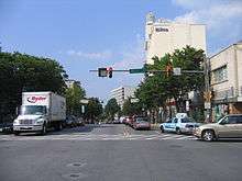
US 29 emerges from Washington, D.C. along Georgia Avenue. Running alongside the Jessup Blair Park it intersects MD 410, the East–West Highway, just outside the D.C. border. It then meets the northern terminus of MD 384 and the southern terminus of MD 97 at a four-way intersection in Silver Spring; US 29 subsequently becomes Colesville Road, taking over from MD 384, while MD 97 continues as Georgia Avenue.
Crossing Sligo Creek Park the highway intersects the Sligo Creek Parkway just to the south of Interstate 495 (Capital Beltway); a partial cloverleaf interchange between the highways prevents direct access from US 29 south to I-495 east and I-495 west to US 29 north. Now a divided highway, US 29 continues north, intersecting MD 193 just beyond the Capital Beltway; this highway provides access to I-495 that is not available at the aforementioned interchange.
Columbia Pike
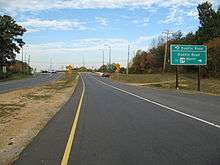
After crossing the Northwest Branch Park the route is now known as Columbia Pike and becomes a six-lane divided expressway. It interchanges with MD 650 to the northwest of the former Naval Surface Weapons Center. The route passes through Paint Branch Park, over the Paint Branch, before meeting Randolph Road at a recently constructed diamond interchange. Continuing northeast the route intersects Fairland Road, then comes to the interchange with MD 200, the InterCounty Connector before meeting Briggs Chaney Road at another recently constructed diamond interchange.
Running northwest of Fairland Regional Park US 29 reaches its first major freeway segment at Burtonsville, bypassing a former, heavily curved at-grade expressway portion through the town. At this point, it downgrades into a four-lane divided expressway until it enters Howard County. The bypass incorporates the southern end of the former alignment and a diamond interchange with MD 198 within its southern endpoint; US 29 continues straight ahead through the combined interchange, meeting the northern end of the former alignment at a partial diamond interchange. The 0.92-mile bypassed section of the old road is officially designated US 29A with street signs that say "Old Columbia Pike" which previously ended at MD 198.
The route crosses the Rocky Gorge Reservoir and enters Howard County just beyond the northern end of the bypass. It intersects Old Columbia Road just beyond the reservoir and then upgrades into a six-lane grade-separated almost-freeway within its interchange with MD 216 at Scaggsville. Continuing as an almost-freeway it interchanges with Johns Hopkins Road after two miles (3 km), then downgrades to four lanes again just before the Middle Patuxent River and intersects Rivers Edge Road at a half-signalled intersection (Rivers Edge Road, which is the sole entryway into a subdivision containing over 300 homes, intersects the southbound carriageway, which has the signals; the northbound carriageway has a signalled turn lane and an unsignalled acceleration lane, both within the median).
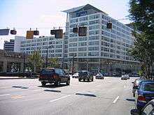
Next, US 29 encounters MD 32 at a symmetrical cloverleaf; for an extended period this interchange marked the southern end of US 29's grade separation, with the entire route south of there being an at-grade expressway. North of the interchange, US 29 intersects several major routes that serve the town of Columbia: Shaker Drive/Seneca Drive, Broken Land Parkway, MD 175, and MD 108. Between Broken Land Parkway and MD 175, US 29 has a right-in/right-out interchange between the southbound carriageway and South Entrance Road; the northbound carriageway has two at-grade direct turnoffs to Gates Lane and Old Columbia Road, with median crossovers provided for southbound traffic. Near the MD 108 interchange the northbound carriageway has another direct turnoff to Diamondback Drive.
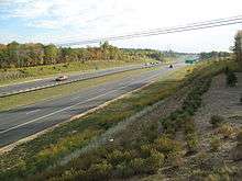
Beyond the MD 108 interchange, US 29 upgrades again into a fully limited-access six-lane grade-separated freeway as it encounters the western terminus of MD 100. The heavy flows to and from MD 100 result in US 29 widening again to eight lanes within the interchange, which also incorporates a three-quarter diamond interchange with the western terminus of MD 103. The eight-lane segment narrows to six lanes again as it encounters the historic northern end of the US 29 expressway at U.S. Route 40 within Ellicott City.
Beyond US 40, US 29 interchanges with Interstate 70 at a modified directional cloverleaf, and finally terminates at an at-grade intersection with MD 99 near Mount Hebron.
29th Infantry Division Memorial Highway
The entire route in Maryland is also known as the 29th Infantry Division Memorial Highway, and some trailblazer assemblies in the Ellicott City area are marked with the division's distinctive yin-yang symbol. At the US 40 interchange, a monument dedicating the highway to the division has been installed and can be seen from both carriageways.
History
In 1933, the Maryland state government and the D.C. government approached AASHO and the Virginia state government about the possible northern extension of US 29 from its original northern terminus in Culpeper, Virginia on US 15. After much deliberation, AASHO and Virginia assented to the modifications, and US 29 was extended from Culpeper along US 15 and US 211 into D.C. and thence into Maryland.[2]
Turnpikes
On January 10, 1810, the Columbia Turnpike Road Company was chartered by the General Assembly of Maryland to "make a turnpike road from where the road leading from Montgomery courthouse to Baltimore intersects the Baltimore and Frederick turnpike road near Ellicott's lower mills, in a direction towards Georgetown, until it intersects the line of the district of Columbia, and so that it shall cross Rock creek at not less than three miles above Georgetown"[3] The road was managed by the Columbia Turnpike Company and later came to be known as the Columbia Pike.[4] In 1835 Columbia Pike surrendered its Montgormery and Anne Arundel (Howard) County roads and bridges to the State of Maryland.[5]
The Washington, Colesville and Ashton Turnpike Company was established in 1870 in Maryland in the United States. Its path began at the Washington and Brookeville Turnpike (also known as the Union plank and turnpike road, today's Georgia Avenue), followed the modern path of Colesville Road (US 29) until the crossing of the Northwest Branch at Burnt Mills, where the turnpike took the route of modern Lockwood Drive to join the path of modern New Hampshire Avenue (MD 650) near White Oak north to Colesville and then to Ashton.[6]
“Toll Gate #1” was located just as travelers approached the end of the turnpike at Sligo. The small wooden toll gate, located at the intersection of today’s Georgia Avenue and Dale Drive, closed in 1910 with the death of its last toll keeper, Henry Charles Ulrich (born 1849). By the mid 1910s, privately run turnpikes had ceased operations with the establishment of Maryland’s State Roads Commission. On April 1, 1930, Harvey and Blanche (Mrs. K) Kreuzberg opened Mrs. K’s Toll House Restaurant in the toll house (with significant expansion) at 9201 Colesville Road.[7][8]
MD 27 and MD 29
| |
|---|---|
| Location: | Silver Spring–Ellicott City |
| Existed: | 1927–1934 |
US 29 arrived in Maryland in 1934, a year after the initial creation of the Maryland highway numbering scheme. US 29 followed a route initially designated as Maryland Route 27, while today's MD 27 was designated as Maryland Route 29. The first MD 27 emerged from Washington D.C. along Colesville Road, then followed US 29's existing route as far as White Oak, where it turned north along MD 650 and followed its alignment as far as Ashton. This route had previously been the Washington, Colesville and Ashton Turnpike. At Ashton, MD 27 then turned east along MD 108 and followed its alignment through Clarksville (overlapping MD 32 before 1996) until it reached an intersection with Columbia Road, just to the west of MD 108's current interchange with US 29's current route. Then, MD 27 turned north and followed Columbia Road (formerly designated MD 982), becoming Old Columbia Pike (formerly designated as MD 987) after crossing MD 103 and continuing north until reaching Main Street (old US 40) in old Ellicott City, where it ended.
After US 29's arrival in 1934, MD 27 and MD 29 swapped numbers; today's MD 27 received its current designation and did not physically change, while the original MD 27 was re-designated MD 29, and then immediately promoted to US 29, thus removing a conflict between the US highway number and the state highway number system, as AASHO prohibits number duplication between state and US route systems. US 29 followed MD 29's route all the way into Ellicott City, where it then turned east and overlapped US 40 through Catonsville all the way into Baltimore, where it ended at US 1 (Monroe Street) in southwestern Baltimore. Today, the Baltimore County portion of this route is part of MD 144.
US 29 Alternate
On November 11, 1954, the state of Maryland gained AASHO's consent to divert US 29 to a more direct alignment, paralleling the now-defunct MD 196 between MD 650 and MD 198, and then continuing onward to Ellicott City via Scaggsville.[2]
The diversion of the route necessitated the construction of a divided highway between the site of US 29's current interchange with MD 650 in White Oak and an intersection with MD 198 in Burtonsville, and a two-lane highway between Burtonsville, across the Patuxent River at the site of the future Rocky Gorge Reservoir, through Scaggsville and Columbia (then a small village east of today's US 29/MD 108 interchange) to a point south of Ellicott City, where the new route merged with the original route near the site of the US 29/MD 103 interchange and continued as normal. It is unclear if the new route was immediately signed as US 29 or as an extension of MD 196, but an undated GULF map of the state of Maryland shows no highway designation for the route between White Oak and Columbia.[2] The first new segment of the current route of US 29 opened on November 30, 1959,[9] and by 1964 MD 196 had been retracted to Burtonsville and US 29 had been rerouted to its current route.[10]
Initially, the AASHO Executive Committee, meeting in Seattle, Washington, designated US 29's original route via Ashton as U.S. Route 29 Alternate, which would be signed upon the originally scheduled completion of the direct route in late 1955.[2] US 29 Alternate has since vanished, being replaced with a northward extension of MD 650 through Ashton (replacing MD 116 north of Ashton) and an eastward extension of MD 108 as far as MD 175 Waterloo Road (now itself part of MD 108).
The new Columbia Pike

The 1966 expansion of the tiny village of Columbia into a massive planned community under the auspices of the Rouse Company led to the construction of the modern Columbia Pike. By the early 1970s, with the completion of the new Columbia Pike, a four-lane divided at-grade highway, between Burtonsville and US 40, US 29 had assumed its current shape. The Regal Construction Company completed a section South of Route 108 in June 1970 at a cost of $1.1 million per mile.[11] In 1968, the terminus of US 29 was diverted away from Baltimore; it was retracted to US 40 in Ellicott City and then moved north two miles (3 km) to MD 99, and an interchange similar to the one in place between US 29 and US 40 was built to connect the route with Interstate 70 (then designated I-70N).[2]
US 29 Freeway
Initially, the northernmost 2 miles (3.2 km) of US 29 were the only grade-separated limited-access segment of that route in Maryland. However, gradual construction of interchanges south of US 40, starting with Howard County's segment in the late 1980s and continuing to the 2000s in Montgomery County, has resulted in a full freeway between I-70 and MD 108, an almost-freeway between MD 108 and MD 216, and a partially grade-separated expressway between MD 216 and MD 650, with interchanges at Johns Hopkins Road and MD 216 completed in the early 2000s. Interchanges were completed in 2004 at MD 198, in 2005 at E. Randolph Road/Cherry Hill Road, and in 2007 at Briggs Chaney Road. With the completion of the interchange at MD 198, US 29 was realigned slightly to the east. The former alignment is now designated as US 29A. Immediately south of Briggs Chaney Road, construction commenced on a new interchange with Maryland Route 200 (the Intercounty Connector) in 2008.
Baltimore Outer Beltway
The four miles (6 km) of the US 29 freeway between MD 100 and I-70 is part of the Baltimore Outer Beltway. The Outer Beltway was perceived as a 3/4 circular beltway designed to provide a route parallel to the Baltimore Beltway. MD 100 represents the major portion that was built; the aforementioned four miles (6 km) of US 29 is another portion. The Outer Beltway was projected beyond MD 99 to run through Howard and Baltimore Counties and intersect MD 140, Interstate 83, US 1, and Interstate 95 before terminating at US 40 northeast of Baltimore.
Junction list
| County | Location | mi[1] | km | Exit | Destinations | Notes |
|---|---|---|---|---|---|---|
| Montgomery | Silver Spring | 0.00 | 0.00 | Southern terminus of US 29 in Maryland; District of Columbia boundary | ||
| 0.18 | 0.29 | Five-way intersection; no direct access from southbound US 29 to eastbound MD 410 or from eastbound MD 410 to northbound US 29 | ||||
| 0.67 | 1.08 | |||||
| 0.82 | 1.32 | US 29 turns east onto Colesville Road; no direct access from northbound US 29 to westbound MD 384, eastbound MD 384 to northbound MD 97, or southbound MD 97 to northbound US 29 | ||||
| 1.74 | 2.80 | Sligo Creek Parkway | ||||
| 2.38 | 3.83 | I-495 Exit 30; no access from southbound US 29 to eastbound I-495 or from westbound I-495 to northbound US 29 | ||||
| 2.72 | 4.38 | |||||
| White Oak | 4.76 | 7.66 | Partial cloverleaf interchange | |||
| Fairland | 6.85 | 11.02 | Randolph Road / Cherry Hill Road | Single-point urban interchange; Randolph Road and Cherry Hill Road are unsigned MD 929A and MD 929B, respectively | ||
| 7.68 | 12.36 | Fairland Road | Southbound US 29 uses exit ramp to access Fairland Road | |||
| 8.03 | 12.92 | MD 200 Exit 16 | ||||
| 8.46 | 13.62 | Briggs Chaney Road | Partial cloverleaf interchange | |||
| Burtonsville | 10.16 | 16.35 | Blackburn Road | Northbound US 29 uses exit ramp to access Blackburn Road; southbound US 29 uses US 29A | ||
| 10.72 | 17.25 | No exit southbound | ||||
| 11.02 | 17.73 | Southbound exit and entrance | ||||
| 11.48 | 18.48 | Southbound exit, northbound entrance; Columbia Pike is US 29A; Dustin Road is MD 929F | ||||
| Howard | North Laurel | 13.63 | 21.94 | 13 | ||
| 14.78 | 23.79 | 15 | Johns Hopkins Road to Gorman Road | |||
| Columbia | 16.56 | 26.65 | 16 | MD 32 Exit 16; split into exits 16A (east) and 16B (west) | ||
| 17.21 | 27.70 | 17 | Seneca Drive / Shaker Drive | |||
| 18.20 | 29.29 | 18 | Broken Land Parkway – Town Center, Merriweather (West) Oakland Mills, Owen Brown (East) | Split into exits 18A (south) and 18B (north) northbound | ||
| 18.55 | 29.85 | South Entrance Road – Merriweather Post Pavilion | Right-in/right-out interchange southbound | |||
| 19.99 | 32.17 | 20 | Split into exits 20A (MD 175) and 20B (Little Patuxent Parkway) | |||
| 20.57 | 33.10 | Diamondback Drive | Right-in/right-out interchange northbound | |||
| 21.10 | 33.96 | 21 | Split into exits 21A (east) and 21B (west) | |||
| Ellicott City | 22.30 | 35.89 | 22 | |||
| 22.54 | 36.27 | 23 | No northbound exit | |||
| 24.07 | 38.74 | 24 | Split into exits 24A (east) and 24B (west) | |||
| 25.42 | 40.91 | 25 | I-70 Exit 87; split into exits 25A (east) and 25B (west) | |||
| 25.86 | 41.62 | Northern terminus of US 29 | ||||
| 1.000 mi = 1.609 km; 1.000 km = 0.621 mi | ||||||
See also
 Maryland Roads portal
References
- 1 2 Highway Information Services Division (December 31, 2013). Highway Location Reference. Maryland State Highway Administration. Retrieved 2012-09-09.
- Montgomery County (PDF)
- Howard County (PDF)
- 1 2 3 4 5 Federal Highway Administration. U.S. 29 Maryland to Florida URL accessed 15:05, 21 January 2007.
- ↑ Facsimile of act creating the Columbia Turnpike Road Company
- ↑ Davis, Joseph Stancliffe (2006). Essays In The Earlier History Of American Corporations. The Lawbook Exchange, Ltd. ISBN 1-58477-427-4.
- ↑ Index to the Laws and Resolutions of Maryland.
- ↑ Archives of Maryland, Volume 0188, Page 3236 - Proceedings and Acts of the General Assembly, 1870
- ↑ Takoma Voice: Features - Silver Spring Then & Again
- ↑ Historic Silver Spring - Jerry A. McCoy, Silver Spring Historical Society - Google Boeken. Books.google.com. 2005-11-30. Retrieved 2012-08-17.
- ↑ Washington Post, 11/11/1959 & 12/1/1959, page B1
- ↑ "Maryland Unveils 3 Area Road Projects". Washington Post and Times Herald. December 1, 1959, page B1. Check date values in:
|date=(help) - ↑ Louise Vest (23 June 2015). "County preps for the opening of Route 29". The Baltimore Sun.
| Previous state: District of Columbia |
Maryland | Next state: Terminus |