Bozoum
| Bozoum | |
|---|---|
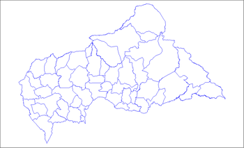
 Bozoum Location in Central African Republic | |
| Coordinates: 6°19′02″N 16°22′42″E / 6.31722°N 16.37833°ECoordinates: 6°19′02″N 16°22′42″E / 6.31722°N 16.37833°E | |
| Country | Central African Republic |
| Prefecture | Ouham-Pendé |
| Elevation | 660 m (2,170 ft) |
| Population (2012) | |
| • Total | 22,284 |
Bozoum is the capital of Ouham-Pendé, one of the 14 prefectures of the Central African Republic.
Climate
Köppen-Geiger climate classification system classifies its climate as tropical wet and dry (Aw).[1]
| Climate data for Bozoum | |||||||||||||
|---|---|---|---|---|---|---|---|---|---|---|---|---|---|
| Month | Jan | Feb | Mar | Apr | May | Jun | Jul | Aug | Sep | Oct | Nov | Dec | Year |
| Average high °C (°F) | 32.5 (90.5) |
33.5 (92.3) |
33.1 (91.6) |
31.6 (88.9) |
30.5 (86.9) |
29 (84) |
28 (82) |
28.2 (82.8) |
28.8 (83.8) |
29.7 (85.5) |
31.8 (89.2) |
32.5 (90.5) |
30.77 (87.33) |
| Daily mean °C (°F) | 24.3 (75.7) |
25.4 (77.7) |
26.4 (79.5) |
26 (79) |
25.3 (77.5) |
24.1 (75.4) |
23.5 (74.3) |
23.9 (75) |
24 (75) |
24.3 (75.7) |
24.5 (76.1) |
24.2 (75.6) |
24.66 (76.38) |
| Average low °C (°F) | 16.1 (61) |
17.4 (63.3) |
19.8 (67.6) |
20.4 (68.7) |
20.1 (68.2) |
19.3 (66.7) |
19.1 (66.4) |
19.6 (67.3) |
19.2 (66.6) |
18.9 (66) |
17.2 (63) |
15.9 (60.6) |
18.58 (65.45) |
| Average precipitation mm (inches) | 2 (0.08) |
10 (0.39) |
36 (1.42) |
74 (2.91) |
131 (5.16) |
158 (6.22) |
228 (8.98) |
272 (10.71) |
235 (9.25) |
172 (6.77) |
12 (0.47) |
1 (0.04) |
1,331 (52.4) |
| Source: Climate-Data.org, altitude: 671m[1] | |||||||||||||
See also
References
- 1 2 "Climate: Bozoum - Climate graph, Temperature graph, Climate table". Climate-Data.org. Retrieved 21 October 2013.
This article is issued from Wikipedia - version of the 11/21/2016. The text is available under the Creative Commons Attribution/Share Alike but additional terms may apply for the media files.