Bimbo, Central African Republic
| Bimbo | |
|---|---|
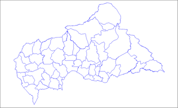
 Bimbo Location in Central African Republic | |
| Coordinates: 4°15′21″N 18°24′15″E / 4.25583°N 18.40417°E | |
| Country |
|
| Prefecture | Ombella-M'poko |
| Elevation | 1,109 ft (338 m) |
| Population (2013) | |
| • Total | 267,859 |
Bimbo (also, Bimo) is the capital of Ombella-M'poko, one of the 14 prefectures of the Central African Republic, and is located 25.5 kilometres (15.8 mi) by road southwest of the centre of the capital, Bangui.[1] The country's second-largest city,[2] Bimbo had a population of 124,176 as of the 2003 census and a calculated 2013 population of 267,859.[3]
Bimbo is the site of the country's only sex-segregated women's prison, Bimbo Central Prison. The prison was built in 1980 to hold 200 prisoners, although as of 2005 it only held 44, most of whom were pretrial detainees.[4]
Climate
Köppen-Geiger climate classification system classifies its climate as tropical wet and dry (Aw).[5]
The highest record temperature was 44 °C (111 °F) on Rebruary 25, 2004, while the lowest record temperature was 3 °C (37 °F) on January 22, 1993.[6]
| Climate data for Bimbo | |||||||||||||
|---|---|---|---|---|---|---|---|---|---|---|---|---|---|
| Month | Jan | Feb | Mar | Apr | May | Jun | Jul | Aug | Sep | Oct | Nov | Dec | Year |
| Record high °C (°F) | 39 (102) |
44 (111) |
42 (108) |
40 (104) |
39 (102) |
39 (102) |
40 (104) |
38 (100) |
40 (104) |
38 (100) |
41 (106) |
39 (102) |
44 (111) |
| Average high °C (°F) | 31.8 (89.2) |
33.4 (92.1) |
32.8 (91) |
32.2 (90) |
31.5 (88.7) |
30.2 (86.4) |
30 (86) |
29.7 (85.5) |
30.2 (86.4) |
30.5 (86.9) |
30.8 (87.4) |
31.2 (88.2) |
31.19 (88.15) |
| Daily mean °C (°F) | 25.2 (77.4) |
26.4 (79.5) |
26.7 (80.1) |
26.6 (79.9) |
26.2 (79.2) |
25.3 (77.5) |
25 (77) |
24.9 (76.8) |
25.1 (77.2) |
25.3 (77.5) |
25.1 (77.2) |
24.6 (76.3) |
25.53 (77.97) |
| Average low °C (°F) | 18.6 (65.5) |
19.5 (67.1) |
20.7 (69.3) |
21 (70) |
20.9 (69.6) |
20.4 (68.7) |
20 (68) |
20.2 (68.4) |
20 (68) |
20.1 (68.2) |
19.5 (67.1) |
18.1 (64.6) |
19.92 (67.88) |
| Record low °C (°F) | 3 (37) |
8 (46) |
13 (55) |
5 (41) |
11 (52) |
16 (61) |
12 (54) |
8 (46) |
10 (50) |
11 (52) |
12 (54) |
10 (50) |
3 (37) |
| Average precipitation mm (inches) | 22 (0.87) |
41 (1.61) |
107 (4.21) |
124 (4.88) |
169 (6.65) |
151 (5.94) |
193 (7.6) |
229 (9.02) |
191 (7.52) |
195 (7.68) |
94 (3.7) |
32 (1.26) |
1,548 (60.94) |
| Source #1: Climate-Data.org, altitude: 365m[5] | |||||||||||||
| Source #2: Voodoo Skies for records[6] | |||||||||||||
See also
References
- ↑ Google (30 March 2013). "Bimbo, Central African Republic" (Map). Google Maps. Google. Retrieved 30 March 2013.
- ↑ Dominique Auzias (2010). "Un peu d'histoire". République Centrafricaine 2010-11. p. 79. ISBN 2746926075.
- ↑ "Central African Republic: largest cities and towns and statistics of their population". World Gazetteer. Archived from the original on 11 January 2013. Retrieved 30 March 2013.
- ↑ Country reports on human rights practices. US Government Printing Office. 2005. p. 91.
- 1 2 "Climate: Bimbo - Climate graph, Temperature graph, Climate table". Climate-Data.org. Retrieved 21 October 2013.
- 1 2 "Bimbo, Central African Republic". Voodoo Skies. Retrieved 21 October 2013.
Coordinates: 4°15′21″N 18°24′15″E / 4.25583°N 18.40417°E