Bracut, California
Coordinates: 40°49′38″N 124°05′00″W / 40.82722°N 124.08333°W
| Bracut | |
|---|---|
| Unincorporated community | |
|
The District 1 CalTrans yard at Bracut | |
|
Bracut  Bracut Location in California | |
| Coordinates: 40°49′38″N 124°05′00″W / 40.82722°N 124.08333°W | |
| Country | United States |
| State | California |
| County | Humboldt County |
| Elevation[1] | 16 ft (5 m) |
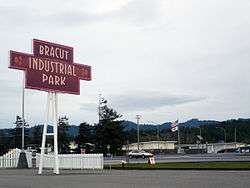
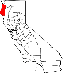
Bracut (formerly, Brainard)[2] is an unincorporated community in Humboldt County, California.[1] It is located on the Northwestern Pacific Railroad 3 miles (4.8 km) south of Arcata,[2] at an elevation of 16 feet (5 m).[1] The name originated as a contraction of the railway cut through Brainard hill in the Humboldt Bay salt marsh. Railway trestle work originally connected the hill south to Eureka and north to Arcata. Much of the hill was subsequently excavated to provide fill to replace the original trestle work; and the railway fill prism became a dike encouraging conversion of the inland salt marsh to pasture land.[3] The leveled hill is now the site of several large structures remaining from previous lumber operations, a District 1 CalTrans yard, and a KOA campground.
References
- 1 2 3 U.S. Geological Survey Geographic Names Information System: Bracut, California
- 1 2 Durham, David L. (1998). California's Geographic Names: A Gazetteer of Historic and Modern Names of the State. Clovis, Calif.: Word Dancer Press. p. 25. ISBN 1-884995-14-4.
- ↑ Gudde, Erwin G. California Place Names: The Origin and Etymology of Current Geographical Names p.45

