Johnsons, California
Coordinates: 41°21′01″N 123°52′19″W / 41.35028°N 123.87194°W
| Johnsons | |
|---|---|
| Unincorporated community | |
|
Johnsons  Johnsons Location in California | |
| Coordinates: 41°21′01″N 123°52′19″W / 41.35028°N 123.87194°W | |
| Country | United States |
| State | California |
| County | Humboldt County |
| Elevation[1] | 180 ft (55 m) |
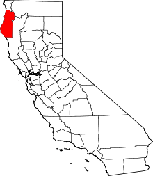
Johnsons (formerly, Klamath) is an unincorporated community in Humboldt County, California.[1] It is located on the Klamath River 14 miles (23 km) northwest of Weitchpec,[2] at an elevation of 180 feet (55 m).[1]
History
Johnsons was a settlement in the former Klamath County, California. A fairly isolated and small Yurok ancestral village, Johnsons is located within the Yurok reservation almost the Klamath River and is known for its excellent fishing and serenity. Electricity has not yet made its way to this community; instead, there has been a long standing utilization of solar & generator power.
References
This article is issued from Wikipedia - version of the 8/24/2016. The text is available under the Creative Commons Attribution/Share Alike but additional terms may apply for the media files.
