Briar Creek, Pennsylvania
| Briar Creek, Pennsylvania | |
|---|---|
| Borough | |
|
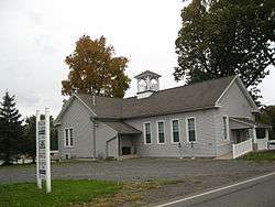
The borough hall in October 2012 | |
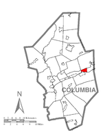 Location of Briar Creek in Columbia County | |
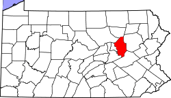 Location of Columbia County in Pennsylvania | |
 Briar Creek Location in Pennsylvania | |
| Coordinates: 41°03′10″N 76°16′42″W / 41.05278°N 76.27833°WCoordinates: 41°03′10″N 76°16′42″W / 41.05278°N 76.27833°W | |
| Country | United States |
| State | Pennsylvania |
| County | Columbia |
| Incorporated | 1917 |
| Government | |
| • Type | Borough Council |
| Area | |
| • Total | 1.9 sq mi (4.8 km2) |
| • Land | 1.7 sq mi (4.3 km2) |
| • Water | 0.2 sq mi (0.5 km2) |
| Elevation | 495 ft (151 m) |
| Population (2010) | |
| • Total | 660 |
| • Density | 400/sq mi (154.4/km2) |
| Time zone | Eastern (EST) (UTC-5) |
| • Summer (DST) | EDT (UTC-4) |
| Area code(s) | 570 |
| Website |
briarcreekboroughpa |
Briar Creek is a borough in Columbia County, Pennsylvania, United States. The population was 660 at the 2010 census.[1] It is part of the Bloomsburg–Berwick Micropolitan Statistical Area.
Geography
Briar Creek is located in eastern Columbia County at 41°3′10″N 76°16′42″W / 41.05278°N 76.27833°W (41.052639, -76.278369), on the north side of the Susquehanna River.[2] It is bordered to the east by Berwick, to the north by Briar Creek Township, to the west by South Centre Township, and to the south, across the Susquehanna, by Mifflin Township. Mifflinville is across the river southwest of Briar Creek, accessible by Market Street Bridge west of the borough limits.
According to the United States Census Bureau, the borough of Briar Creek has a total area of 1.9 square miles (4.8 km2), of which 1.7 square miles (4.3 km2) is land and 0.2 square miles (0.5 km2), or 10.38%, is water.[1] Briar Creek is served by U.S. Route 11, which follows the Susquehanna River, leading east into Berwick and southwest 10 miles (16 km) to Bloomsburg, the county seat. Although Briar Creek is one of the smaller boroughs in Pennsylvania, it is home to many acres of farmland, a golf course, and a lake. A creek with the same name as the borough flows through Briar Creek.
Demographics
| Historical population | |||
|---|---|---|---|
| Census | Pop. | %± | |
| 1920 | 295 | — | |
| 1930 | 249 | −15.6% | |
| 1940 | 316 | 26.9% | |
| 1950 | 348 | 10.1% | |
| 1960 | 399 | 14.7% | |
| 1970 | 456 | 14.3% | |
| 1980 | 637 | 39.7% | |
| 1990 | 616 | −3.3% | |
| 2000 | 651 | 5.7% | |
| 2010 | 660 | 1.4% | |
| Est. 2015 | 681 | [3] | 3.2% |
| Sources:[4][5][6] | |||
As of the census[5] of 2000, there were 651 people, 250 households, and 162 families residing in the borough. The population density was 408.2 people per square mile (158.1/km²). There were 280 housing units at an average density of 175.6 per square mile (68.0/km²). The racial makeup of the borough was 98.00% White, 0.15% African American, 0.61% Asian, 0.31% from other races, and 0.92% from two or more races. Hispanic or Latino of any race were 0.46% of the population.
There were 250 households, out of which 25.2% had females under the age of 18 living with them, 46.8% were married couples living together, 12.0% had a female householder with no husband present, and 35.2% were non-families. 30.0% of all households were made up of individuals, and 11.2% had someone living alone who was 65 years of age or older. The average household size was 2.38 and the average family size was 2.91.
In the borough the population was spread out, with 20.7% under the age of 18, 8.1% from 18 to 24, 26.3% from 25 to 44, 21.0% from 45 to 64, and 23.8% who were 65 years of age or older. The median age was 41 years. For every 100 females there were 86.0 males. For every 100 females age 18 and over, there were 81.7 males.
The median income for a household in the borough was $23,594, and the median income for a family was $27,833. Males had a median income of $22,150 versus $19,583 for females. The per capita income for the borough was $13,009. About 11.6% of families and 17.6% of the population were below the poverty line, including 31.3% of those under age 18 and 15.3% of those age 65 or over.
References
- 1 2 "Geographic Identifiers: 2010 Census Summary File 1 (G001): Briar Creek borough, Pennsylvania". U.S. Census Bureau, American Factfinder. Retrieved May 19, 2015.
- ↑ "US Gazetteer files: 2010, 2000, and 1990". United States Census Bureau. 2011-02-12. Retrieved 2011-04-23.
- ↑ "Annual Estimates of the Resident Population for Incorporated Places: April 1, 2010 to July 1, 2015". Retrieved July 2, 2016.
- ↑ "Census of Population and Housing". U.S. Census Bureau. Archived from the original on 11 May 2015. Retrieved 11 December 2013.
- 1 2 "American FactFinder". United States Census Bureau. Archived from the original on 2013-09-11. Retrieved 2008-01-31.
- ↑ "Incorporated Places and Minor Civil Divisions Datasets: Subcounty Resident Population Estimates: April 1, 2010 to July 1, 2012". Population Estimates. U.S. Census Bureau. Archived from the original on 17 June 2013. Retrieved 11 December 2013.
External links
Municipalities and communities of Columbia County, Pennsylvania, United States | ||
|---|---|---|
| Town | | |
| Boroughs | ||
| Townships | ||
| CDPs | ||
| Unincorporated communities | ||
| Ghost Towns | ||
| Footnotes | ‡This populated place also has portions in an adjacent county or counties | |