Broadstairs railway station
| Broadstairs | |
|---|---|
|
View of Main Platform | |
| Location | |
| Place | Broadstairs |
| Local authority | District of Thanet |
| Grid reference | TR391679 |
| Operations | |
| Station code | BSR |
| Managed by | Southeastern |
| Number of platforms | 2 |
| DfT category | E |
|
Live arrivals/departures, station information and onward connections from National Rail Enquiries | |
| Annual rail passenger usage* | |
| 2010/11 |
|
| 2011/12 |
|
| 2012/13 |
|
| 2013/14 |
|
| 2014/15 |
|
| History | |
| Key dates | Opened 5 October 1863 |
| National Rail – UK railway stations | |
| * Annual estimated passenger usage based on sales of tickets in stated financial year(s) which end or originate at Broadstairs from Office of Rail and Road statistics. Methodology may vary year on year. | |
|
| |


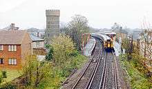
View NNW, towards Margate in 1963. Crampton Tower on the left
Broadstairs railway station is on the Chatham Main Line in north Kent, England. It serves the coastal tourist town of Broadstairs and is located at the inland end of Broadstairs High Street. The station is 77 miles (124 km) south east of London Victoria. Train services are provided by Southeastern.
Trains to London can run either way through the station, depending on the route they take to get there either via Margate or Ramsgate.
History
Broadstairs station under British Rail with two 4 CEPs in 'Jaffa cake' livery in 1990.
The station opened on 5 October 1863.[1]
A high-speed service to London St Pancras began on 13 December 2009.
Services
As of December 2015 the typical off-peak service from the station is:
- 1 tph to London St Pancras via Chatham and Ebbsfleet International (High Speed)
- 1 tph to London St Pancras via Ramsgate, Deal, Dover Priory, and Ashford International (High Speed)
- 1 tph to London St Pancras via Ramsgate, Canterbury West, Ashford International and Ebbsfleet International (High Speed)
- 1 tph to Margate (High Speed)
- 1 tph to London Victoria via Chatham and Bromley South (Main Line)
- 1 tph to Ramsgate (Main Line)
| Preceding station | |
Following station | ||
|---|---|---|---|---|
| Margate | Southeastern Chatham Main Line - Ramsgate Branch |
Dumpton Park | ||
| Margate | Southeastern High Speed 1 St Pancras International to St Pancras International Circular |
Ramsgate | ||
| Margate | Southeastern High Speed 1 London-Margate via Ashford |
Ramsgate | ||
| Disused railways | ||||
| Margate East Line open, station closed |
London, Chatham and Dover Railway Chatham Main Line - Ramsgate Branch |
Ramsgate Harbour Line and station closed | ||
References
External links
- Train times and station information for Broadstairs railway station from National Rail
Coordinates: 51°21′38″N 1°26′1″E / 51.36056°N 1.43361°E
This article is issued from Wikipedia - version of the 10/30/2016. The text is available under the Creative Commons Attribution/Share Alike but additional terms may apply for the media files.