Brodhead, Kentucky
| Brodhead, Kentucky | |
|---|---|
| City | |
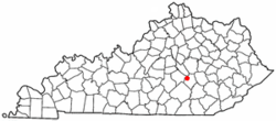 Location of Brodhead, Kentucky | |
| Coordinates: 37°24′8″N 84°24′56″W / 37.40222°N 84.41556°WCoordinates: 37°24′8″N 84°24′56″W / 37.40222°N 84.41556°W | |
| Country | United States |
| State | Kentucky |
| County | Rockcastle |
| Government | |
| • Mayor | Walter Lee Cash |
| Area | |
| • Total | 2.2 sq mi (5.7 km2) |
| • Land | 2.2 sq mi (5.7 km2) |
| • Water | 0.0 sq mi (0.0 km2) |
| Elevation | 935 ft (285 m) |
| Population (2010) | |
| • Total | 1,211 |
| • Density | 550.4/sq mi (212.4/km2) |
| Time zone | Eastern (EST) (UTC-5) |
| • Summer (DST) | EDT (UTC-4) |
| ZIP code | 40409 |
| Area code(s) | 606 |
| FIPS code | 21-09838 |
| GNIS feature ID | 0487947 |
Brodhead is a home rule-class city[1] in Rockcastle County, Kentucky, in the United States. The population was 1,211 at the 2010 census. It is part of the Richmond–Berea Micropolitan Statistical Area.
Brodhead has been noted for its unusual place name.[2]
Geography
Brodhead is located at 37°24′8″N 84°24′56″W / 37.40222°N 84.41556°W (37.402360, -84.415679).[3]
According to the United States Census Bureau, the city has a total area of 2.2 square miles (5.7 km2), all land. Brodhead is located at the headwaters of the Dix River.
Demographics
| Historical population | |||
|---|---|---|---|
| Census | Pop. | %± | |
| 1890 | 277 | — | |
| 1900 | 337 | 21.7% | |
| 1910 | 477 | 41.5% | |
| 1920 | 555 | 16.4% | |
| 1930 | 630 | 13.5% | |
| 1940 | 702 | 11.4% | |
| 1950 | 808 | 15.1% | |
| 1960 | 515 | −36.3% | |
| 1970 | 769 | 49.3% | |
| 1980 | 686 | −10.8% | |
| 1990 | 1,140 | 66.2% | |
| 2000 | 1,193 | 4.6% | |
| 2010 | 1,211 | 1.5% | |
| Est. 2015 | 1,205 | [4] | −0.5% |
As of the census[6] of 2000, there were 1,193 people, 462 households, and 307 families residing in the city. The population density was 542.1 people per square mile (209.4/km²). There were 518 housing units at an average density of 235.4 per square mile (90.9/km²). The racial makeup of the city was 98.91% White, 0.08% African American, 0.25% Asian, and 0.75% from two or more races. Hispanic or Latino of any race were 0.59% of the population.
There were 462 households out of which 32.9% had children under the age of 18 living with them, 46.3% were married couples living together, 17.1% had a female householder with no husband present, and 33.5% were non-families. 31.0% of all households were made up of individuals and 14.1% had someone living alone who was 65 years of age or older. The average household size was 2.35 and the average family size was 2.90.
In the city the population was spread out with 23.1% under the age of 18, 9.6% from 18 to 24, 24.3% from 25 to 44, 20.7% from 45 to 64, and 22.4% who were 65 years of age or older. The median age was 40 years. For every 100 females there were 85.5 males. For every 100 females age 18 and over, there were 76.2 males.
The median income for a household in the city was $17,500, and the median income for a family was $25,000. Males had a median income of $25,375 versus $19,750 for females. The per capita income for the city was $15,252. About 30.7% of families and 32.8% of the population were below the poverty line, including 42.6% of those under age 18 and 30.2% of those age 65 or over.
References
- ↑ "Summary and Reference Guide to House Bill 331 City Classification Reform" (PDF). Kentucky League of Cities. Retrieved December 30, 2014.
- ↑ Strecker, Zoe; Finch, Jackie Sheckler (1 July 2009). Kentucky Off the Beaten Path. Rowman & Littlefield. p. 11. ISBN 978-0-7627-5790-9.
- ↑ "US Gazetteer files: 2010, 2000, and 1990". United States Census Bureau. 2011-02-12. Retrieved 2011-04-23.
- ↑ "Annual Estimates of the Resident Population for Incorporated Places: April 1, 2010 to July 1, 2015". Retrieved July 2, 2016.
- ↑ "Census of Population and Housing". Census.gov. Archived from the original on May 11, 2015. Retrieved June 4, 2015.
- ↑ "American FactFinder". United States Census Bureau. Archived from the original on 2013-09-11. Retrieved 2008-01-31.
Municipalities and communities of Rockcastle County, Kentucky, United States | ||
|---|---|---|
| Cities | 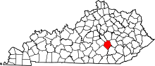 | |
| Unincorporated communities | ||