Brookfield, New York
| Brookfield, New York | |
|---|---|
| Town | |
 Brookfield, New York Location within the state of New York | |
| Coordinates: 42°48′16″N 75°20′41″W / 42.80444°N 75.34472°WCoordinates: 42°48′16″N 75°20′41″W / 42.80444°N 75.34472°W | |
| Country | United States |
| State | New York |
| County | Madison |
| Government | |
| • Type | Town Council |
| • Town Supervisor | John J. Salka (R) |
| • Town Council |
Members' List
|
| Area | |
| • Total | 78.0 sq mi (202.1 km2) |
| • Land | 77.9 sq mi (201.9 km2) |
| • Water | 0.1 sq mi (0.3 km2) |
| Elevation | 1,473 ft (449 m) |
| Population (2000) | |
| • Total | 2,403 |
| • Density | 30.8/sq mi (11.9/km2) |
| Time zone | Eastern (EST) (UTC-5) |
| • Summer (DST) | EDT (UTC-4) |
| ZIP code | 13314 |
| Area code(s) | 315 |
| FIPS code | 36-08587 |
| GNIS feature ID | 0978757 |
Brookfield is a town in Madison County, New York, United States. The population was 2,403 at the 2000 census.
The Town of Brookfield is located in the southeast part of the county. The county agricultural fair is held here every year.
History
The town was first settled around 1791. The Town of Brookfield was established in 1795, but part was removed in 1805 to form the Town of Columbus, all this occurring while it was still part of Chenango County, New York.
Geography
The north town line is the border of Oneida County, New York, and the south town line is the border of Chenango County, New York. The east town line is the border of Otsego County, New York.
According to the United States Census Bureau, the town has a total area of 78.0 square miles (202 km2), of which, 77.9 square miles (202 km2) of it is land and 0.1 square miles (0.26 km2) of it (0.13%) is water.
Demographics
| Historical population | |||
|---|---|---|---|
| Census | Pop. | %± | |
| 1820 | 4,240 | — | |
| 1830 | 4,367 | 3.0% | |
| 1840 | 3,695 | −15.4% | |
| 1850 | 3,585 | −3.0% | |
| 1860 | 3,729 | 4.0% | |
| 1870 | 3,565 | −4.4% | |
| 1880 | 3,685 | 3.4% | |
| 1890 | 3,262 | −11.5% | |
| 1900 | 2,726 | −16.4% | |
| 1910 | 2,403 | −11.8% | |
| 1920 | 2,092 | −12.9% | |
| 1930 | 1,750 | −16.3% | |
| 1940 | 1,703 | −2.7% | |
| 1950 | 1,841 | 8.1% | |
| 1960 | 1,990 | 8.1% | |
| 1970 | 2,064 | 3.7% | |
| 1980 | 2,037 | −1.3% | |
| 1990 | 2,225 | 9.2% | |
| 2000 | 2,403 | 8.0% | |
| 2010 | 2,545 | 5.9% | |
| Est. 2014 | 2,482 | [1] | −2.5% |
As of the census[3] of 2000, there were 2,403 people, 877 households, and 658 families residing in the town. The population density was 30.8 people per square mile (11.9/km²). There were 1,041 housing units at an average density of 13.4 per square mile (5.2/km²). The racial makeup of the town was 98.29% White, 0.54% African American, 0.25% Native American, 0.37% Asian, 0.04% from other races, and 0.50% from two or more races. Hispanic or Latino of any race were 0.33% of the population.
There were 877 households out of which 37.4% had children under the age of 18 living with them, 60.5% were married couples living together, 9.0% had a female householder with no husband present, and 24.9% were non-families. 20.1% of all households were made up of individuals and 9.1% had someone living alone who was 65 years of age or older. The average household size was 2.74 and the average family size was 3.13.
In the town the population was spread out with 28.7% under the age of 18, 8.2% from 18 to 24, 28.7% from 25 to 44, 23.8% from 45 to 64, and 10.7% who were 65 years of age or older. The median age was 35 years. For every 100 females there were 99.6 males. For every 100 females age 18 and over, there were 99.1 males.
The median income for a household in the town was $31,000 and the median income for a family was $35,000. Males had a median income of $26,462 versus $19,226 for females. The per capita income for the town was $13,719. About 10.4% of families and 13.9% of the population were below the poverty line, including 19.4% of those under age 18 and 5.5% of those age 65 or over.
Notable people
- William R. Williams, former US Congressman
John Palmer Usher, Secretary of the Interior, under the Lincoln Administration was born in Brookfield,NY[4]
Communities and locations in Brookfield
- Brookfield – The hamlet of Brookfield in the east part of the town on Route 80. Beaver Creek flows past the village. The village was once known as "Baileys Corners" and "Clarkville" (named after Joseph Clark).
- Guideboard – A hamlet west of Brookfield village on Route 80.
- Leonardsville – A hamlet near the east town line.
- Marsh Corners – A location in the southwest part of the town.
- Moscow Hill – A hamlet in the west part of the town on Route 95.
- North Brookfield – A hamlet in the northwest part of the town.
- River Forks – A location in the northeast corner of the town.
- South Brookfield – A hamlet in the southeast corner of the town.
- West Brookfield – A hamlet north of Moscow Hill, near the west town line.
- West Edmeston – A hamlet on the east town line.
Education
- Brookfield has one school, the Brookfield Central School, and it instructs grades K-12.
- The Brookfield Central School mascot is the Beaver.
- The 1983 Brookfield Central School boys varsity basketball team won the Section III Class D state championship.
References
- ↑ "Annual Estimates of the Resident Population for Incorporated Places: April 1, 2010 to July 1, 2014". Retrieved June 4, 2015.
- ↑ "Census of Population and Housing". Census.gov. Archived from the original on May 11, 2015. Retrieved June 4, 2015.
- ↑ "American FactFinder". United States Census Bureau. Archived from the original on 2013-09-11. Retrieved 2008-01-31.
- ↑ Wikipedia
External links
Municipalities and communities of Madison County, New York, United States | ||
|---|---|---|
| City | 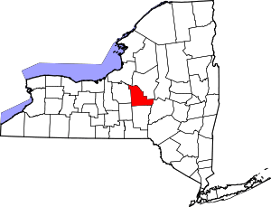 | |
| Towns | ||
| Villages | ||
| CDP | ||
| Other hamlets | ||
| Indian reservations | ||
| Footnotes | ‡This populated place also has portions in another county or counties | |